Roeliff Jansen Kill – Part 5 – Elizaville
Roeliff Jansen Kill, Part 5: Twin Lakes
Stories in Stone
Updated by Robert and Johanna Titus
The Roeliff Jansen Kill is certainly not one of the world’s great rivers; in fact, it is not much more than a run-of-the-mill creek. But this is the fifth article that we have written about the Roe Jan. We picked it up near its source and have been following it downstream, tracing its journey to the Hudson River. Each of our first four installments has revealed an entirely different facet of the kill. Each segment of the creek has brought to light a separate geological “personality.” That’s remarkable and we are only just past the halfway point!
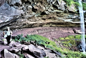
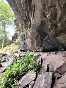
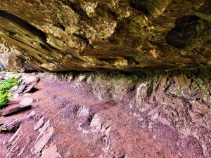
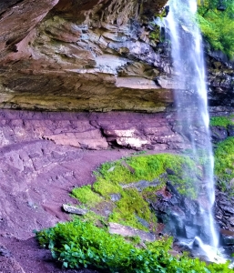
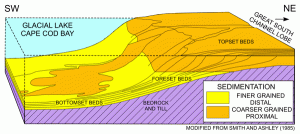
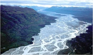
Last time we had arrived at Elizaville. There we found that the Roe-Jan had emptied into what is known as Glacial Lake Albany. That was an expanse of cold water that spread across much of the Hudson Valley at the close of the Ice Age. We ended up standing along Hapeman Road, realizing that we were at the bottom of a 60-foot-deep ice water lake.
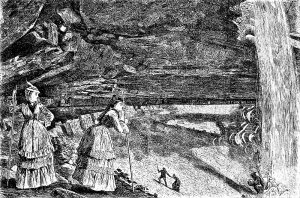
We can begin this episode where we left off. Gaze up those 60 feet and appreciate that you are on the floor of an old lake. At noon, on a late ice age day, you could have looked up here and seen the sunlight playing upon the passing waves. Occasionally cakes of ice, mini-icebergs, would drift by, swept along by the wind. To be a geologist is to be able to plant each of your two feet firmly in different moments of time and we can really do that here. Look off to the west; we see one of your feet on today’s flat landscape and then also see your other foot standing upon the dark still, muddy bottom of a lake. What of this, exactly, is imagination and what, exactly, is real? And where are the boundaries of the imagined and the real? To be a geologist is to experience such things.
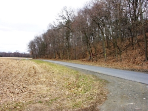
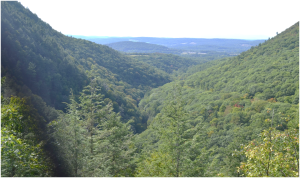
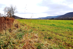
But we must continue. Drive back east on Hapeman Road and arrive at a good vantage point to see one of the two “Twin Lakes” that are here. Elizaville is perched upon a very fine plateau, one which we have seen was once a delta. With good drainage and lying well above any flood threats, this was a logical place to build a village. But it was the two lakes that most attracted people here. They have built homes around the shores of the lakes because people just like living on shores.
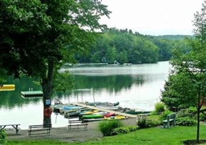
But what is the story of these lakes? How did they come to be? Those are the sort of questions that a geologist loves to answer. The two lakes take us back to the time of the Elizaville Delta. We must imagine the time when the Roe Jan was actively flowing into Glacial Lake Albany. The word “actively” probably does not do justice to what was going on here; enormous amounts of meltwater were raging down the Roe-Jan, and, loaded with dirty sediment, pouring into the lake. Much of that sediment was being added to the growing delta, but there was a problem.
The shoreline area of the lake is likely to have had a lot of floating ice running along it. As sediment was deposited in the lake shore vicinity, a lot of that ice would have come to be buried. Sediment is very good insulation so this buried ice might well have lasted for centuries, but eventually it would melt. As masses of shoreline ice did melt, the sediment above would have collapsed and that would, in each case, leave a large hole. That is what happened at Elizaville, not once but twice.
The result is something called an “ice-cored delta” and these are common in New York State. We frequently find a perfectly good ice age delta with one or, in this case, two holes in it. If the holes are not very deep then they are just swales in the landscape, pretty but not very important. But if they are deep enough then they will fill with water and form lakes or ponds. If they are very big, then people will settle along their shores and maybe put boats into the water. In any event, geologists will always come along and admire these emblems of the Ice age.
Contact the authors at randjtitus@prodigy.net. Join their facebook page “The Catskill Geologist.”
 “Old Man River”

 Ghosts at Clermont