Thomas Cole’s 200th
THE CATSKILL GEOLOGISTS BY PROFESSORS ROBERT AND JOHANNA TITUS
But We and the Glaciers Got There First!
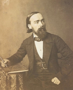
This year marks an important anniversary here in the Catskills. It was exactly 200 years ago that Thomas Cole made his first journey up the Hudson Valley. He visited and explored the vicinity of the newly opened Catskill Mountain House. We have been told that he did not stay at the hotel, but he certainly explored the whole vicinity. We can imagine him hiking on the new trails with a sketch pad and pencils, looking for picturesque images. What a moment this must have been. Cole was seeing for the first time the scenery that would make him a serious and very successful landscape painter. There were so many views; they offered a superabundance of images.
The two of us have spent much of the last quarter century retracing his footsteps. We have been seeing his paintings and the landscapes that inspired them in a fashion that has influenced so much of our writing. We can’t let this anniversary pass without offering our take on Cole’s first year of work. Cole must have drawn sketchpads full of images. It was left to him to ponder and choose those that would become full-fledged paintings. Art historians have debated which of them date back to that first season. They agree on two of them and we present them here. These are important; they are among the earliest of the works of the Hudson River School of Art!
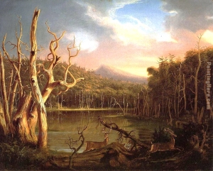
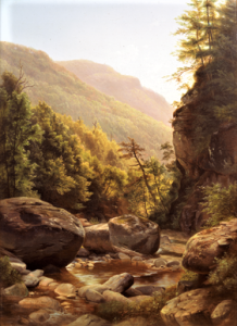
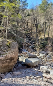
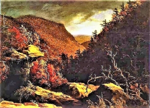
Our first offering is entitled “Lake with Dead Trees.” We know the view to be of South Lake shortly after a dam raised the level of the lake waters and drowned all the trees along its shores. We explored the north edge of the lake and found a boulder where we think Thomas Cole must have sat and sketched. It offers exactly the same view, and we took turns sitting where we think he sat. But we saw so much more than he could have. It was suddenly 14 thousand years ago. We gazed south and watched a glacier coming towards us. It had passed across the Kaaterskill Falls site and continued slowly on to the northeast. As it advanced, it ground into the bedrock below and scoured out the basin that makes up today’s South Lake. We gazed as it approached and then we turned to the left and saw another glacier. It had similarly carved out the basin of North Lake. We watched in total wonder as the two glaciers collided. The collision zone is now the mass of earth that separates the two lakes. We had stood and seen what Thomas Cole saw – but we had also seen how the Ice Age had created the painting he did here.
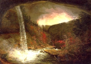
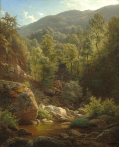
Then we hiked south to Kaaterskill Falls, climbed down a few hundred stairs and clambered up under and behind the falls. We searched for the exact spot where two centuries ago Cole had sketched another of his pioneering paintings: and there it was. We were, once again, awed. That’s hard to do to a geologist but we were looking at an important scene, a second of at least two birthplaces of the Hudson River School. Then we time-traveled – once again. It was about 12 thousand years ago and all that ice which had overwhelmed both North and South Lakes was melting – and melting fast in an episode of global warming – the good global warming that made our world hospitable. Raging foaming, pounding and – mostly – eroding torrents were dropping down from the top of the falls. It had been eroding back a full mile from the clove beyond, but on this day the waterfall retreat was literally grinding to a halt.
We and Thomas Cole had shared the very same and very small dots on the surface of the globe, but we occupied two very different moments in time. Our take was different than his. He had been there two centuries ago. We and the glaciers had gotten there 138 centuries earlier.
Contact the authors at randjtitus@prodigy.net. Join their facebook page “The Catskill Geologist.” Read their blogs at “thecatskillgeologist.com.
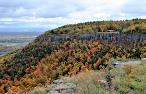 Thacher Park