The Old earth Jan. 10, 2019
A very old story
Stories in Stone – The Columbia County Independent
Nov. 23, 2007
Robert Titus
Before I was lured away by the fame and fortune of writing geology columns, I was a professional paleontologist. I published many an article on the ancient life of New York State in professional journals. I speak of this because my science is and has been under assault. The centerpiece of paleontology, like all biology itself, is the great theory of evolution. All of my professional research was founded upon evolutionary theory and the best studies that I ever did myself were documentations of evolutionary events.
I have, three times, followed a fossil species through sequences of stratified rock and watched as it evolved into a second species. I have not only seen species evolve but I have followed them as they evolved into new ecologies. These studies were among the greatest privileges that ever came with my being a scientist. I have seen evolution about as well as anyone, anywhere. That’s not bragging; it’s just the record.
Paleontology is the exploration of life’s distant past. It is nearly heartbreaking that some religious groups oppose my science’s very foundation. Science is not about religion; we steer well clear of the supernatural; ours is the study of the natural world only. We neither oppose, nor support any religion. Some of us practice religions; others, like me, do not.
But we do teach our sciences. Ours is a scientific and technologically advanced society in a competitive world, and it must maintain the highest standards in the teaching of science. There is no place for, say, economics or politics to play a role in classroom science. Likewise, this is no place for any religion to intrude its views. Such notions should be dismissed immediately. Economists and political scientists generally don’t interfere with the teaching of science, but there are members of the religious community would if they could.
Young Earth “Creation Science” and its fraternal twin “Intelligent Design” profess that a great supernatural entity (God) created the world and all life on it. Well, fine, many scientists are religious and believe the very same thing. Where science and these particular religious views part company is over the issue of evolution. Was the Earth and life on it created as we see them today, or did they form and then change naturally? Did life change slowly through time, evolving from a simple ancestral form into what it is today?
In recent years serious efforts have been made in Pennsylvania and Kansas to inject Intelligent Design into high school biology programs. I hate to think of the position that many dedicated biology teachers might find themselves in. Should they risk their careers in defiance of religion? Or should they knuckle under? It is a dreadful dilemma.
All this has been portrayed as part of the ongoing “culture wars” but I disagree. Issues like abortion, school prayer and displays of the Ten Commandments and manger scenes are value issues. People of good conscience can come to different views. But science has, I would hope, always fallen beyond that. We study the natural world as it is, not as we want it to be. We scientists have always determined to steer clear of values as much as possible
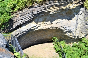
This column has found a very considerable body of evidence that, like the rest of the planet Earth, our Hudson Valley has a very venerable geological history. We have, over the last few years, taken many trips into our region’s distant past. We have visited the great deep oceanic abyss that once covered all of Columbia County. Its dark oozy mud is now hardened into the black Normanskill Shale which makes up much of the land along the Hudson. We have also visited the shallow tropical sea that once existed here. Its Helderberg limestones make up all of Becraft Mountain and they are rich in an exotic array of fossils. All those fossil species are now extinct; they were denizens of distant past. At Bash Bish Falls we have watched as great mountains rose to enormous altitudes in what would eventually be the Appalachian realm. Then we saw those mountains slowly weather away. We’ve seen glaciers advance down the Hudson Valley and, after they melted away, we saw Glacial Lake Albany fill most of our valley with icy meltwater. Altogether these historic events took enormous lengths of time: hundreds of millions of years.
If either Creationism or Intelligent Design is true, then all of this geological history is horribly misconstrued at best, fraudulent at worst. I and all of my colleagues are seriously deluded people. Can that be? I have always tried to tell where you can go and see the evidence for yourself. I hope that many of you have done some of the many field trips that I have described. If so, you can judge for yourself. Our valley and our Earth are very old.
——————————————————————————————————————————————-
If Creationism or Intelligent Design is true, then science itself is a hoax. Well, keep reading my columns and judge for yourself.
Reach the author at titusr@hartwick.edu.
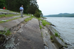
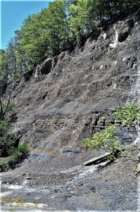 Rte. 209 outcrop
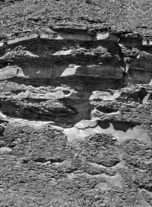 Mix of black shales and sandstones
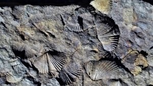
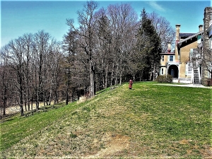
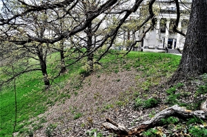 Vanderbilt mansion – on edge of Hyde Park Delta