Silence of the Limbs – Nov. 1, 2018
SILENCE OF THE LIMBS
Updated by Robert and Johanna Titus
The Woodstock Times
Nov. 14, 1997
It’s November and the hiking season is winding down. There are still a few relatively mild days, but there are so many fewer reasons to get out now. The foliage with its green is gone and the landscape is for the most part just a dull gray. Darkness comes so early now. Later the snow may draw some of us out on skis or snow shoes, but that is yet to come. For the time being the scenery is uninspiring.
But we have found that there is one outdoors experience which is pretty much confined to this time of year, and it is something that does sometimes draw us out for one last end of the season Catskill hike. It’s not something that we can go and see, nor something that we can hear or feel. Instead it is the very silence of the woods at this time of year.
Each November brings a few days when the skies are a uniform gray, and the gloomy weather patterns seem to settle into complete doldrums. Pick one of those days and hike high up into the Catskills so that you are far away from any road noise. There are usually no planes above our mountains, but if so just wait until they have passed by. Pick a good spot and sit and listen. Not a breath of air stirs, and even if it did a little, there are no leaves to rustle at this time of the year. Once in a while a twig will fall, but these events are scarce and momentary. The forest becomes so completely silent that it is almost unnerving.
In this season of the year there are few animals stirring. The insects are seasonal, and this year’s generation has all died; the next generation sleeps in its egg cases, silently awaiting the spring thaws. The song birds have departed, and most of the ground animals have settled into some burrow for the winter. In short it is mighty quiet up in the mountains at this time of year.
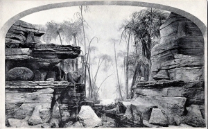
To a geologist there is a special experience here. Silence is unusual in our world, but that is only our world that we are talking about. Today we expect the woods to be noisy with insects, birds and furry animals, but that has not always been the case. Long ago these noise-making creatures did not exist. We are thinking of the Gilboa Forest which long ago presided over our Catskill landscapes.
The Gilboa Forest was a very different sort of woods. There were no furry animals, neither were there birds. There were insects, but they were so primitive that they had not yet evolved the ability to make noise (or even hear it). Noise making is something we take for granted, and probably regard mostly as a nuisance. But we should not forget that it is a relatively complex form of animal behavior and that was something far beyond the abilities of Gilboa’s primitive creatures.
Neither were the trees of Gilboa very noisy. They lacked true leaves and so it is not likely that they would have been able to make much of a rustle. Even on a windy day, the forest of Gilboa must have been a remarkably quiet place. All this silence ended, maybe 300 million years ago, when more advanced insects appeared and began their songs. Eventually birds and other animals followed suit and the world’s forests and jungles became noisy.
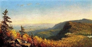
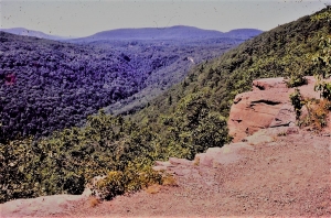
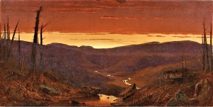
So that is what draws us into the mountains at this time of year. It’s a chance to go and experience a form of nature that has been gone for all those 300 million years. We like the western slopes of Hunter Mountain. These face the interior of the Catskills and are shielded from the cacophony of the Hudson Valley. Near Woodstock we would hike up to Overlook Mountain and turn down the yellow trail to Echo Lake. On a real quiet day, the lake’s name should truly be a misnomer. Try it; it’s this year’s one last good excuse for a hike into the mountains.
==============================================================
Contact the authors at randjtitus@prodigy.net. Join their facebook page “The Catskill Geologist.”
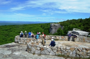
 Photo courtesy of Ralph Ryndak
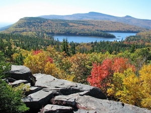