"I will never kick a rock"

Category archive

Uncategorized - page 28

Stratigraphy on Route 23

in Uncategorized by

The Devonian of Greene County Part 11
The Red Delta
The Greenville Press
June 5, 2006
Updated by Robert and Johanna Titus

The year 2005 will long be long remembered as the year that the great hurricane hit New Orleans. In many parts of the city the destruction was nearly total, and rebuilding the city was a difficult, expensive and perhaps futile endeavor. Even rebuilt there is no guarantee that another, even worse, storm won’t come along. We, in Greene County, can rest easy. We shall not see that sort of flooding. But, back during the Devonian, that was not the case; back then Greene County must have suffered many such floods. It’s an interesting story and there is a lot about New Orleans that can be learned right here.
You will, we hope, remember from our last chapter that Greene County was once covered by a great delta, called the Catskill Delta. That Devonian age structure was easily as large as the Mississippi Delta and it displayed most all of today’s delta habitats. There were swamps and bayous and floodplains, but most importantly there were rivers, lots and lots of rivers. The general public has recently learned a great deal about such deltas, especially about the flood threats they are exposed to. We talked about some of them in our last chapter.
We learned that it is normal for such deltas to be subsiding. The mass of the sediment deposited on them presses down on the crust and the delta simply sags beneath its own weight. That has been going on in Louisiana for millennia. Some parts of the state are subsiding about an inch per year. That’s fast. What went wrong with all this began centuries ago. Back then the levees of New Orleans started being built to prevent floods. Those levees worked quite well and, in fact, relatively few floods have occurred. But, ironically, the absence of floods has increased the threat of bad floods. It has meant that there has been no new deposition along most of the Mississippi River, especially at and upon New Orleans. You see, normally, flood waters carry sediment onto the delta plain and the resulting sedimentation keeps up with subsidence. As the delta presses down, flood deposition maintains a constant level just above sea level. But since New Orleans came to be “protected” by levees it has sunk but no new sediment has been able to “keep up” with the sinking. Instead, as New Orleans continued to subside, people have just kept raising the levees. It was a race between man and Nature; Nature has won, she always does, and the results were very predictable.
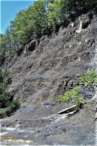
Few people can appreciate the relentless nature of such subsidence. How can they; they just can’t see the results? Subsidence buries all the evidence of itself. Well, surprisingly, here in Greene County, we can see the evidence. Go south on Rte. 32 until you reach its intersection with Rte. 23 where that road begins its ascent towards Windham. All along the road from the bottom of the mountain to on past Point Lookout you will observe a seemingly endless sequence of mostly red shales and red sandstones.
This is, all of it, the Plattekill Formation. We learned a lot about the sandstone and shale in the last installment. The sandstone represents the channels of many ancient, Devonian Catskill Delta rivers. The sand had been carried in the stream channels. Eventually it came to be lithified into sandstone. Most of the shale formed originally as soils and flood deposits on the floodplain surfaces in between the channels.
We saw all of this in the last episode when we visited the Ashokan Formation, along Rte. 23 in Cairo. The difference here is that red color. That brick red is particularly handsome, and it is characteristic of the Catskills as a whole. We owe a lot of our region’s picturesque appearance to it. Why is it there? This red is from the mineral hematite, an iron oxide which forms mostly in well oxygenated terrestrial landscapes. Also, it is most common in tropical settings; red soils are very common in the Amazon and Congo Basins.
So, the Catskill Delta was a great red tropical Devonian landscape. But our interest is in relating it to New Orleans. Let’s get back onto Rte. 23 and head up the mountain. Just a short distance past and across the highway from the Cornwallville parking area is a fine exposure of a Catskill Delta river. You can see a cross section of the entire channel. The deep side of the stream is on the right and the shallow side is on the left. It is, in short, a “fossil” river. We are not sure if you have ever heard of such a thing as a fossil river, but they do occur, and this is a very good one. And let us tell you, you don’t see them this good just anywhere.
This outcrop sets the tone for the rest of the uphill journey. Watch as you drive along and stop along the way and look at the ledges. There are long thick sequences of red shale; these speak of great delta floodplains. Then, periodically, there are thick sandstone sequences. Those speak of other fossil rivers; none of them, however, are nearly as nicely preserved as the Cornwallville specimen. Horizons of gray and red shale are usually ancient fossil soils. When you come to understand what you are looking at you get a great sense of the time involved. Each of the layers of stratified rock that you pass represents a large amount of time. As you continue uphill you are traveling through a vastness of time, almost more than a person can comprehend. All together, from Cairo to East Windham, you are rising through a thickness of about 1,500 feet of sedimentary rock. That’s a lot of stratified rock and that’s where New Orleans comes in.
One of the critical things to remember in all this and that all of these sediments accumulated at an elevation of just a few (really, a few) feet above sea level. The Cornwallville channel formed at sea level. About 1,500 ft. uphill and across the highway from Point Lookout is another sandstone channel deposit. It also formed at sea level. You might ask “how can 1,500 ft. of sediment be deposited, all of it at just about sea level?” You might think that deposition should pile up to an elevation rising well above sea level, but you have to remember that, just like with the Mississippi Delta, as the Catskill Delta subsided more sediment was deposited. Subsidence and deposition always just keep up with each other.

 
There is nothing whatsoever unusual about this East Windham sedimentary sequence, these thicknesses are typical of large deltas. And that includes New Orleans. Beneath New Orleans there are many, thousands of feet of sediment that were all deposited at sea level. Above New Orleans there will someday be many thousands of feet more. That will take many millions of years. And after all of that sedimentation, the area will still be at about sea level. And that’s where we really come to understand what has happened to the (once great?) city. Over the centuries, as it was being built, it was being dragged downward along with the subsiding crust. Nothing can stop that process. New Orleans will continue its subsidence. And no matter how high we build the levees, Nature will eventually catch up (as it already has) . . . again, and again, and again. In the end New Orleans will be a “fossil” buried under hundreds and then thousands of feet of sedimentary rock.
Today Rte. 23 takes us to a wonderful place; there is great scenery here. On one side of the highway are beautiful red stratified rocks, on the other side is one of the best panoramic views of the northeast. To relate all this to the tragedy in New Orleans leads to some pretty somber thoughts. It is almost a sacrilege, but it is what we see as we drive up the highway towards Windham.

Contact the authors at randjtitus@prodigy.net. Join their facebook page “The Catskill Geologist.”

TheSinking Coast 9-30-19

in Uncategorized by

The Sinking Coast
The Devonian of Greene County Part Ten
Updated by Robert and Johanna Titus

We usually think of environmental disasters as great, awful catastrophic events. What could be worse than a sudden earthquake or volcanic eruption? But sometimes these disasters proceed quietly, even stealthily with almost nobody taking notice until the worst of the damage has been done. People are alarmed about catastrophic events, but it is easy for them to remain blissfully unaware of those more subtle, downright sneaky problems.
One of those today is the sinking coastline of the Mississippi Delta in southern Louisiana. There the great mass of earth that is the delta has been subsiding, very slowly so that coastal regions have sunk into the Gulf of Mexico. Homes and villages, right on the shore, have had to be abandoned to the advancing waves. Millions of acres of coastal land have thus been lost over the decades and centuries. But, have you ever heard about this? Quite possibly not; it is such an inconspicuous process, who notices?
Why is the Louisiana coastline sinking? Many of the reasons are quite natural. Over the millennia, as the Mississippi has carried sediment to this coastal realm it has piled this material up in increasingly thick masses. Just the weight of all this sediment has pressed down on the crust and caused subsidence. Then too, there is the normal process of compaction. The sediment has simply settled and that causes still more sinking.
It probably won’t surprise you to learn that man has interfered with Nature’s balance. Normally the Mississippi replenishes most of the land that has been lost. Floods rise up over the banks of the river and carry new sediment to fill in and replace volumes of sediment that have been lost to subsidence. The land surface is maintained. Sadly, that important process has been halted; over the past three centuries man has built levies along the banks of the Mississippi in a successful effort to thwart flooding. Now there are many fewer threats from flooding, but the benefits have also been lost. It is impossible for floods to carry new sediment onto sinking landscapes. Ironically man’s efforts to control riverbank floods have helped let coastal flooding get out of control. It gets worse; over the past century so many oil wells have been drilled in the region and so much oil has been pumped out of the ground that this has hastened the rate of subsidence. The oil had helped buoy up the ground, and now where it is gone the land is sinking.
Well, for these and other reasons, much of coastal Louisiana has been condemned to sink beneath the waves. It will take decades or even centuries, but a lot of Louisiana is doomed. Some have decried this as one of the greatest looming environmental disasters of our time.
It couldn’t happen in Greene County, could it? Well no, but it has happened and of course that was back during the Devonian. In the recent installments of this series we have watched Greene County rise out of the sea as a great expanding delta, the Catskill Delta, advanced westward across much of New York State. For a considerable length of time Greene County lay along the front of that delta and, just like the Mississippi Delta of today, it was subject to the natural effects of subsidence. There were no Devonian age levies or oil wells, but Nature herself caused just the sort of sinking that we see today in Louisiana. And, of course, we have the rocks to prove it.
Take Rte. 32 south from Freehold until you arrive at Rte. 23. Turn left and travel east a quarter mile, or so. There on both sides of the highway are some fine outcroppings of what is mostly Devonian age sandstone. It is the north side of the road where you can see the best exposures so find a good place to turn around and park at the outcrop.
Pause and survey the whole outcrop. You will, we hope, be able to see that it is broken up into three separate layers of stratified rock. In other words, there seem to be three packages of rocks here, laid out, one atop the other, in a vertical sequence. As geologists, we always start at the oldest layers of rock and those are the ones at the bottom of the outcrop at its western end. That first “package” of strata is the least well exposed but let’s start there. You will see a sequence of thickly bedded, light colored sandstones. Above them the stratigraphy grades into finer grained, thinner bedded material. This has a greenish gray to brick red color.
This stratigraphy is repeated in the next package and in the third. In other words, we are looking at cyclical events in a cyclical stratigraphy. In the second cycle you can see that many of the thick sandstones are inclined to the west (left). This is typical of river sediments and we have found, in recent columns, that such sandstones are, indeed, river channel deposits. That’s the case here; each of the three cycles begins with river channel sandstone. The overlying finer grained material is a petrified soil profile, literally a fossil soil. So, if you follow all this, each cycle represents the presence of a Devonian age Catskill Delta river channel overlain by a floodplain soil.
So, what is going on here and how does it relate to today’s Louisiana? There were two dynamics going on here back in Catskill Delta days. First those ancient rivers were what we call meandering streams. They formed beautiful, sinuous channels that literally snaked back and forth across their delta floodplains. This process, called river meandering, is a very slow one but it is effective over time and it can still be seen in many modern rivers. But it is slow and that gets us to the second dynamic.
Remember how Louisiana is sinking and that the sinking is slow? Well, our Catskill Delta was sinking slowly also. Slow river meandering was matched with slow crustal subsidence. There was a back and forth motion. First the river would meander one way and then it would return. “Back” was easy, but by the time a river meandered “forth” the crust has already sunk quite a distance. A new river channel/ floodplain “forth” deposit would be laid down on top of the old “back” one. If meandering continued, and it would, then given time a third deposit (cycle) would be deposited on the same sinking delta.
That’s what we see on Rte. 23. Did one river deposit all three cycles? We don’t know but it might have been. Was one river or several rivers meandering across this site? I don’t know but it doesn’t much matter. The important thing is that we can look into the stratigraphy here and recognize chapters in the history of the Catskill Delta. It was sinking and its streams were meandering, and it behaved very much like the Mississippi of today. And that is because Greene County, back during the Devonian, was very much like the Louisiana of today. Only time has changed.
Let us add a note about the names of these geological units. This Devonian sequence has been classified and reclassified over the decades. Different names have been applied to the several units of rock described in this series. The rocks described in this installment are probably the upper portion of the Ashokan Formation. I called the rocks in the last installment the Plattekill Formation but that is likely in error. Those outcrops probably belong to the lower Ashokan Formation. To the average reader these will not be very important issues but to professional geologists they are the subjects of often heated debate.

Rising out of the sea Aug. 22, 2019

in Uncategorized by

The Devonian of Greene County, Part Eight
Rising out of the Sea
Updated by Robert and Johanna Titus

On our journeys back to the Devonian time period we have been visiting a very different Greene County. It was, back then, a tropical land; surprisingly our landscape lay about 20 degrees latitude south of the Equator. That’s about as far from the equator as Cuba is, and it’s quite warm at such latitudes. We have seen the evidence for the tropical climate – right here! Our county has a great amount of limestone that dates back to the Devonian and limestone is the product of shallow tropical seas (it’s what the Bahamas are made out of). But we also see evidence of times when very deep waters covered Greene County, that evidence was in the black shales that are also common around here. None of this is surprising, it is, of course, a geological history and through long spans of time things gradually change.
Today’s episode takes us into a time of transition, and you can go and see some that change for yourself. What we have not seen much of on our journeys is sandstone. Sandstone is one of the most common rocks that a geologist is likely to encounter, but, around here, very little of it formed during the early stages of the Devonian. That would all change.

Go to Rte. 81, east of Greenville, and find your way about 8/10ths of a mile west of the Quarry Restaurant. There, along both sides of the highway, is a fine set of outcroppings. We found the north side offered the best views. Before we get started, we would like you to take a good look at the whole outcrop. You will see a series of closely spaced and nearly parallel fractures. They are very steep but are also inclined just a bit to the east. They give the image of stratification but that is deceiving. Geologists have to be careful not to be fooled by rocks and that is easier that you might think. The actual stratification is inclined gently to the west, but it is quite difficult to perceive. The fractures that we have been looking at are called rock cleavage. With such cleavage the rock breaks into numerous closely spaced and parallel fractures. Because cleavage planes have the appearance of stratification, they serve to hide the real thing.
Now, let’s forget about the fracturing and take a good look at the rocks themselves; they are what is important here. Look towards the downhill, east side of the outcrop. You will observe that, down there, the rocks are dark and very fine-grained. These rocks are pretty much the same black shales that we saw last time. They represent a deep-water marine environment. But, turn around and look uphill a bit and you will see that most of the outcrop is lighter in color. Get up close and you will find that this lighter colored stuff is composed of sand grains; this is sandstone.
Everybody remembers the story of Columbus crossing the Atlantic. After two months of westward sailing his crew was getting very anxious about when they would find land. They wondered if there even was land out there, was their journey a dangerous and futile effort? Well, the appearance of floating twigs of land plants reassured everyone; there was land ahead. Soon they found it.
Our discovery of sandstone plays much the same role as those twigs. We have been “sailing” across a Devonian sea and, so far, there has seemed to be no prospect of finding land. Those dark shales, at the bottom of our outcrop, belong to the open ocean. They are the last beds of the Marcellus Shale. But the rest of the outcrop tells a different story. This sandstone belongs to a new geological formation, which is the Mt. Marion Formation.
The Mt. Marion Formation was deposited at the bottom of a sea, the Catskill Sea, but it is a nearshore version of that ocean. Columbus’ twigs were found near to the shore and so too are large quantifies of sand. Grains of sand don’t weigh very much but marine currents have a hard time carrying them offshore, so sands accumulate near the coast. That’s the case here.
The Mt. Marion is a marine deposit and we relished the prospect of finding fossils at this outcrop, but we were mostly disappointed. In other places the Mt. Marion is rich in the remains of Devonian shellfish, but not in Coxsackie. We did a little fossil hunting, but we found nothing much, maybe you will have better luck. We did find something of interest; it was a fossil, but not the fossil of a shell. We found the fossilized burrows of worms. Back when this was marine sand, the Mt. Marion had marine worms living within it. Like today’s earthworms, these humble creatures consumed sediment and found nutrition within it. They left behind the evidence: the sands still retain the patterns of their burrowing. Look about ten feet below the top of the west end of the outcrop. We left a small white paint rectangle to mark it.
This sandstone is named after, of course, Mt. Marion, down in Saugerties. Maybe you have driven south along the Thruway and seen Mt. Marion. It towers above the western horizon. The mountain is so big and so steep because of its sandstone composition. Down there the Mt. Marion Formation is composed of fairly pure quartz sand. Quartz is very resistant stuff and it holds up well in the face of weathering and erosion. That’s why Mt. Marion is such a prominent feature in Saugerties.
But what about up here? It would seem that here the Mt. Marion is not quite so pure, there is a fair amount of silt and clay in it. Up here the rocks are a little less resistant to weathering. We do have a “mountain” up here, and you will probably know its name: Potic Mountain. But this mountain just barely deserves such a designation. If you drive east from Coxsackie to Greenville, you will be crossing Potic Mountain, but it just won’t feel very mountainous. Still, if you follow it on a map, Potic Mountain traces south right into Mt. Marion, only the composition of the sandstone has changed.
What the Mt. Marion lacks in altitude it makes up for in thickness; it’s about 1000 feet thick in our region. That’s a lot of sandstone and it was once a lot of sand. Where did it all come from? We answered that question in the last episode. Off to the east, there was a rising range of mountains: the Acadians. At that time, they must have already reached elevations of thousands of feet. Today all that is left of them are the hills of the Berkshires. What happened to the rest? Well, a lot of it was weathered into sand and much of that sand was deposited here in eastern New York. Our one thousand feet of sandstone was probably once several thousand feet of mountain range.
In the end, we have visited a humble outcropping of rock. Most of you have probably passed it numerous times without giving it a glance. But now you know better. This outcrop records the moment in time when the great Acadian Mountains of western New England were beginning a rapid and very impressive uplift. In terms of Greene County, this humble little outcrop represents a lot of history.

Contact the authors at randjtitus@prodigy.net. Join their facebook page “The Catskill Geologist.”
The coming of the black shales

in Uncategorized by

The Abyss of Time
The Devonian of Greene County, Part Seven
The Greenville Press
Updated by Robert and Johanna Titus

Most all of us have seen film of the bottom of the Atlantic in the vicinity of the Titanic. The underwater explorers descend into a vast inky blackness and then, suddenly, their searchlight spots the bottom. They drift slowly across the seafloor and, one after another, artifacts from the shipwreck appear. There is a lot to see, most of it being wreckage from the ship itself. But there is more, you view people’s shoes, their glasses and poignant images such as a child’s porcelain doll face.
We hardly notice the rest, but there it is: in between the artifacts is the mud of the deep Atlantic. Without the artifacts this would be pretty dull stuff. A dark sea bottom of gray mud is all that we would see. A journey to the bottom of a barren abyss is exciting, but only for so long. The view of the seafloor quickly grows monotonous.
We have been visiting the depths of time in our journeys to the Devonian of Greene County. This series of articles has brought us back to many exotic environments of the past, made all the more interesting by the fact that these images tell us of our own familiar landscape as it was in the ancient past. This chapter brings us to that almost awesome seafloor: the abyss. The abyss is a flat ocean bottom of great depth: many thousands of feet. It’s dark down there and cold too. The water pressures are enormous and, all in all, it is an inhospitable place. Even in modern times there is very little life down there; after hundreds of millions of years of evolution only a relatively few animals have come to live in these deeps. Very few of us actually get to go to such a habitat, but most of us get to see film or still pictures of this distant place.
But our accounting of the local geology has brought us to so many such distant ecologies and the abyss is just another one. Drive north from Greenville four corners about six miles. There, just short of the all-terrain vehicle shop, you will see a fine tall outcropping of black shale. Our journey to this abyss has begun. Before you is an outcropping of what’s called the Marcellus Black Shale. This unit of rock is nearly 400 million years old; it was deposited during the Devonian time period.


If you take a good look, you will see that these rocks are thinly stratified: they are laminated, and the layering is almost as thin as the pages of a book. In a way these rocks are the pages of a book. Each stratum or horizon of rock records a moment in time. That moment was the brief period when the top of each horizon was the sea’s bottom. If you touch one of these beds you are touching an ancient sea floor, and we mean that quite literally.
You, like all humans, are blessed with a wonderful imagination. You can use it here. Touch a bed and look around you, in your mind’s eye you are at the bottom of the ocean. It is dark and cold, and the pressures are enormous. There are no ship’s artifacts here; there were no ships in the Devonian. Now we are looking “in between the artifacts” and we are seeing nature’s monotonous dark muddy sea floor. It is, indeed, not as exciting as the Titanic, but it isn’t bad. All around us the ocean waters are still, there are few currents at such depths. Also, there are very few living creatures. There are no fish swimming about and not even any shellfish lying on the bottom. This habitat is seemingly lifeless.
But, periodically, there was both activity and life at the bottom of this abyss. If you search the outcrop carefully you will find foot thick layers of light-colored sandstone. These strata stand out among the black shales. They represent real breaks in the monotony. They may well represent submarine avalanches. The slope of this Devonian sea was relatively steep and every so often masses of sand from shallow waters above would come to be dislodged. Great sand masses would then tumble downslope, just as a mass of snow can do on high mountain slopes. Reaching the sea’s flat bottom, the sand would be deposited as a single thick stratum.

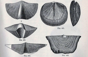
These sands sometimes contain some of the few signs of life that do appear in the Marcellus. If you search these sands, you will sometimes find the fossils of shellfish. We only found one kind. It is something called a brachiopod. Brachiopods, like clams, have two shells but they have a very different anatomy from clams. There are very few brachiopods alive today but there were quite a few of them during the Devonian. This species is called Mucrospirifer. It’s a common Devonian form. It’s only found on the sandstones; we suspect that Mucrospirifer was able to colonize the sand bottom but avoided the dark mud.


So, there is a lot to see on this stretch of Rte. 32, but what does it all mean? We have now visited some very deep water, and that by itself, is quite something, but is there a broader meaning to all this? There is. In our journeys we have already visited some deep-water black shales, those of the Schoharie Formation back on Rte. 23. In fact, we have found that there has been an alternation of geology. We saw the thick Helderberg and Onondaga Limestones alternating with the Schoharie and now the Marcellus black shales. Greene County itself alternated in its Devonian ecology. Sometimes there were shallow tropical limestone seas. Other times there were deep black mud seas. Why was this happening?
Limestones, and limestone seas, form during times when there was no mountain building going on. Today, modern limestones are only found far from any rising mountains. There are no limestones on the American west coast, but there are plenty of limestones in Florida. The west has mountains and they are rising, Florida does not.
Black shales represent the dark muds that washed off of distantly rising mountain ranges. There are, for example, plenty of dark muds in the Bay of Bengal, south of the Himalayas. So, mud means mountains: this is where, to a geologist, it starts getting exciting. Our Greene County Devonian history is speaking to us of cycles of distant crustal uplift, at the onset of a great mountain building event. Those mountains are called the Acadians and by the end of the Devonian Period, they towered over western New England. They would rise to very great elevations, high enough to actually rival the Himalayas of today.
But, in this episode, our Acadian Mountains have just begun their uplift, they are not yet very tall. As soon as a mountain range begins its uplift it also begins the long processes that will, in the end, destroy it. Those processes are 1) weathering of the rock, breaking down into sediment and soil, and 2) erosion of those materials. These twin processes always triumph in the end; they destroy the mightiest of mountain.
In these early stages of mountain building, weathering and erosion mostly produce mud and river and ocean currents carry that mud away from the mountains. The grains of mud are mostly clay and clay can travel very great distances. That’s why mountain building in New England can form black shale in eastern New York, especially including Greene County.
As we said, to a geologist all this is exciting. We look at black shales along Rte. 32, then turn around, look east and see great mountains rising on the distant horizon.
Our story of the Devonian in Greene County has begun to find its main theme. So far, all of our first six chapters have only been the preliminaries. But, from now on, we will be looking at the evidence of the truly great events of the Devonian. The word a geologist uses for a mountain building event is orogeny (literally the genesis of mountains). This one is called the Acadian Orogeny. It’s important around here, the Acadian Orogeny shaped Greene County more than any other event in history.

Contact the authors at randjtitus@prodigy.net. Join their facebook “The Catskill Geologist.”

GreeneCounty Devonian: the coral reefs arrive

in Uncategorized by

The Devonian of Greene County, Part Six
End of an Era
Updated by Robert and Johanna Titus

New Baltimore’s Limekiln Road runs south to north in the very pretty northeast corner of Greene County. It’s steeped in history and, as we are sure you can guess, much of that history is centered around a lime kiln. To drive there head east from Greenville on Rte. 26. Go 9.7 miles east from Stewarts, turn left onto Limekiln Road and continue north. You will go exactly one and three quarters miles north to get to your destination, but don’t be in a hurry. A little more than a mile along the way you will see the lime kiln itself on the left side of the road. A historic marker states that the kiln goes back to the 1850’s, but it’s still in a very good state of repair. It must have been quite the operation back then because there has been a lot of quarrying along the road. Watch carefully and you will see remains of the excavations that once fed limestone into the kiln. The rock ended up as lime and fertilizer.

As we said, there is a lot of history here. But we will find that this 19th Century history has allowed us to see into a much deeper period of the past. Continue north another half mile along the road and you will soon see pools of water just to the right (east) side of the road. Here more of the old quarrying carved out a rough basin. Quarries always provide geologists with keyholes into the distant past; this is a very good keyhole.
In the five earlier episodes of this series we have traveled through a great deal of the Devonian time period as it is recorded in Greene County geology. It is estimated that the Devonian began about 419 million years ago and, in our last installment, we reached a time of perhaps 396 million years ago; we have so far traveled through about 20 million years or so: not bad.
We have witnessed the comings and goings of several very different types of oceans. First, we saw a limestone producing Helderberg Sea, something that might remind you of the Bahamas of today. Then we saw the black shales of an enormously deep ocean, the sort of place where you would look for a sunken ocean liner.
In this episode we start a new episode of our area’s history, when there was the return of another shallow tropical sea, once again something very much like the Bahamas of today. We are going to visit some very nice limestones. These are called the Onondaga Limestone and, once again, we will find that they have quite a story to tell.
Limestone was the focus of the first four chapters of this saga. We remind you that they are the sorts of rock that originate in shallow tropical seas. Visit the western coast of Florida, famed for its shell collecting, and you will see just exactly this sort of habitat. Fossil rich limestones are forming there today. Travel to the southern tip of Florida and go snorkeling, and you just might be fortunate enough to be able to explore a coral reef. Someday, some of these reefs will harden into limestone and become fossil coral reefs.
As you will probably guess we don’t have to go to Florida, or the Bahamas, to see such wonders; our trip to Limekiln Road has brought us to a very good one. Above us is an inconspicuous hill named Roberts Hill. It’s a pretty little place, but not the sort of landscape that would attract much notice. But look above you and through the woods, you will see a number of outcroppings of limestone. A closer look will tell you something most remarkable: this hill, all of it, is a fossil coral reef. See for yourself. At first you only see inconspicuous gray outcrops, but close up it is all very different. The rock is “alive” with corals. You have to see this to believe it, but it is there. The reef even has a name; it’s called the Robert’s Hill Reef.

Stand along the side of the road and gaze up at Roberts Hill. Now your mind’s eye must travel back in time. It is the Devonian and all around you are the agitated waters of the tropical Onondaga Sea. Rising in front of us is the murky image of a great coral reef. Immediately in front of us are a number of coral mounds. Rising above these are the skinny arms of branched corals (B on picture); these colorful arms seem to reach out towards the water’s surface. Farther up, near the top of the reef we see a large cluster of smaller and shorter corals. Each of these has the shape of a cow’s horn (A).
Look straight up and you will see the undersides of passing waves. They sparkle in the sun as the swells and troughs pass overhead. The waves are approaching the reef from behind us (the southwest). Our eyes can follow any one of these waves and watch as it closes in on, and then smashes into, the reef in front of us. The collision stirs up a chaos of bubbles and silt. Together, these materials make our view of the reef an indistinct and cloudy one. Below and behind us is a rubble of broken dead corals. This litter records damaging episodes of intense wave activity. Roberts Reef can be a very rough place to live.
Today, the waves are quite strong, and few animals are venturing out. The corals are well adapted to the stress, but all the fish have hunkered down. They are hiding in reef crannies and they are out of sight. It’s too bad about that. Suddenly, an especially great wave crashes into the reef and our image of it is completely obscured. In a flash we are back in the present and the summer greenery replaces our view of the reef. It’s nice to look at but just not the same.
Our trip into the past was too brief, but let’s use what we learned to make the best of it. This outcrop is a hash of whole and broken corals, probably preserving most of the original reef. Take a look and see for yourself. We found the best fossil hunting in the roadside knob just south of that small pool of water. You won’t have to climb around very much; the nearby exposed rocks there show most of what you need to see.
There are three broad categories of corals to look for. The biggest are not the most common and not the easiest to find, but they are worth the effort. They are the old coral heads that grew into mound-like forms. Look for large dark corals, up to two or three feet across, and focus on the detail. You can identify these from the honeycomb patterns within them (C). Each honeycomb chamber was once inhabited by a single coral animal, so the coral head makes up a colonial structure, coral apartment houses. The second type of coral can be recognized by its circular shape. Watch for something that sort of looks like the cross section of a gray orange. The appearance is misleading as the whole specimen actually has a horn shape. It’s only the cross-sectional view that looks circular. These, logically enough, are called “horn corals (A). “They lived in clusters on the reef. The third type is a digitate coral. In this case a number of corals grew together in branches (digits) that reached up toward the currents (C). You will mostly cylindrical fragments of their branches, often with many of them lying parallel to each other.
If you have never seen anything like this before, we think you will find it to be most remarkable. Look all around you; today it is Greene County in high summer and all around the greenery is beautiful to see, the air fresh to breath. But we have already looked at all this with the eyes of geologists; all around us we have seen the relentless wave pounding of a sparkling shallow tropical sea. We have seen reef corals reaching out to these waves. We have found that this space, back in the Devonian, was a very, very different place indeed.
If you make your return trip down Limekiln Road watch for two more exposures of the Onondaga Limestone along the way; they are fine cliffs on the right (west) side of the road. Notice that with these outcrops there are no fossil corals. These strata expose a different environment of the Onondaga. These well-stratified limestones formed in the open ocean; a habitat without any reefs. It seems that the Onondaga Sea was too deep here to allow coral reefs to get established. The reefs are all found to the north; in the south the ocean was a different open ocean ecology.
All this represents an end of an era. After the Onondaga there would never again be a time of such shallow tropical seas in Greene County. Our county would never again resemble the Bahamas; a major period in its history was over.

Contact the authors at randjtitus@prodigy.net. Join their facebook page at “The Catskill Geologist.”

End of a Limestone Sea July Geological Rumblings in Greene County The Devonian, Part Five 7-25-2019

in Uncategorized by

End of a Limestone Sea July Geological Rumblings in Greene County The Devonian, Part Five Updated by Robert and Johanna Titus Greenville Press September 7, 2005

We have, in the first four chapters of this opus, encountered a very different Greene County from the one that we are familiar with. We have been visiting outcrops of the Helderberg Limestone and envisioning the tropical, shallow water sea that once covered all of our county. We have seen a sea that can be likened to the Bahamas of today. That’s a remarkable concept to ponder, but that is what the rocks tell us.

Obviously, such a tropical sea did not last. This ecology would disappear and be replaced by something new. It is in the stratigraphy that we pick up in this chapter. Find your way to Rte. 23A and travel to a site exactly three tenths of a mile east of the New York State Thruway. There you will find a large dark outcropping on the south side of the road and a much smaller gray outcrop on the north. There is a lot of history here.

If you look this site over carefully you will realize that, before being largely eroded away, the dark strata passed horizontally over the gray beds; they used to extend across the highway, but they have been eroded away on the north side. That makes them the younger strata. We geologists always start at the bottom so let’s take a look at the older gray rocks. The gray strata represent the top of the Helderberg Limestone. That’s the unit we have been looking at in recent columns. Now, at last, we have reached the end of Helderberg deposition. These limestone strata represent something of an end of an era. If you poke about on this outcrop you will probably be lucky enough to see some fossils here. There aren’t many so please be patient. These creatures were the fortunate inhabitants of a very nice ecology. For millions of years our beautiful shallow tropical seas have been accumulating these limestone sediments and turning them into rock. But now, that time is over. Those overlying dark rocks represent a dramatic, even profound, change for all of Greene County. This was an important moment of history so I hope you can appreciate it.

Walk across the street and take a look at the thick sequence of dark beds exposed there. The lower levels are massive ledges of dark strata. The rock type is an unusual one and we were very surprised to find it here. These strata are composed of chert. You likely know chert by one of its other names: flint; it’s a form of silica. Bedded flint is more common east of the Hudson River; it is rare on our western side. The overlying strata, all the way to the top of the outcrop, are black shales. Or at least these beds were black shale originally. These strata have probably been baked a little during Appalachian mountain building events.

These flinty chert and dark shale beds make up a unit of rock called the Esopus Formation. As you can see, it certainly stands out in sharp contrast to the Helderberg Limestone. You can quickly deduce that the environment of deposition must be equally different; this was no tropical shallow sea.

Geologists usually interpret bedded chert as having formed at the bottom of very deep seas. If that is the case here then you are looking at sedimentary rocks which formed at the bottom of an ocean that was, perhaps, thousands of feet deep. We don’t know if this ocean was quite that deep, but this was no puddle. This was a quiet seafloor with very few currents. It was likely that it was very still and that there was very little oxygen in the water. That would have made this a lifeless seafloor.

The overlying black shale accumulated as black mud in waters that were probably a good bit less deep. There may have been some currents, but we suspect that there was very little oxygen. This too is likely to have been a lifeless seafloor.

The Esopus Formation speaks to us of major crustal events. It would seem that the bottom dropped out (literally) of that shallow tropical Helderberg Sea. The crust sagged abruptly, and soon deep, quiet water conditions prevailed. The rich marine sea life and the complex ecologies of the Helderberg Limestone disappeared entirely. A monotonously dark, deep, cold abyss replaced them.

There is more to the story, but you will have to drive a little in order to see it. Find your way to Rte. 23 and then drive a short distance west of the Catskill Creek Bridge. There are outcroppings on the north side of the road. If you look around you will see more of the Esopus Formation here. You will find somewhat baked black shale. The strata here have not only been baked but they have been folded as well. You will see a great round fold in the rock. In the past, this location has been referred to as the “Wheel Cliff”.

On the west (left) side of the outcrop we found some strata that have escaped being baked. Here we could find an original delicate lamination in the strata. These thin beds record long episodes of very slow deposition. A quiet seafloor only slowly accumulates very fined grained, muddy sediment and it does it very slowly. You are looking at a lot of time.

We learned more on the south side of Rte. 23 at the eastern end of the outcrop. There we found another unit of rock. Geologists call this one the Carlisle Center Formation. It is lighter colored, thick-bedded and made up of a little bit courser sediment. The shale has been succeeded by siltstones. This unit completes a sequence which may have a lot to tell us about Devonian history.

Those Esopus chert beds appear to have been deposited in very deep and very still water. They grade upwards into shale strata which seem to represent somewhat more shallow waters. Now there was little in the way of current activity, but conditions were not as stagnant as had been the case. The Carlisle Center siltstones complete the story. These light-colored rocks have much less organic matter in them. Black organics decay in the presence of oxygen which, in turn, is related to currents. The Carlisle seems to have formed in the shallowest waters, in depths which allowed winds to generate currents. This whole sequence of strata can be called a “shallowing upwards cycle”. The great downwarping that initiated this sequence was followed by a prolonged slow shallowing. A lot of that shallowing may have been caused by the sediments that slowly filled in the basin. Pour enough silt and clay into a deep sea and it must become shallow. As it becomes less deep, currents will begin to affect the seafloor. It’s a nice pattern.

But where did the sediment come from? There may be a couple of hundred feet of clay and silt involved. What made it? That, in fact, is the crucial question and answering it tells us the most about what was going on. Geologists look east and back through time to answer that question. Back in the Devonian all of New England was rising in a great, in fact very great, mountain building event called the Acadian Orogeny. What we might call Europe today had collided with old North America just as India has collided with today’s Asia. India’s collision created the enormous Himalayan Mountains, Europe’s collision created the Acadians. Look east from Rte. 23 and imagine the towering mountain range that once was there. It would reach elevations that made it the rival of the Himalayas.

But not during Esopus times. By then the Acadians had just begun their uplift. Small mountains produce small amounts of sediment and most of that is in the form of silt and clay. Our Esopus/Carlisle sequence might look big and thick to us, but it is relatively small by mountain building standards. Still, the infant Acadians had accomplished a lot. They had destroyed that beautiful limestone sea of the Helderberg. They had replaced the limestones with chert and shale, and they had forever left a mark on Greene County. But that was just the beginning. 25, 2019

The Kalkberg Limestone July 18, 2019

in Uncategorized by

The Devonian of Greene County, Part 4 – the Open Sea

The Greenville Press

Updated by Robert and Johanna Titus

Both of us have spent time in the Bahamas. One of the most exciting parts of the journey is the first-day plane ride across the Bahamian platform, that great wide shallow tropical sea that makes up most of the Bahamas. From the plane you can look down and see a wonderful, very shallow, tropical ocean. It’s a fabulous sight and the experience has equipped the two of us to see the Catskills in a way that not many can. A plane ride across the Bahamas is also a flight across our land as it was long ago.

Sunrise, October 31, 410,390,139 BC, just before dawn – Weare the mind’s eyes; we can go anywhere and do anything. We can go fast, and we can go slow, we can soar high and we can fly low. Right now, we are a mile above the future site of Stamford, and we are headed east. The sun is, of course, headed west and we watch as the gray eastern horizon brightens into a red and then a yellow. We can see a brightness that betrays exactly where the sun is, even if it still remains hidden below the horizon.

     Below us is the grand expanse of a great broad sea. It is called the Helderberg Sea, but it is still too dark this morning to actually see it. Behind us, the last of the morning stars are still shining but before us the sky continues growing brighter and suddenly a red pinpoint of light expands into the full disk of a rising sun. We, the mind’s eye, pause and hang still in the sky and watch this daily cycle of light. Soon it will be bright enough.

     The rising Sun reveals that, below us and stretching to the east, is a beautiful shallow sea. This ocean can’t be very deep. The water is clean and transparent, but the seafloor is just a little too deep to be clearly visible. Nothing much of it can be seen even this high up, but we are the mind’s eye and we descend down to an altitude of merely 50 feet above the waters. The morning air is still and already warm; the water is undisturbed by any waves. We slowly move across the aqua-colored sea and gaze through the waters of the Helderberg Sea down to its bottom. There are a few fine patches of green. Large seaweeds and sea grasses do not exist yet in this the Devonian time period and it is too deep here for most algae. Nevertheless a few “fronds” of algae rise from the seafloor and make up small green patches.

    We, the minds eye, now are drifting across the sea. It is as if it was given to us to be in a glass bottomed boat, but this boat travels across a 410 million year old ocean. It is fascinating to see the past like this.

     Now, we cross a stretch which appears to be a marine meadow. The seafloor is not covered with our algal greenery but, rising above that, are what appear to be flowers. We drop into the sea and go down to the bottom and look. We are the mind’s eye and we can do this.

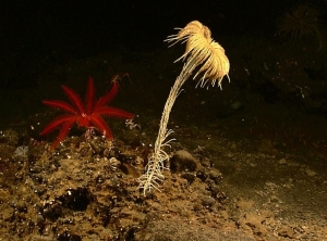
     Our “flowers” turn out to be animals; they are called “crinoids” in the Latin terminology, but many people like to just call them “sea lilies” as that is what they look like. They are distant cousins of the starfish. Their brightly colored arms reach up into the waters of the Helderberg Sea as they search for food. There is a lot of food and, not surprisingly there are many crinoids too. They truly make up something that looks like a meadow.

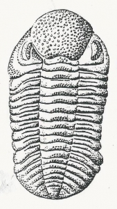
     Our “meadow” is something of a marine jungle and it is not without animals lurking in the “brush.” Shellfish, that paleontologist call brachiopods, are the most common. Then there are the delicate lacy networks of animals called bryozoa, Latin for moss animals. Both of these forms appear sporadically among the green algae. The most interesting of our Devonian animals are the trilobites. They might remind you of a horseshoe crab. One of them is slowly creeping through our meadow. It is clawing at the sediment beneath. This form is a scavenger and it is seeing what sort of food luck has in store for it. We, the mind’s eye, are fortunate enough to see this one alive.

    The brightest of the Devonian animals were the nautiloids. We see them and quickly recognize that they were related to the squids. They had the long tentacles and the fine eyesight that modern squids have and were actually close cousins with the modern forms. The two groups were similar except that, unlike squids, the nautiloids “wore” shells. Some of those were conical, but the ones we are looking at are coiled. Our Helderberg specimens seem to be social. Six of them lull on a patch of sandy sea bottom. Their tentacles paw back and forth through the sand; they too seem to be searching for food.

     We have spent hours drifting lazily across the Helderberg seafloor, but we have covered a lot of ground. Now we have arrived at a spot where someday Rte. 23 will pass the Thruway. Our journey into the Devonian is not over however; our travels will simply take a different route. Now we will travel about 400 million years forward through time, but when we get there, to today’s world, we will still be in the Devonian.

May 16, 2004 – Rte. 23, south side of the road, just east of the Thruway – Traffic speeds by this spot 24 hours a day. Cars rarely stop here; there are few reasons to do so. The only thing of note here are the ledges of gray limestone that line both sides of the road. The rocks have a name: geologists say that they belong to units called the Kalkberg and the overlying New Scotland Limestones. To the discerning eye, these sedimentary rocks are composed of sandy textured materials which were once, indeed, sands. These are not the quartz sands that we know in the northeast; they are soft calcium carbonate sands that harden into limestone.

     The Kalkberg and New Scotland are stratified; the rocks are composed of horizontal layers of limestone. What is remarkable is that each horizon of rock was once, for a short time, the bottom of the Helderberg Sea. Each horizon had its turn as seafloor; its sediments were laid down by passing currents. Then, for a time, warm waters lapped across them. Algae and shellfish took their turns living here. But “turns” are always brief; soon these temporary seafloors were buried by more sediment carried by more currents. When the weight of burial was great enough, they slowly hardened into rock. This describes the almost endless cycle of sedimentation.

   That sea was deepening, and the New Scotland was deposited in deeper waters than the Kalkberg. Geologists call this a “transgressing” sea. We have been seeing this record of transgression in the several articles that we have been writing. The transgression first began with the appearance of the Manlius Limestone. The Helderberg Sea gradually deepened through the sequence of the Coeymans, Kalkberg and New Scotland Limestones. With deposition of the New Scotland the deepening would reach a maximum and the Helderberg Sea would not get any deeper. But it is important to understand that “deep” is relative; this was never anything but a shallow tropical sea, much like the Bahamas of today.

    If you visit a place such as this, you can search out horizontal ledges of limestone. When you look at such surfaces, you are looking into the past. You are literally looking at ancient seafloors. Often these surfaces are littered with the fossils of the very shellfish that once lived here. These creatures have been dead for about 410 million years, but they were the living creatures who actually knew the Helderberg Sea when it covered most of upstate New York

     Those surfaces can still be littered with the fossils of brachiopod, bryozoa, crinoids, trilobites and much more. In a way the Helderberg Sea is still alive, but only to those who know where and how to look.

   Contact the authors at randjtitus@prodigy.net. Join their facebook page at :The Catskill Geologist.

The Coeymans Limestone July 11, 2019

in Uncategorized by

The Devonian of Greene County
Part 3: The Coeymans Limestone
The Greenville Press March 3, 2005
Updated by Robert and Johanna Titus

The two of us once had dinner at the “Seven Seas Restaurant” at Walt Disney World in Florida. It’s quite the experience. If you get a good table, you are right up against the window of one of the world’s largest aquariums. It’s enormous, and they don’t keep just goldfish in there either. There are full size sharks and an abundance of other large, colorful tropical fish. There is even a small living coral reef. Of course, it’s not that the corals actually do anything, but they add a great deal of color to the experience.
You might think that you can’t have dinner at a place like that here in Green County, but you would be wrong – sort of. All you really need is a good imagination and a little bit of knowledge. We can provide the knowledge.
In recent issues of the Press we have been surveying the geology of the Devonian time period, here in Greene County, and so far, the emphasis has been on the Helderberg Sea. That was the shallow tropical sea that once covered our entire county. We have gone and visited outcrops of the Rondout and Manlius Limestones but now it’s time to visit what may be the most interesting of all the local Devonian rock units. It’s called the Coeymans Limestone and it’s named after the town. The Coeymans is composed of thick bedded, very fossiliferous limestone and it is often a good thick unit of rock.
You can go and visit it yourself. Take Rte. 81 east from Greenville until you come to the Quarry Restaurant (yes that’s where you can have dinner next to an imaginary aquarium). Just east of the Quarry, on both sides of the highway, are large outcrops. The upper two-thirds on both sides are exposures of the Coeymans.
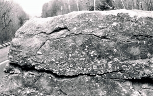
If you pull over and take a good look you will see just what we promised. The limestone comes in solid thick layers (strata). From any distance it is pretty dull looking stuff, but if you get really close you will see a lot more. You should be able to pick out the crescent shaped cross sections of fossil shellfish. These are bivalved invertebrates. That means they had two shells, just as a clam does. They just weren’t clams; they belong to a very different group called brachiopods. This one is named “Gypidula coeymanensis.”
With a little patience you should be able to find something a little more recognizable than a cross section. Some of these fossil brachiopods are actually pretty good specimens. Sadly, I don’t think you will have much luck trying to collect any of them; this is very solid rock and it will only give up its fossils grudgingly. Anyway, the outcrop makes a fine outdoor museum just as it is.

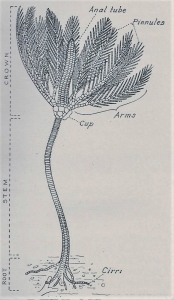
You will also likely find a number of what look like fossil Cheerios or fossil Life Savers. These are the circular remains of what are called “sea lilies.” They were distant cousins of the starfish. Imagine a five-armed creature stacked atop a long stem-like structure. In life the small Cheerios were stacked together to make up parts of the stem.

  Living crinoid

All in all, we can conjure up an image of a colorful tropical seafloor here. Imagine pink sands, with some green algae, then add the sea lilies and brachiopods and you have a pretty good marine ecology.
All this gets us back to having dinner with the view of a tropical sea. The Coeymans Limestone once passed right through the site of the Quarry Restaurant. Of course, the limestones long ago eroded away right where the Quarry is, but they were there. And so was that ancient Devonian sea.
What we are saying here is that the very space now occupied by the dining rooms at the Quarry was once shallow tropical sea. Back then this was just as good as, and probably better than, anything you can see at Walt Disney World!
That’s quite a claim, but it all gets even better when you spend a little time looking around. We found a couple of very interesting boulders of the Coeymans nearby at the intersection of County Rtes. 26 and 81. One of those displayed the cross sections of several of those thick limestone layers that typify the Coeymans. But these were special. They each displayed a foot or so of limestone. At the bottom of each horizon was a litter of broken fossil shells. This coarse-grained litter graded upwards into finer-grained limestone. What we were looking at were two storm deposits. Way back in the Devonian, two awful storms, perhaps even hurricanes, swept across Greene County. Each event stirred up the sediment of the seafloor. As the storms passed, the coarse-grained shell fragments settled back onto the seafloor first and then the sand sized particles followed. Geologists call such strata “graded beds.”
So now, when you are sitting and having dinner at the Quarry, you can imagine the raging currents of a passing hurricane swirling all around you. How’s that for an appetizer? But it gets better.
That second boulder really caught our eyes. It displayed several small fossil coral heads. These fossils gave the appearance of honeycombs; they were composed of numerous small hexagonal chambers. That’s what a coral head is supposed to look like. In life, each chamber possessed the soft anatomy of an individual coral animal. This cold gray boulder was, in short, a part of an old coral reef.
This was a pretty good-sized boulder and we have little doubt that it was originally from a site very close by. Once again, you look at the evidence and you begin to realize that things used to be very different around here. Try to imagine a coral reef all around you while dining at the Quarry. These are colorful habitats and rich with living creatures. Few of them would look very familiar. We suspect there were a lot of fish here, but we don’t think you would recognize any of these ancient ancestral fish. We are guessing that these fish would have been a lot slower and clumsier than the ones that typify a reef today.
But they were marine fish, and they did live right here. So too did those corals. Our outcrops on Rte. 81 near the Quarry are a gateway to a distant past. This was Greene County at the time of the Coeymans Limestone. Wave your arms through the space around you and realize that you are sharing space with an ancient marine ecology; you just cannot share its time.
Contact the authors at randjtitus@prodigy.net. Join their facebook page “the Catskill Geologist.

The Manlius Limestone July 4, 2019

in Uncategorized by

The Devonian, Part two
The Greenville Press, Feb. 17, 2005
Updated by Robert and Johanna Titus

The last time we wrote, we traveled down Rte. 23 towards the Rip Van Winkle Bridge and looked at a unit of rock called the Rondout Formation. The strata of that rock unit took us back to a very old fossil mudflat at the edge of the Devonian age Helderberg Sea. This time let’s look at the overlying rocks. Those strata pick up right above the Rondout. The top of the Rondout showed some distorted strata. The next unit, the Manlius Limestone, lies immediately above them.

Geologist points at the Manlius Limestone

These strata are limestones. They are composed of calcium carbonate (CaCO3), and that makes them the same stuff that most of Florida and all of the Bahamas are made of. If you have been to either of those places, then you can begin to imagine what those limestones tell us about what this area was like back in the Devonian. It was tropical and covered by a sparkling, aqua-colored, very shallow sea. Actually, most of the Manlius was deposited within the tidal zone or just above the high tide mark.

In short, most of the Manlius was deposited in a broad tidal flat. It was not exactly a pleasant place to be. It was hot, salty and would have been really uncomfortable for humans. Not many organisms lived in this setting but there were some. There was a form of crustacean living there. This creature, called an ostracod (E in our second illustration), was a small and distant relative of the shrimp. Like brine shrimp these little fellows must have been tolerant of the very salty conditions that prevailed. Alongside the ostracods were some of those mysteries of paleontology, creatures we call tentaculitids (F&G). These were some sort of invertebrate shellfish but, exactly what, we can’t hope to ever know. They possessed handsome little conical shells and those cones were ornately ridged. There is nothing like them alive today and we, thus, have no way of ever figuring out what they might have been.


Ostracods and tentaculitids seem to have been pretty well adapted to life on the hot, mudflats, broiling in the tropical sun. Few other animals could, however, tolerate these conditions. But there was one form of life that did quite well in this setting. These were the blue green algae. They often go by another name, the cyanobacteria, and that name gives you a clue as to just how primitive and old these forms were. These ones are still alive, and we can study them, so we know a lot about them.
Cyanobacteria are, as the name implies, photosynthetic bacteria. That makes them very primitive one-celled organisms which were the earliest to photosynthesize. They first appear in the fossil record about three and one half billion (yes, with a b) years ago and that makes them among the oldest creatures that we know of. Hot, broiling, sunny days were common back then and these creatures, long ago, evolved a tolerance for such conditions. By the Devonian, they were old hands at life in such awful settings.
They formed algal mats that coated the old mudflat surfaces and we can recognize those mats in cross sectional views of the Manlius. We see thinly laminated horizons of the limestone. Each bed is an old algal mat. The algae grew and they were sticky so that grains of silt and clay would stick to them. That made the laminated rock that we see.

Not all of the Manlius was mudflat; the upper part of the unit was deposited in very shallow sea water, just deep enough for another whole ecology. If you look carefully in this outcrop, you can find the faint (very faint) images of reef building organisms. They are called stromatoporoids and these are very mysterious organisms. Just as with the tentaculitids, these forms have long been extinct. We can only guess what they amounted to in life, now they are just poorly preserved fossils. Please see last week’s blog.
The Manlius Limestone most likely records a long period of geological stability, but there are some interesting interruptions. There is at least one level we have evidence of serious erosion. Apparently, the crust buckled upwards (an earthquake?) and this was followed by a period of erosion as Nature sought to reestablish Her pre-uplift level.
Crustal activity such as this must have been very rare in the early Devonian, but as we shall see, this event was the harbinger of much more to come. To look at this erosional surface, and especially to touch it, is to be in direct contact with a moment in the past.

Aug. 23, 406,321,482 BC, high noon – The sky is clear and cloudless, and the Sun is positively baking the landscape below. It is extremely hot, well above 100 degrees, and to make it all the worse, the heat has pooled on the still surface. There is no breeze at all, and the light-colored landscape reflects wavy masses of hot air rising off its surface. This is the stuff mirages are made of, and in the distant east, there appears to be a large pool of water. There isn’t; Nature is trying to fool us.
But to the west there is water; it is the Helderberg Sea. It is active on this day; the large swells of approaching waves roll towards the coast. The waves consist of crests and troughs; it is the troughs that are most interesting. As they pass, they momentarily reveal the top of reef “heads.” These are the brief exposures of stromatoporoids. Too bad they are so far away; we might get a better look at them is maybe learn something about what they really are. But, in a flash, we lose interest in those stromatoporoids.
Suddenly, without any warning, comes a low rumble. It sounds like a very powerful loudspeaker playing a very low frequency sound. Then there is a shaking of the ground beneath us. The earth’s shaking picks up for a few seconds and the mudflat seems to roll and fold up and down just as the advancing waves had been doing, just seconds earlier. The ocean is churned up and wild with action. Now several large waves of displaced water crest and roll over what had been beach.
Almost as quickly as it began, the earthquake has ended. The mudflat is a mess, contorted, distorted and folded by the seismic activity. Strangely, the layers of sediment were cohesive enough to maintain much of their form in the thick of the activity. Now they look like shiny, light-colored carpets that have been folded. The mud flats are a good foot higher than before the quake; the crust has risen that much.
The water that has sloshed across the beach is flowing back into the Helderberg Sea. It is beginning to carve small channels as it finds its way downhill. It’s part of a process; Nature is already trying to lower what the earthquake has lifted.
Hundreds of millions of years from now people will come and look at all this.
Contact the authors at randjtitus@prodigy.net. Join their facebook page “The Catskill Geologist.”

Dawn of the Devonian June 27,2019

in Uncategorized by

Dawn of the Devonian
Greenville Press
Feb. 3, 2005
Updated by Robert and Johanna Titus

You have, no doubt, driven down Rte. 23 on your way towards the Rip Van Winkle Bridge, and passed one or more vans parked along the large limestone outcrops that are commonly seen all along the highway there. Along the road, large numbers of students can be seen pounding with hammers on the rock ledges. These are geology field trips. Students and faculty come from colleges all over the northeast to visit these rocks.


The location is one of the great geological tourist traps of our part of the country. Between now and early autumn scores of these visiting vans will appear here. The outcrops stretch for a mile or so along Rte. 23, but there is one location which is even better than all the rest. That site is the exit ramp where drivers leave Rte. 23 and get onto Rte. 145 west. They may be headed for Leeds, but they are passing some very good geology.
The location displays what geologists call an angular unconformity. If you stop there you will see one set of stratified rocks dipping steeply to the right. These strata are alternating horizons of sandstone and black shale. They make up a very small part of what is called the Normanskill Formation. That rock unit dates back to a time called the Ordovician and that makes them about 450 million years old. These strata were deposited in what was probably some very deep, marine waters, but that is not our story today.
Above the right-dipping strata are some left-dipping beds. Left and right, these contrasting inclinations form the “angular” part of an angular unconformity. The overlying strata are called the beds of the Rondout Formation. That unit is Silurian in age and that makes it merely about 420 million years old. That leaves about 30 million years missing and that is the “unconformity” part of our angular unconformity.
The sedimentary rocks of the Rondout are called dolomites. Dolomite is a calcium/magnesium carbonate. It used to be a different rock, something commonly known as limestone. That’s important as limestone only forms in a tropical climate. These sediments accumulated on an ancient mudflat, at the edge of an ancient tropical sea. The sediments made up the upper reaches of the high tide level, we call that a “super-tidal” setting. The ocean waters only reached this high up at the highest of tides. You would have to travel to the Persian Gulf to see something like this today.
The Rondout is important to geologists as it forms the first and oldest unit of the Helderberg Sea. This is a thick sequence of limestone that makes up the Helderberg Escarpment which looms as a great ridge above Albany. The Helderberg strata make up a lot of the bedrock in this area and so geologists pay a great deal of attention to it.
At the Rte. 23 outcrop, the Rondout is capped by some badly distorted strata. They were deposited as flat sheets but subsequently they came to be deformed as great crustal stresses folded them up. You can easily see this at the outcrop. The top of the folded sequence marks what many geologists call the very end of the Silurian time period. Above this horizon is the very first stratum of the next time unit, the Devonian, dating back to about 419 million years ago. This is a very important horizon as the Devonian is the most important unit of time in the entire Catskill region. Every bit of bedrock from here to Syracuse and beyond is Devonian. That’s a lot of rock and it all started right here. This horizon of rock takes us back to the dawn of the Devonian and the very dawn of the Catskills themselves. That makes it important. But, before the Devonian, there was the Silurian.
Sunrise, July 14, 419,632,751 BC – The air is absolutely quiet. Not the slightest of breeze can be felt. The landscape is similarly still. All around us to the east is a monotonous flatness. It’s not that the land is smooth; it’s a very rough mudflat. Every few feet there is a low tilted ledge of rock just poking above the surface. These ledges vary in thickness; some are just a few inches thick, while others can be a few feet thick. Each ledge is composed of sandstone; each has a bleached creamy yellow appearance. Each is broken up by fractures that pass perpendicular to the rest of the rock. The ledges all seem to be broken up into rough cubes.
In between each set of ledges is a small “valley;” all of these are filled with a litter of dark gray pebbles, mixed with a darker, almost black, earth. Here and there, some very small puddles can be seen in the valleys. The edge of each of these is rimmed with a white substance that appears to be salt. These are, indeed, saltwater pools, and they have been evaporating in recent times.
This is the most dead-looking of landscapes. There are no plants here, not a blade of grass nor even a lowly weed. There are no insects on the ground, nor are there birds in the sky. A careful check of the “soils” would not even reveal any worms.
And it is, of course, absolutely quiet. There is no wind and there are no animals to break the silence. It is a silence that is almost impossible for us to imagine for we are visitors from a noisy world.
But this actually is our world, and it’s a very familiar part of our world. Someday this very location will be the intersection of Routes 23 and 145; this will be the exact place were an exit lane connects the two highways. People will call this the town of Leeds. But, at the time of our visit there is no sound of traffic. This is not the noisy world of today, but the almost silent world of the late Silurian time.
But we are time travelers and we have our left foot in the Silurian and our right one is in the modern world. We look to our left and see a Silurian sunrise, to our right the highway traffic of Rt. 23 zips by.
But our interest and presence in the modern world fades; it is the Silurian vision that captivates our mind’s eyes. There and then, on the distant eastern horizon, the sun is about to rise. A gray light first appeared, and then slowly turned red, and now it is brightening with ambitions of an intense yellow. The exact moment of sunrise is always magic. The brilliance of the sun just creases the horizon and, quickly, the rest of the great orb ascends into its rightful position in the sky. The movement is smooth and surprisingly quick. It is the only time of the day when you can really sense the movement of our great nearby star.
For almost four and one half billion years the sunrises have been appearing on this horizon, but the sun does not show its age. This Silurian time period has been a fine era for sunrises. What with all the flatness of the landscape extending off to the east, nothing ever gets in the way of a view of the rising sun. And now the sun is gaining altitude and its light shines across our flat lands to far behind us.
We turn and gaze westwards and there, before us, is a very broad and very smooth sandy mudflat. On the distant western horizon, the disk of a gorgeous full moon is just setting. Full moons are like vampires; they do not like to be out during the day. They always set just as the sun comes up.
And way out there, where the moon is setting, is the flat horizon of a distant ocean. It is nothing like the great Atlantic of today. There is no chop to the water, not even waves lap up against this shore. But it is a sizable body of water and it will, someday, be called the Helderberg Sea. It is, as far as we can observe, a very shallow water ocean. Today, with no wind, there are no waves or substantial currents, and its clear, aqua-colored waters lie still on the horizon.
Our nearby mudflat is composed of white, fine-grained limy sand and its smooth surface almost glistens. It was recently soaked under a very high tide, but those waters are receding rapidly. Mudflats should be dotted with snails, slowly meandering about, but this one is not. It seems to be just as dead as the flat landscape to our east.
With the rising of the sun, a little breeze is at last generated. It is a very warm wind; these are the tropics and the temperature will be very hot later in the day. It was like this yesterday and it will be like this tomorrow. Change comes very slowly in the Silurian.

Contact the authors at randjtitus@prodigy.net. Join their facebook page The Catskill Geologist.”

1 26 27 28 29 30 44
Go to Top