The top of a nose, the bottom of a lake?
The Catskill Geologists, The Mountain Eagle 2018
Robert and Johanna Titus
We certainly hope to be writing large numbers of columns for the Mountain Eagle. And, over and over again, we plan to take you on journeys into the past. Our strategy is simple; in each column we will be looking at a modern landscape somewhere, and at the same time, gazing into that location as we think it was thousands, and even hundreds of millions of years ago.
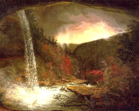
Let’s start today. We would like to take you up the trail that ascends Vroman’s Nose in Middleburgh. It’s a moderate climb and most of you can do it. In fact, we are guessing that most of you have done it. We want you to be watching for exposures of bedrock along the way. If you find a good enough one, then you are likely to see flat lying strata. Each stratum was once a horizon of sediment that had been deposited at the bottom of an ocean called the Catskill Sea. It’s flat because sea floors are almost always perfectly flat. Those sediments are about 375 million years old; that’s how long ago the Catskill Sea existed. Reach out and touch one of those strata; you are literally touching the bottom of that ancient sea!
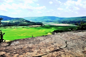
That’s some pretty interesting geology all by itself, but it’s not the main focus of our story today. Keep going up the trail. When you get to the very top, you find yourself on a great flat ledge of bedrock; it’s called the “dancefloor.” This cliff overlooks the valley of Schoharie Creek. We want you to look south, down to the bottom of the valley; that’s where our story is. It is awfully flat down there. It’s even flat as set by the standards of river floodplains. But it is not a floodplain. It is, in fact, the bottom of an ice age lake.
Now, our journey into the past has begun in earnest. We still stand atop Vroman’s Nose, but we have traveled about 15,000 years into the past. We are witnesses to the final phases of the Ice Age. There had recently been a substantial glacier filling the whole valley. Look down there and, in your mind’s eye, fill the valley with ice. But now the climate has been warming and that ice has been melting away; the valley glacier has been melting back to just about where Middleburgh is today.
All that ice fills the valley and acts as a dam, plugging the Schoharie Creek Valley. That dam has blocked the flow of Schoharie Creek and the valley below us has filled with water – creating a lake. The lake has a name; geologists call it Glacial Lake Schoharie. It stretches out before us, extending as far as we can see to the south.
That makes it a very large lake and it is a deep one too. The bottom of the lake is at 600 feet in elevation and the top of Vroman’s Nose is at 1,200. We are looking down 600 feet into the deep, dark bottom of a very substantial lake. We promised you, right at the start, that we would be looking into the past. We think we have kept our promise.
When you get a chance, why not climb Vroman’s Nose and see it as we do.
Contact the authors at randjtitus@prodigy.net. Join their facebook page “The Catskill Geologist.” Read their blog postings at “thecatskillgeologist.com.”