Rip’s Spillway – Feb. 3, 2022
The Legend of Sleepy Hollow
The Woodstock Times – On the Rocks
Updated by Robert and Johanna Titus
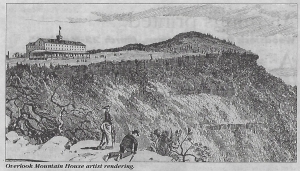
For most of the 19th Century the Rip Van Winkle House stood near the top of the canyon at Sleepy Hollow. It was a restaurant and inn that served the needs of the many travelers of the Old Mountain Road. That road stretched off west from the city of Catskill and it ascended all the way up the Catskill Front and beyond into the Catskill Mountains. It was once one of the great highways of the region. Today, Rt. 23A is its only descendent, and that road climbs up Kaaterskill Clove, the old path has long ago been bypassed.
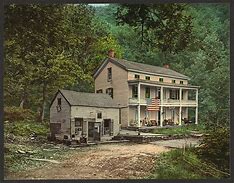
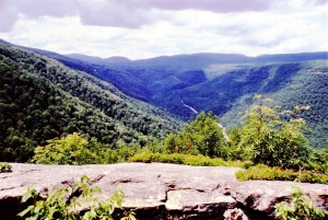
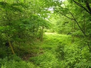
But the old highway is still there in the form of a very fine hiking trail and it’s open to horse riding as well. The Rip Van Winkle House burned down in the early part of the century, but its site is still very easy to find. Sleepy Hollow is a very typical Catskill Clove. It has a nice rocky mountain stream, and the cool, shady location is still an ideal rest for today’s recreational travelers. It’s the stream that made this location. The creek has been here since the ice age ended and the powerful erosive currents that were generated by the steep slopes have carved the canyon.
The creek here is what geologists called a misfit stream. That is the stream is much smaller than it should be in order to have carved the canyon in which it flows. Little valleys are carved by small streams and big canyons are carved by big streams. That’s the way it should be, however that’s not the way it is here. But that is not to say that there is any real mystery. Geologists encounter many misfit streams and the explanation for the bad fit is almost always involved with an ice age past.
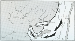
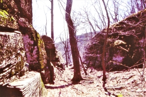
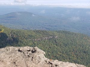
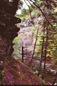
Back at the end of the last ice age there was a very large amount of ice being melted in the face of warming climates. Not surprisingly, many streams were temporarily glutted with meltwater. Great foaming, churning whitewater streams existed where today quiet little brooks are the norm. That’s what happened here. If you climb up the canyon from the Rip Van Winkle House site, you will soon encounter an old stream channel that branches off to the right (north). It’s a fine channel, but it is dry. If you follow it and climb quite some distance, about 500 feet, nearly straight up, you will ascend to a gap in the mountain. To your right is something known as Rip’s Rock, a great picturesque ledge that reaches out into the Hudson Valley. To your left the same ledge merges with the Catskill Front. In between is the gap of which we speak. It is an old meltwater spillway.
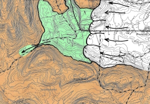
Toward the end of the ice age there was a glacier in the Hudson Valley that banked up against the mountains right here. That glacier was melting, and water was rushing off of it. The water had to go somewhere, and it was channeled right where this dry spillway is. For a relatively brief period of time there was a great rush of water right here. All that foaming, churning, swirling water we spoke of earlier was funneled through this gap. Brief as that flow was, it was very powerful and erosive enough to produce the gap we see here.
This sort of thing is called a paleo-form. That is to say that this landscape feature is literally a fossil, or relic, of different climatic conditions in the past. This is a relic of that very brief moment in time when the ice was melting. Once carved, such a feature is very difficult to erase, today’s erosion rates are so slow.
We like the term “fossil spillway” for this feature, but some geologists like to make it a little more dramatic and they would call this a fossil waterfall. That’s an exaggeration, but it’s really not too far off the mark, there was once a very powerful flow here, close to that of a true waterfall. If you climb up and down this spillway, try to keep that in mind. Make the fossil image part of what you see here. It should not be too difficult to imagine the great fossil flow that once was here. It was ice cold, extremely fast and, more than anything else, powerful. Above it there was still a very sizable glacier. The ice was wet, gray, and dirty; it was melting so quickly that you might say it was disintegrating. But the overpowering impression you would have had here back then was the noise. This fall of the water was loud, a steady mind-numbing roar. How ironic, how wrong it is that this is called “Sleepy Hollow.”
Contact the authors at randjtitus@prodigy.net.” Join their facebook page “The Catskill Geologist.”
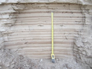 Varves