"I will never kick a rock"

Author

Robert Titus - page 17

Robert Titus has 435 articles published.

Hurricane Katrina’ floods – right here? Sept 16, 2021

in Uncategorized by

Katrina’s Floods: Here?

The Daily Star, 2007

Updated by Robert and Johanna Titus


The enormous destruction inflicted upon New Orleans back in 2005 fulfilled warnings that many geologists had been making for years. The city lies below sea level, hiding behind man-made levees, and it was only a matter of time before river flooding or hurricane storm surges would overwhelm it.

At the heart of the problem is that New Orleans and all of the Mississippi Delta has been sinking. It’s the weight of the sediment that the river has carried onto the delta that has pressed down and caused the subsidence. Ironically sedimentation builds and maintains the delta, but at the same time, causes it to sink. In recent centuries, however, man has disrupted this process. We have built levees to prevent floods and they have mostly done that, but they have also kept those floods from carrying sediment to pile up onto the delta plain. Without those sediments the entire delta is doomed to continue its sinking, probably into the sea.

It used to be a lot like that in Oneonta.

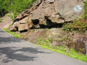
Take Main Street south to Rte. 28. Turn right and begin the ascent up Franklin Mountain. Travel exactly two miles and you will see a sequence of red shales and sandstones along the left side of the road. You have entered the realm of the great Catskill Delta. A bit less than 400 million years ago a sizable ocean, the Catskill Sea covered all of central and western New York. Large rivers flowed out from New England and into that sea. Those rivers deposited a delta that easily matched the one in Louisiana. The sediments of that ancient delta are still around; they have hardened into the rock that we call the Catskill Mountains. Our mountains are a fossil delta. Those roadside red shales and thin red sandstones are the deposits of the Catskill delta plain. Much of that material is the product of the many floods that occur in such a setting. These are exactly the deposits that levees have kept from forming in Louisiana. What you need to know is that these sediments always accumulate at just about sea level.

Continue a very short distance up the road and pull off at the dirt lot. Look downhill and you will see some thick gray sandstone ledges. Look uphill and you will see some more red shales and then another gray sandstone ledge. Those two sandstone ledges are petrified rivers of the Catskill Delta. Both of them, in their own times, were also formed at exactly sea level. The red shales are floodplain deposits, essentially floodplain soils.

   Gray sandstone, above, is river channel deposit. Red shale below formed on floodplain.

We have traveled about 50 feet uphill from our first sea level outcropping. We have probably also traveled through thousands of years of sedimentation, but we are still looking at deposits that formed at sea level. What gives? What happened long ago is that the Catskill Delta subsided slowly and, as it subsided, sedimentation filled in behind so that the net effect was no change in elevation at all; sea level was maintained.

Let’s drive up the road to the top. There, near the garage with all the hub caps is still another gray sandstone ledge. Again, we are looking at another delta river. And, of course, this one too was deposited at sea level. Now we have risen 200 feet and now, of course, the crust beneath us has subsided an equal amount.

Our journey illustrates the inevitability of what is happening to New Orleans; someday it too will sink 200 feet and by then it will be totally buried, a fossil city completely forgotten. Man can fight this with levees; man will lose.

Contact the authors at randjtitus@prodigy.net. Join their facebook page “The Catskill Geologist.”

Birth of a Gorge Sept 9, 2021

in Uncategorized by

Birth of a gorge

On the Rocks the Woodstock Times, Sept 2011

Updated by Robert and Johanna Titus


We are the mind’s eye, the human imagination and we are located about where Stoll Road is today. The date, however, is Jan. 15, 18,608 BC. This, it will turn out, will be the coldest day in the history of Woodstock. Tonight, the temperature will plummet to 63 degrees below zero. This is the peak of the Ice Age but, even so, that sort of temperature is extreme.

We look around and, even though it is late afternoon, all is very dark. We are at the bottom of the Hudson Valley Glacier and a few thousand feet of ice lie above us; no sunlight will be seen here today.

If there is no light, there are at least a few sounds to be heard. From time to time there is a low groaning. Then too, there are occasional loud snaps that echo through the ice. These are the sounds of ice under intense strains. The glacier is frozen solid, and it should not be moving, but there is a constant pressure from the north. Back in Labrador the glacier has been slowly accumulating new ice and the weight of that ice, here in the Hudson Valley, is being translated into a southward shove.

We, the mind’s eye, rise up through all of the ice and ascend into the Arctic sky. Below us and all around we see nothing but the flat white of a great ice sheet. We climb higher into the sky and then disappear into the vastness of time. The mind’s eye can do that . . .

When we reappear, we are back in the Stoll Road vicinity. It is August 8th, 14,387 BC. All around us, it is still black; the Hudson Valley glacier still covers all of our region. But that will not last. Today, above the ice, the temperature will climb to 63 degrees above zero, the hottest it has been here in about 9.000 years. Up above, the ice is melting and melting quickly.

That is why it is so noisy all about us. Again, the glacier is groaning and popping; the ice is now very unstable, sinking here and there and lurching to the south as well. But there is more: now there is a low roaring sound in the distance. Nearby there are gurgling noises as well and these are pretty loud. The glacier is melting, and enormous volumes of water are draining through the ice. We cannot tell it from down here, but the ice is thinning. Once again, we disappear into the ether of time.

Now it is 600 years later; the date is July 14, 13,787 BC and during these 600 years most of the Hudson Valley ice has melted away. The climate has continued its warmup. Now, all around us, is the very loud roar of flowing water. We find ourselves in a powerful current of water. We are within a sub-glacial stream. It’s a raging torrent of ice water which has originated from the melting glacier, drained through the ice and formed into this stream. The current would kill mortal humans, but we are the mind’s eye and cannot be harmed. We can stand still in the flow, if we want, or we can drift along with it, if that is preferred.

We stand in the current for a short period of time and feel the pressure of the passing ice water. Not infrequently, large blocks of ice pass by. It is clear that we are watching the very disintegration of a great glacier. Suddenly, and with a loud crash and violent splash the icy roof of this stream caves in. Now sunlight shines where it has not been for thousands of years

Over a period of days we watch as more and more of our stream’s roof caves in. We soon observe that this flow is something that one day in the distant future will be called Sloan Gorge. We are privileged to be there at its birth. The current is so powerful that it transports great blocks of rock. We can watch boulders as they bounce by, buoyed by the pressure of the flow.

The river we see here today is a raging, foaming, angry torrent. Its powerful flow is enormously erosive; it is carving the canyon that today’s inhabitants of Woodstock are familiar with. The flow is dense with sand and that exerts a powerful abrading force on the bedrock. Sloan Gorge is having its violent birth. We, once again, disappear into time.

We reappear and it is August 24, 2008. Sloan Gorge is its modern self. It is not a torrent; in the late summer it is a place with little water at all. Sloan gorge is what geologists call a “paleoform.” That’s a landscape that is an anachronism; it belongs to that other time: the time at the end of the Ice Age. But, we are the mind’s eye and it has been our privilege to see the Gorge as it was.

Contact the authors at randjtitus@prodiy.net. Join their facebook page “The Catskill Geologist.” Read their blogs at “thecatskillgeologist.com.”

Noah’s flood in the Catskills – Sep. 2, 2021

in Uncategorized by

Cabin Tales #5: Noah’s Flood?

The Woodstock Times; On the Rocks June 16, 2011

Updated by Robert and Johanna Titus


We would like to resume some columns in a series that we have called “Cabin Tales.” We have spent a lot of time at the little red cabin at the top of Plattekill Clove, owned and loaned out by the Catskill Center for Conservation and Development. As something of an experiment, we have been writing about geological topics that we discovered within a mile of the cabin. We wondered just how many we could find. How rich is the geology there? The answer is very rich. Here is another episode.

We headed east from the cabin, down the highway, early one morning with nothing particular in mind. But we didn’t get very far before we made a discovery. There, at the absolutely highest crest of the hill, and alongside the road, was a beautifully rounded, fist sized cobble. We looked around and soon found another. Then, in the course of a few minutes, we found several more. We knew what these were; they were stream washed cobbles. Long ago they had traveled down some rugged whitewater creek and over a period of time Nature had done her lapidary work; the cobbles, once angular, came to be sculpted into the sinuous roundness we were admiring. None of these were perfect spheres, but all displayed, to one extent or another, a good deal of rounding.

But what were stream-rounded cobbles doing at the very top of the highest level of the highway, far from, and above any stream? There never could have been a stream up here. Well, we knew the answer to that question too and we will reveal it later on, but we had the good sense to appreciate that we had just experienced one of the great geological questions of the early 19th Century. We had, intellectually, been transported back to the boundaries of science as they were before the 1820’s!

Way back then, geology was on the front lines of science; this science was making many of its greatest breakthroughs; it was becoming modern. Our forebears were a sharp eyed lot. They looked, and they noticed, and they saw the same sorts of things that we do today, but they were doing it for the first times – including seeing stream rounded cobbles away from any streams. But they often were quite different from modern geologists; they made their observations from the point of view of a very different mindset. Many, probably most, were devout Christians.

If you are a very religious scientist, before 1820, and you are looking at stream rounded cobbles, lying where they should not be, then there is a very appealing interpretation – these could be cobbles left over from Noah’s Flood!

Ou find, at the top of Plattekill Clove, is not an uncommon one. If you are careful and watchful, you will likely find rounded cobbles all over the place, including many found very great distances from any stream. Lots of geologists were finding these back in the early 19th Century and they eagerly made the Noah’s Flood interpretation. And this included some of the most respected geologists of the time. The one we think of first was Benjamin Silliman, a professor of geology at Yale. Silliman enthusiastically argued for the Noah’s Flood hypothesis all during the 1810’s. Such geologists thought that their views and, in fact, the views of science in general would and should confirm Christian theologies. They certainly did not see science as a servant of religion; it just never occurred to them that there ever should be a conflict. Science would reveal the mind of God, just as the Bible had. The science of nature was thought to be a second testament. There had been a Noah’s Flood; most did not doubt that. If God had revealed the flood in the Bible, then surely, he would have revealed it in the geology. So surely there was a global geological record of that flood. You can imagine how thrilled they must have been to see the rounded cobbles such as we have been speaking of.

But slowly an alternative hypothesis was being developed. During the 1820’s the climate was warming up as the world emerged from something called the Little Ice Age. In Switzerland glaciers were actively melting and the landscapes revealed by the retreating ice showed features that, without any doubt, were the product of those glaciers. And those features included a lot of stream rounded cobbles.

Evidence of a great Ice Age began to emerge, and it was soon clear that almost all of northern Europe and northern North America had been glaciated. As the glaciers advanced and retreated there was a lot of meltwater streams, all producing rounded cobbles. Renewed cycles of glaciation saw glaciers picking up those cobbles and transporting them all over the place. Now there was a perfectly logical explanation for the widespread distribution of stream rounded cobbles, and it had nothing to do with Noah’s Flood.

Acceptance of the glacial hypothesis came quickly as geologist saw how much evidence there was for it. The glacial hypothesis came to be promoted to the glacial theory, and it has been, since then, one of the foundations of modern geology.

There are several morals to our story. First, science has always been careful to avoid the supernatural. Science cannot explain the supernatural; we cannot formulate hypotheses about the supernatural, nor can we test such hypotheses. We study the natural world, not some hypothetical supernatural one.

Ou second moral has to do with “intelligent design” advocates who argue that there should be a place for the supernatural in science, specifically that we should find a place for God in science. The answer to that is that there was a chapter in the history of science when we did exactly that; we searched for the works of God in the science we were uncovering.  But when we did so, it just did not work very well. We do so much better when we search for and find natural explanations for the natural phenomenon we study.

Ou walk down the canyon at Plattekill Clove had carried us through some important moments in the very history of science, a remarkable traverse.

Contact the authors at randjtitus@prodigy.net. Join their facebook page “The Catskill Geologist.”  Read their blogs at “thecatskillgeologist.com.”
Hurricane Irene in Windham Aug. 26, 2021

in Uncategorized by

Visiting a disaster: Windham

Windows Through Time; The Register Star

Sept. 2011

Updated by Robert  and Johanna Titus


We have all seen the television reports of the enormous disaster that has befallen the Catskills. Hurricane Irene passed straight through the heart of our home mountains and unloaded vast torrents of rainfall upon us. Some of the worst hit areas were in Greene County, especially the towns of Prattsville and Windham. I don’t have rainfall numbers for these locations, but there were about 13 inches of rain in nearby Durham and Hunter, and it was very bad throughout the county. The television coverage was very gripping; it was riveting to see the devastation done to these many towns and the harm done to so many lives.

But it is altogether another thing to go out and visit one of these villages and see for yourself what has happened. My wife, Johanna, and I wanted to go to Prattsville, which was hardest hit than of all, but that was out of the question. Prattsville was too wrecked to let people in. We were able to visit Windham and see what was going on there.

As we approached the town from the east on Rte. 23, we began to see some of what had occurred. Along the side of the highway great ditches had been cut into the ground. Some of them had even scoured into the road itself. I got out and looked at erosion that had, in some places, cut four feet down into the earth, all the way down to bedrock. Now we could see that, at the height of the storm, Rte. 23 was, in effect, converted into a river. That’s common in flood events. The currents had been so powerful that it had turned the ditches into great gullies.

We continued on toward Windham and, to our left, the valley of Batavia Kill opened up. It’s a large valley and, behind it to the east, it stretches into Black Dome Valley. Black Dome Valley reaches eastward and ends in a large bowl-shaped basin which reaches into the high front ranges of the Catskills. The bowl was probably carved by an Alpine glacier towards the end of the Ice Age. Bowl is a good term and accurately portrays what this basin was doing on that Sunday. This bowl began the flood. It was receiving that massive rainfall, collecting it, and passing it on down Batavia Kill – to Windham.

We diverted our trip to visit the village of Maplecrest and there we saw a stunning testimony to the power of the flood that had developed. The bridge at the west end of the village was completely destroyed. In the five miles that the Batavia Kill had flowed west from that bowl, it had already swollen so much that it welled up over its banks and had undercut the bridge, leading to its destruction. Soon that torrent would flow on to Windham. We followed.

????????????????????????????????????

As we entered Windham, we immediately saw the whole effect of the flood. What has to be understood is that, at Windham, the Batavia Kill had not just risen, it had expanded. Most floodplain floods are relatively calm; there are few powerful currents. But what happened at Windham is that the river had become bigger than ever. As its currents had grown more powerful, they had swollen into the town. The Main Street business district was literally located in the middle of a powerful river. And that stream was being fed by the pounding rain in the Black Dome Valley. It was an awful moment.

But we got there during the aftermath, the flood had subsided, and people had come out to start dealing with the damage. Folks were not dazed; they were very unhappy, but they had determination on their faces as they set about doing what they could. We saw large hoses emerging from basements, pumping water out of family homes. We saw several cars where they had been lifted up, carried by the flow, and dumped by the flood. Windham had been, and will be again, a pretty town. Part of that is from the bluestone sidewalks, but we saw that the flood had been strong enough to lift up many of those heavy stone slabs and sweep them some distance. Whole stretches of sidewalk had been carried off. We saw lampposts that had literally been bent over by the currents: something frightening just to contemplate.   Storefronts, here and there, had been badly damaged. Many homes had seen their first floors flooded. It was a terrible sight. We were looking at all of Nature’s power.

We asked if we could drive on to Prattsville and were told that no, things were very much worse there. Soon we would start hearing about Martinsburg, Middleburgh, Phoenicia and many others.

Contact the authors at randjtitus@prodigy.net. Join their facebook page “The Catskill Geologist.” Read their blogs at “thecatskillgeologist.com.”


The Mountain House Ledge Aug. 19, 2021

in Uncategorized by

Visions of a distant past, Pt. two –“From the Mountain House Ledge.”

On The Rocks; The Woodstock Times, Dec 23, 2010

Updated by Robert and Johanna Titus


Certainly, one of the very most historical sites and all of the Catskills is the Mountain House Ledge at North/South Lake State Park. We are betting that most of you have been there. It’s a grand, broad ledge of sandstone, jutting out 2,000 feet above the floor of the Hudson Valley. It’s claimed that you can view some 70 miles of that valley from this site. It is, of course, the very place chosen for the building of the Catskill Mountain House in the 1820’s. That was the grandest of the grand hotels of the Catskills during the Catskill’s most fashionable era. Back then a Gilded Age aristocracy visited the site and its hotel. A Who’s Who of the American elite spent time here. But something spiritual happened here too. America came to love nature at this location. It was here that the Hudson Valley school of art was born, when Thomas Cole spent a summer sketching the scenery. Almost equally distinguished was the poetry and prose that was inspired by this “sublime” landscape.

There is no way to overestimate the historical heritage of these few acres of land. The whole culture that we equate with the word Catskills had its birth on the Mountain House Ledge. It is one of our favorite places to visit and we have begun any number of geology field trips and walks right there. But we frequently like to go there by ourselves and sit upon the rocks at the rim of the ledge. We touch the sandstone and look around. All that lies above the ground, above those rocks, belongs to history. Here Roland Van Zandt and Alf Evers prevail. They explored the history of this site and recorded its many influences on our culture.

But we touch those rocks again. Everything from the ground down belongs to us! All around is the historical heritage of culture in the Catskills; below is a geological past that reaches back hundreds of millions of years. More than a mile of sedimentary rock lies beneath us, and every stratum has its own history, from its own time. We touch this ledge and contemplate its petrified sand. It accumulated on the floor of a river channel. That was during the Devonian time period, about 375 million years ago. A river flowed by, right here, and then it disappeared off to the west. We gaze that way and then turn around and look, more intently, eastward hoping to see where that stream and its sand came from. But . . . there’s nothing there but the great emptiness of the valley.

For us, suddenly, it is the Devonian; we sit just above the stream in the middle of the flow, looking east. To our left and right are the low banks of the river. Rising above them are trees, at least they must be trees; they are so exotic, so strange in appearance. Frail looking trunks rise 20 feet above the banks. There are no branches, not until the very top is there even any foliage. And this defies all efforts at description. There are no leaves, just something that might be called fronds. But even that term does not suffice. These are among the most primitive “trees” known to history. They represent evolution’s earliest efforts at the very concept of a tree and evolution is not yet very good at that. Their “foliage” defies description because nothing like it grows green today.

We look again to the east, but we cannot see very far; the scenery blocks our view.  We are the mind’s eye; we can go anywhere and do anything the human imagination can conceive. We rise up into the Devonian air and from a new high perch, we can again look east, this time actually surveying what is there.  Before us, and rising miles into the sky, are the slopes of a great mountain range. These are the Acadian Mountains, and, during the Devonian, they rose as high as the Himalayas of today. Between those mountains and us lies an expanse of green; this is the first and the oldest forest in the history of our planet.

Beyond, the greenery thins out as the lower slopes of the Acadians rise up. Evolution has not yet brought forests to anything but the lowest of elevations. These Acadian foothills are thus bare of trees; only brick red slopes are seen. These are nearly devoid of life. Above, it only gets worse. The middle slopes of the Acadians are gun metal blue. They are cut by deep and jagged canyons and ravines. These speak of moments when intense rainfall has resulted in terrible episodes of unrestrained erosion. Up there, no roots are found to slow the powerful effects of eroding torrents. This is the genesis of all the sediment that composes, in modern times, that mile of sedimentary rock which we call the Catskill Mountains.

We gaze still higher up. These are great mountains, and the distant images of high elevations are not as clear. Those high slopes are gray, and they too seem to be cut by more gulches, gullies, and defiles. Then, abruptly, there is a perfectly horizontal and sudden transition to a pure brilliant white. This is the snow line. These are the tropics, but those elevations are so high that snow lasts throughout the year.  At the top of the Acadians lies an icy and jagged skyline. Pointed peaks gleam white above.

We are the mind’s eye and our journey into the past is a grand experience, but we cannot stay for long. This image of the ancient Acadians is a fleeting one; it blurs and then fades. We stand, once again, looking east across the Hudson Valley. Beneath us is that mile of sedimentary rock; before us is the memory of the mighty mountain range that, long ago, eroded away to make these Catskills.  Only the low Taconics remain.

Mountains, like people, have ancestors.

Reach the authors at randjtitus@prodigy.ney. Join their facebook page at “The Catskill Geologist.”


A deep sea at New Baltimore August 12, 2021

in Uncategorized by

Geology at the New Baltimore Conservancy, Part two: a very deep sea.

Windows Through Time, Dec 12, 2013

Robert and Johanna Titus


We have been exploring the geological history of a property maintained by the New Baltimore Land Conservancy. It is the old Armstrong farm site, just a little south of the Village of New Baltimore along County Rte. 61. We have worked with several similar groups in the past. We developed a geology trail for the Woodstock Land Conservancy at their Sloan Gorge property in Woodstock. We have consulted with the Columbia Conservancy, across the Hudson, and have written a number of articles about their various properties.

We admire the members of these groups, most of them volunteers, and we appreciate their efforts to preserve scenic landscapes and save them for generations to come. But commonly, they do not know much about the geological past of their sites. That is where we come in. We explore these properties and study the geologic evidence. Then we research what is known about them, what professional geologists have learned, and finally we pass on what we have discovered to the people of these groups. Often, we summarize what we have learned in our columns.

Today, we continue our trek down the old farm path at the Armstrong site. Last time, we had lost ourselves into a distant ice age past. This week we will descend far deeper into the past, and far deeper in every other way. Soon we found what was left of an old shallow quarry. There was a hodgepodge of broken boulders and masses of rock. All of it was almost black in color. We quickly recognized that there were two types of rock in the old quarry. One was a type of sandstone called greywacke. That is a very dark sandstone; it is dark because it contains large amounts of silt and clay lying in between the sand grains. We geologists sometimes call this a dirty sandstone and that is good descriptive term for the rock.  The other rock type was black shale, a thinly laminated, very fine-grained petrified mud.

We recognized the rock unit; it is one of the most commonly seen geological formations in this part of the Hudson Valley. It is called the Austin Glen Formation. This mass of rock is quite old, in fact probably about 465 million years old. But such great antiquity is just routine for geologists; that’s not what impressed us. It was the environment of deposition that was so fascinating.

We already knew a good bit about the Austin Glen Formation. We knew that its sediments had accumulated at the bottom of a pretty deep ocean. This oceanic basin has a technical name; it is called a foreland basin. What you need to make a foreland basin is a nearby rising mountain range; it helps a lot if it is a long linear mountain range. The mountains we are talking about were an ancient version of today’s Taconic Mountains.

Well, this foreland basin was a long linear, very deep-water basin that ran adjacent to those mountains. As the mountains were rising, the basin was subsiding. Rising mountains are always weathering and eroding and that produces a lot of sediment. It is this sediment that was the genesis of the Austin Glen Formation. The sediment was carried by steep powerful streams from the mountains into the sinking foreland basin.

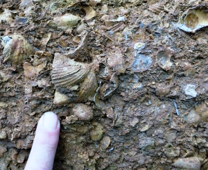
We suddenly encountered a very vivid image of the floor of that sea. In that small quarry we found a special type of lithology. Take a look at our photo. It shows a slab of graywacke with some very striking patterns on its surface. These structures are called flute casts. Flute casts are produced by the rapid flow of a sediment rich current across the floor of an ocean. We were looking at a petrified submarine landslide.


????????????????????????????????????

In our mind’s eyes we could imagine a single moment of time long ago. An ancient earthquake had just shaken the old seafloor and threw masses of sediment up into suspension. It slowly began to flow downslope towards the bottom of the basin. It picked up speed and momentum. Those speeds could have reached 30, 40, or 50 miles per hour. This was a powerful, even violent moment on the seafloor. But it was just a moment.

Eventually that landslide got to the bottom of the basin, and it began to slow down. Sediment began to settle onto that seafloor. But first it pressed into the soft sticky muds that had already been down there. As it did, it sculpted those flute cast structures. Our journey into the past was over and we were in that little quarry again. We knew so much more about those rocks and about the Conservancy itself.

Contact the authors at randjtitus@prodigy.net. Join their facebook page “The Catskill Geologist.”
 

Nanny Goat Hill; Pt. 2 – the Ice Age.

in Uncategorized by

Nanny Goat Hill: The Ice Age

On the Rocks; The Woodstock Times;  Feb 19, 2009

Robert Titus


Last week, we visited Nanny Goat Hill, a site in Saugerties, which is slated to be developed for a new hotel, conference center. We are told that plans call for the hill to be dynamited, and 19,000 cubic yards of rock will be carted off to leave space for a two story parking garage. We were asked by local residents to look over the site and to see if any interesting geology would be destroyed. We did look it over and found an ancient sequence of sedimentary rocks, which formed at the bottom of a very deep ocean. That was last month; today we would like to return to this location once again and see its history from another vantage point.

Our premise is that any location has a very long history and bits of that history can be deduced from the evidence. Last time we looked at the bedrock; this time we will look at the landscape. If you view Nanny Goat Hill from Krause’s Candy Shop, you will see what looks like just any other hill. But a geologist will be attracted by the shape of this hill. There is something special about it, and that something has a story to tell.

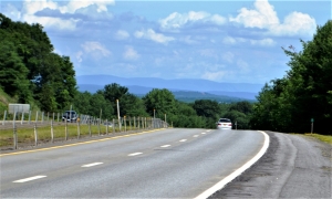
If you look carefully, you will see that there are two distinctively different sides of the hill. To the east (right side if photo), Nanny Goat Hill is a long low ramp. To the west (left side), it is an abruptly steep slope of bedrock, nearly a cliff. It’s so easy to not notice such a thing; it’s so easy to dismiss such a landform as having no significance whatsoever. But to the experienced geologist, this form presents us with a journey into the Ice Age.

The morphology, or we should say, the geomorphology, here is a common ice age phenomenon called a “roche moutonnee.” That has commonly been translated as “sheep back” from the French, but we don’t know why; they don’t look like sheep to us. The form recalls the advance of the ice during an episode of glaciation. The gentle slope faces the direction that the glacier advanced from. The ice, as it moved westward into Saugerties, encountered the bedrock knob that is today’s Nanny Goat Hill, and advanced up its slopes.

Back then the hill would have had a very different shape to it; we can’t imagine exactly what it would have looked like, but it was different. The advancing ice scraped its way up the eastern slope and began to grind away into the rock there. The bottom of any glacier has enormous amounts of sand and gravel and these materials act like the sand of sandpaper. Over a period of time the grinding ice planed off that eastern slope and shaped it into the low, smooth feature we see today.

When the glacier reached the other side of the hill, its behavior changed. Instead of having a grinding effect, the ice did something very different. The ice formed a bond with the bedrock. There is usually some water at the bottom of a glacier. It soaks into cracks below and then freezes and forms that bond. That bond was a very strong one. Now a great tension had been created. The ice was moving to the west, but it was stuck to the bedrock. Something had to give; either the ice would shatter, or chunks of bedrock would fracture and break loose. Probably both occurred, but our interest is in when the bedrock broke. The sticky ice would have adhered to those boulders and plucked them loose and carried them away.

The result of this plucking, over time, was the creation of the steep cliff-like slope on the western side of Nanny Goat Hill. We geologists call this side of the roche moutonnee’ the “plucked side” and we call the smoother slope the “ramp.” A roche moutonnee is often referred to as “ramp and pluck topography.” These sorts of hills are usually very common, but this, so far, is the only one that we have seen in the Hudson Valley. It is a nice ice age feature, and we were very glad to have found it.

This feature did give us a nice journey back into our ice age past. But it also confirmed our thesis about time and places. Once again, as we have seen so many times, a location presented us with the evidence of its own deep past. We were privileged to make two journeys into two of these pasts and we are equally privileged to describe those journeys to you. We hope, when you get a chance, you will visit this site and appreciate Saugerties’ geologic heritage.

Contact the authors at randjtitus@prodigy.net. Join their page “The Catskill Geologist.”


Nanny Goat Hill July 29, 2021

in Uncategorized by

Nanny Goat Hill; Part One, the abyss

On the Rocks, The Woodstock Times

Updated by Robert and Johanna Titus


Development is always a controversial subject in the Hudson Valley. There are those who would ban it altogether, while others decry how little there is. Currently there are plans for a hotel and conference center along Partition Street, near Esopus Creek in the heart of Saugerties. Several acres of land are involved. Part of this is a little knoll called Nanny Goat Hill. The name goes back to the 19th century when, supposedly, goats grazed here. As we understand it, the plans call for Nanny Goat Hill to be dynamited, with 19,000 cubic yards of rock hauled off to make space for a parking garage.

But some residents would like to save the hill and make it into a small park. They contacted us and wondered if we could be of any assistance in evaluating this plan. We generally try to keep this column from being political, and, as we do not live in Saugerties, we don’t think we should be vocal in the town’s decision making, but there is no harm that can come from looking at the geological heritage of this site. We have done so.

It has always been our opinions that nearly any site has an interesting geological story. Each place has a longitude and latitude. These dots on the map have been where they are for more than 4 1/2 billion years, and a great deal has happened during this time. The Nanny Goat Hill site has witnessed a lot of history and some of it is represented in the bedrock while more is carved into the landscape of the hill itself. We enjoyed our visit to Nanny Goat Hill.

This location displays some very nice and sizable ledges of bedrock. The unit exposed here is called the Austin Glen Formation which is part of the Normanskill Group. The geological jargon may be dull, but the story behind these units is quite interesting. All of this sequence consists of thick gray sandstones alternating with nearly black shales. These are sedimentary rocks, and they once were, of course, sediments: sands and muds to be specific. That’s where it gets interesting. The sands and muds accumulated at the bottom of one of the deepest oceans that ever existed.

If you visit this site, you can see horizontal strata of sandstone and some shale, right from the sidewalk. Each stratum was once at the bottom of the ocean. This ocean was a marine trench. To see something like this today you might have to visit the Marianas Trench of the western Pacific Ocean. There the water is about seven miles deep. That’s a lot deeper than Mt. Everest is tall. Think about that. Our ocean, the “Normanskill Sea,” might only have been four miles deep and that is just guessing, but it was deep, very, very deep.

At Nanny Goat Hill there are places where you can stand on such strata and you are, when you do so, quite literally standing on the bottom of such a deep ocean. In your mind’s eye you can look around and see nothing but blackness, you can feel the intensity of the cold, and hear the absolute silence of the abyss. But, more than anything else, you can feel the pressure that is generated by four miles of very heavy seawater. If you understand all this, then Nanny Goat Hill is a real adventure.

There is more. The majority of the rocks are those dark gray sandstones. But in between these strata are much thinner black shales. The sandstones represent what geologists call turbidity currents. Those are the product of submarine avalanches. This ocean bottom was not only deep, but it was also very steep. Periodically, earthquakes would jar loose great masses of sand, and these would form avalanches that tumbled down into the depths. After an avalanche was over, long periods of quiet would follow and that’s when the black shales came to be deposited as “normal” seafloor mud. This was a “hurry up and wait” sort of seafloor.

An obvious question for a geologist to ask is: “Where did all that sand come from?” There is only one answer. Off to the east there was a rising mountain range. These peaks are called by geologists the Taconic Mountains and they made up the original Taconic Range. Mountain building must have come to something of a peak (pardon the pun) and so, as we looked off to the east we could see mountains towering above the horizon, reaching elevations that would rival today’s Rocky Mountains or the Andes. These rising mountains were weathering and eroding, and those processes created the sand. It traveled down mountain slope streams and was carried out to sea. Eventually the sand was caught up in gravity slides and came to rest on a seafloor that would someday be Nanny Goat Hill.

All in all, our visit to Nanny Goat Hill was a bit of an adventure. We had taken ourselves back hundreds of millions of years through time and miles beneath the sea. We had witnessed rising mountains and great marine avalanches. It was, in short, just another day in the life of two minor league geologists.

Contact the authors at randjtitus@prodigy.net. Join their facebook page “The Catskill Geologist.”
 

Yellow alert – July 22, 2021

in Uncategorized by

Yellow Alert?

Stories in Stone – April 17, 2007

The Columbia County Independent

Updated by Robert  and Johanna Titus

  LANDSLIDE IN GLENMONT

We have, recently (2007), had a growing sense that something has been going on geologically, here in our upper Hudson Valley. We think a pattern has been developing. Scientists notice patterns and we seek to understand them. We had better explain.

We commonly drive past the Gilboa Reservoir. Lately, the water has been pouring over the top of the dam. (2007) That’s unusual; most of the time the reservoir is well below the dam’s top, sometimes the reservoir is nearly empty. It’s easy to say that it has just rained a lot recently, but we wonder.

Over the last few years there have been a number of damaging slumps in the upper Hudson Valley. First came the Delmar slump, south of Albany, which put a major road out of commission for quite some time. It had been built on the muddy sediments of an old ice age lake, Glacial Lake Albany. The sediments simply gave way and slid into Normans Kill. Well, these things happen, or so we thought at the time.

But then, last year there was another slump, this one in Schenectady. The edge of an old Lake Albany delta slid downhill and that doomed six homes. Soon we had a small slide just a mile from the Titus family home in Freehold. Again, this spring, we have seen still another nearby bank give way and now it seems to be oozing water. That’s too close for comfort.

Slumps are an ongoing problem in the Hudson Valley, and we have written about them before, but there seem to be a lot of them lately. Two weeks ago, there was a new slump in Amsterdam. This one also seems to have involved the sediments of another ice age lake delta. That’s alarming; why are these events coming at such a rapid rate?

But then it got even worse. We began receiving emails from people in Valatie, complaining about flooding basements. Three houses on New Street have been experiencing serious problems for weeks. Basements flood, that’s their job, but some of these folks claim that they have never seen the likes of this even after decades of residence and they are worried.

All this may just be coincidence and might mean next to nothing. Or all this may just indicate that we have had a lot of rain lately. That would explain this year’s problems, but it would not tie in the events of recent years.

In the end, it seemed to us that there was enough to warrant a little investigation. It looks to us, on the face of it, that the region’s water tables have been rising and that the recent heavy rains have triggered a series of problems. This trend may be something that has been developing over the last several decades. Can we document this the way that scientists should, and can that lead to an explanation? Well, we can try.

We checked with the National Oceanic and Atmospheric Administration website and found some interesting things. New Yorkers have seen some climate change over the past century. Our average temperature has climbed only about one degree Fahrenheit. More interestingly, however, our rainfall has climbed about six inches, from 36 to 42 inches/year, that’s 16 percent.

If we have seen a lot more rainfall, then it follows that there should be more groundwater and higher water tables. Add a few heavy rains and it seems logical that basements would start to flood, and slumps might be triggered. People might well remember that these things didn’t happen in the distant past because they really couldn’t have.

What we are suggesting is that if we have a wet summer or, worse, a snowy winter and rainy spring next year then we may see serious problems. Is all this good science? Certainly not, it is the result of just a little work over a short period of time in response to some rapidly occurring events. It’s not scientific theory, just hypothesis, but maybe you can help; have you noticed any unusual basement flooding, or anything else peculiar?

Contact the authors at randjtitus@prodigy.net. Join their facebook page “The Catskill Geologist.”
The Heart of Darkness (in the Catskills)

in Uncategorized by

The Heart of Darkness

The Kaatskill Geologist 

Kaatskill Life – Fall  2004

Updated by Robert and Johanna Titus


There is, if you can imagine it, a “darkest Catskills,” a place where Nature still truly prevails. It is a wholly untamed wilderness where, even in our time, people are sometimes afraid to tread. Once you have entered it, it becomes a place that seems to draw you on but, no matter how deeply you go into it, and no matter how difficult your trek has become, it will only get worse. Still, it is a place that teases you on with promises of natural beauty that numbs your normal cautions. It is a dangerous place, but, in the end, it is worth the risks; it is one of the most beautiful localities in all of our mountains and that is saying a lot. But you always have to remember that one thing: no matter how difficult it is, it will only get worse. It is the canyon of Plattekill Clove.


You can never think about Plattekill Clove without comparing it to its big brother – Kaaterskill Clove. Each is a very large, deep ravine cut into the “Wall of Manitou:” that great ledge we call the Catskill Front. Kaaterskill Clove is longer

and deeper, and it is a rugged and majestic place. And Kaaterskill Clove also seems to be an older geological feature. It may well be more than 100,000 years old and, in that time, it has been able to carve a canyon bottom that rises relatively smoothly from the Hudson River lowlands to Haines Falls. Plattekill is shorter and not quite as deep, but it is fundamentally different; here erosion has had time to create waterfalls, but not the time to destroy them. This whitewater stream, as it descends its canyon pauses at each sandstone ledge. Often it has created deceptively pretty little pools of water and then tumbled over the edge of the cliff to make a powerful waterfall. There is a geological irony here. The sandstone ledges that cap our modern falls are the lithified sediments of Devonian age rivers. The sands of ancient rivers block the flow of modern creeks.


Thus, it is that stratigraphy has given the Catskill Front a series of very rugged ledges, and, at Plattekill, each one of them has its own waterfalls. Back at the older Kaaterskill Clove the creek there has had time to erode its way through most of those ledges and only a few falls remain. Kaaterskill Clove is like a deep old wound that has had enough time to do some healing. Plattekill is more like a fresh stab. Both are rugged, both are beautiful, but Plattekill is more jagged and raw. Nature has done no healing in this canyon.

We have written about Plattekill Clove before (Kaatskill Life, spring, 1999), but only about the clove as it can be seen from the many wonderful scenic vantage points looming above it.  There is a whole different clove, and that is the one that you can only see from down below. It can be, quite literally, the heart of darkness. On an overcast day, as you ascend this canyon and the walls rise above you, it actually gets dark.

It once was a popular tourist attraction, and back in the late 19th century there were several hotels here. Many old postcards date back to then, but those times are long gone. Today, not many people hike the great canyon. It is a very rough place and there are no marked trails; it is no place for the novice hiker. And it is not a very easy place for the advanced hiker either. We, and some of the best hikers that we know, have actually confessed to have been intimidated by its reputation. But the canyon does beckon and one August day four of us decided to give it a try.

The lower canyon is a deception; it seems to be there with the purpose of luring you on. It’s picturesque but surprisingly easy to hike. The end of the last ice age gave this part of the clove a deep blanket of soft sediment, something we call an alluvial fan of sand and gravel (Kaatskill Life, spring, 2002). The post ice age flow of water cut through those gravels and created a beautiful ravine. You can follow an easy unmarked trail along the rim of that ravine and gaze down into the rugged stream below and enjoy the walk immensely. But remember, this is Plattekill; it only gets worse ahead.

As we said, there are many waterfalls in Plattekill; it’s not easy to count them, but traditionally the number is 17. We reached our first and it was a beauty. Among the nicest things about the falls of Plattekill are the “plunge pools” that form beneath them. Over the millennia, high flows of water have tumbled over the falls and carved out deep pools at their bases. These form very fine swimming holes which are real attractions. We found the messy evidence of much swimming and picnicking and general partying at the base of our first fall. But we had no time for any of this ourselves; we followed an easy trail up and over the falls and pushed on. Now we were really in the wilderness that makes up Plattekill Clove.

Soon we saw the first of many unusual boulders of the trek; it was large, five feet across, well weathered and nicely rounded. We looked it over carefully and found it to be a “foreigner.” It was not composed of Catskill bluestone as it should have been. Instead, it was a rock called gneiss. Gneiss is a metamorphic rock, which means it formed under very high temperatures and pressures; this one had formed in the Adirondacks or New England, and it had been brought down the Hudson Valley and left here by the glaciers. We would look for and find quite a few others during the rest of the day. They spoke to us of the ice age glacier that had preceded us here. Maybe fourteen thousand years ago a tongue of ice had climbed the clove, all the way to the top. It had carried boulders with it and left them here when the climate warmed. Now those boulders were slowly traveling back down the clove. Plattekill tells a lot of stories when you look into its rocks. We pushed on.

At two hours into our ascent, we passed a small tributary stream coming in from the right and then, very soon, another one on the left. These were what geologists call “parallel streams.” They plunge down very steep slopes and are, all of them, nearly vertical, they are almost as much waterfalls as they are streams. Vertical streams are, of course, all parallel and hence the term. Our second one has had a number of names: it has been called “Black Chasm Creek,” and “Coal Kiln Creek,” and “Cold Kill Creek,” and “Cross Clove Creek.” The name doesn’t matter much, but we would not soon forget this little stream. On this day there was very little water in it, but there were a very large number of very big bluestone boulders (fig. 5). Such steep streams can transport very large boulders with little difficulty; they get a large boost from gravity. For millennia, both of these streams had been funneling these great rocks out of the highlands above. This journey was not a very long one, but it was a very slow one. These rocks will be tumbling for many more thousands of years. Plattekill is like some sort of reverse Diogenes, it seems to be forever rolling rocks down the hill.

The idea that there can be streams of boulders was not new to us, but we were most impressed to see this one. We continued up the main canyon and in a hundred yards or so we encountered another stream of boulders, this one being in Plattekill Creek itself. There were hundreds of them, and many were more than ten feet across. We wondered how much they weighed. We had not much noticed it, but Plattekill had slowly become a steeper canyon. Its slope was great enough so that it too was transporting the heavy weight of big boulders. We had seen Plattekill Clove as a fresh wound into the Catskill Front. Now the metaphor was working very well. Our Catskill wound was now bleeding streams of boulders.

Next, we entered into what seemed like a whole new realm of Plattekill. Slowly, we found our attentions drawn upwards, as great vertical cliffs of sandstone came to tower above. And tower is just the right word; those walls were sheer cliffs – left and right -rising what seemed to be a hundred feet or more. At the same time, the canyon seemed to narrow, and we found ourselves being funneled into a tighter squeeze. Here, we saw no more boulders, instead the centuries of intense spring floods had flushed this part of the chasm clear. On this August day, the flow was very low, but the months of March and April must have witnessed a far more powerful flume of meltwater. We didn’t like to think about the angry gray flows of that season. There are some things that humans should not go and see, and this was one of them. We pushed on clambering up the steep and often slippery bare red bedrock. The clouds rolled in high above and now the light in the deep canyon began to dim; we were truly in the heart of darkness.

But you must always remember: no matter how difficult Plattekill Clove is, it only gets worse. Now, after four hours of serious hiking, we found ourselves at the base of Green Falls, perhaps the tallest waterfalls of Plattekill Clove. Much to our dismay, these falls were a shear cliff and offered no hope of being climbed. The thought of turning back was too dismaying. But none of us had been here before and it seemed that there was no way to go on. Only to our left, however, there was there any glimmer of hope for completing our ascent; there lay the now dry channel of another stream of boulders. It was either climb this or turn tail and retreat down the canyon. We began what would be an arduous ascent; it is a 270 foot upward climb over a chaos of rough, angular boulders. We made it, but it took quite a while, and the reward was further disappointment. There at the top of our hard scramble was still another impediment.

Before us was another 20-foot-thick ledge of sandstone, we had seen so many already on this day, but this one seemed of offer no way at all to pass up and over it. In Plattekill, it only gets worse. Once again, we faced the irony of being blocked by a nearly 400-million-year-old, Devonian stream channel as we tried to ascend a modern creek. We explored to our left and to our right and found nothing but that vertical sandstone citadel. Now, it was getting late: should we climb all the way back down the Clove, a five-hour retreat that might carry us into true nighttime darkness? Or should we press on in search of an escape route over this ledge? This was a difficult moment.

Well, all turned out, we explored farther to the right and found a dead tree lying against our ledge. It didn’t have many branches left, but there were just enough to make an “Indian ladder” out of it. We pushed and pulled each other up the ladder and soon found a flat trail to the base of Plattekill Falls and the trail out of the upper clove. Our moods improved greatly.

Before breaking up, our little group climbed out to the overlook above the Devil’s Kitchen and there we saw the solution to the biggest mystery of the day. Why did Plattekill Clove persist in getting steeper and rougher as we climbed to its top? In an instant we saw the answer. At the Devil’s Kitchen we saw that the sandstones here are broken by fractures of the sort that geologists call “joints.” Joints are smooth flat fractures of the rocks. They are like faults, except that there has been no motion of the rocks on either side. Here, as is always the case, the joints are closely spaced and, those of Plattekill Clove, cross the clove

along a northeast to southwest compass direction. That means that as large masses of rock break loose and fall, they leave vertical walls that loom above the head of the clove. The fracturing was concentrated in the upper reaches of the clove, and this had accounted for the ever-increasing steepness. The broken joints had also, no doubt, provided the bulk of the boulders that we had been seeing all day long. Our conquest was now complete; not only had we climbed Plattekill Clove, but also, we had solved one of its best geologic mysteries.

After our long and strenuous day, our companions were happy to disperse and return to their homes. We, however, had a special privilege: the Catskill Center for Conservation and Development had loaned us their little red cabin for the night. That’s the one at the top of Plattekill Falls. We would spend a very nice evening on its porch listening to the roar of the water passing into the great clove that was now, happily, beneath us.

Late in the evening, more clouds rolled in, and all around us it became very dark. The air was still, and the summer insects were very loud. From high up above, on Plattekill Mountain, came the cry of a single coyote. It was quickly joined by the howls of a whole pack of them. We are told that they do this after making a kill. This is a wild place.

Contact the authors at randjtitus@prodigy.net. Join their facebook page “The Catskill Geologist.”
1 15 16 17 18 19 44
Go to Top