
Uplift in the Catskills July 30, 2020
The Uplift of the Catskills?
The Catskill Geologists
Robert and Johanna Titus
Late at night in geology bars we get into all sorts of tussles with people over various geological subjects. Recently we were debating the issue of whether or not the Catskill Mountains had ever suffered from the tectonic effects of folding and uplift. Most mountain ranges have endured both and often to a very great extent. So too have our Catskills but these events have been far more subtle and to properly understand them, they need some careful explanation.
Let’s do folding first; that’s the easy part. There is folding in the Catskills but only in its easternmost areas. All Catskills stratified rocks within the Hudson Valley were folded during the Acadian Mountain building event, a little less than 400 million years ago. We think that the Catskill Mountain House ledge has a gentle westward slope to it which brings it down to the shores of South Lake .Beyond that, there is a gentle southwest tilting of the strata throughout much of the rest of our mountains. It’s virtually impossible to see. None of this deformation is all that impressive, especially compared to the Rocky Mountains but it did occur, and it occurred during an important mountain building event.
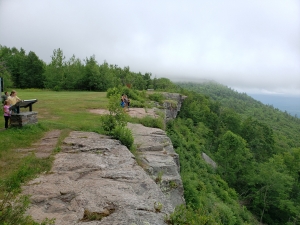
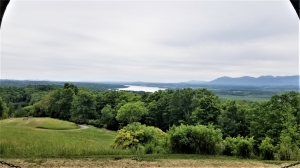
The uplifting is far more difficult to explain. We are going to have to summon up our clearest writing skills and you are going have to be very perceptive readers. Ready? It all began as the Acadian mountains were rising above today’s western New England. Visit the Mountain House site; look east and you can easily imagine this mountainous uplift on the eastern horizon. Those rising mountains weathered and then eroded. Vast quantities of sediment, most of it being sand, poured onto our Catskills region. Over millions of years, the weight of that sediment pressed down into the crust, causing it to be depressed thousands of feet into the depths. Great thicknesses of sediment that had been deposited at the sea level elevation of a delta, came to lie thousands of feet beneath the earth’s surface.
As long as the Acadian Mountains were rising this process continued and even got worse. Thicker and thicker sedimentary sequences were pressed deeper and deeper into the Earth’s crust. All of it hardened into rock, mostly sandstone. But eventually the mountain building ended in New England. And with this the Catskills stopped being a depositional vicinity and, with more time, became erosional. Over the course of tens of millions of years Catskill sandstones eroded away. This triggered what geologists call a rebound. As erosion stripped rock away, the loss of all that weight resulted in an uplift or rebound from below. Stratified rock, that had long been deeply buried literally rose toward the surface and, in its turn, came to be eroded away. Last week we described the Mountain House Hotel ledge as having been a river channel deposit that had formed at sea level. Now it lies at an elevation of about 2,200 feet. It is a typical example of what we are talking of today. Stand there sometime and look down. These rocks had once been thousands of feet lower and now they are slowly rebounding.
In the end, our main points are that the Catskill mountains were deformed by folding, just not a lot of it. And those same rocks have, indeed been uplifted, just not in the same manner as is seen on other mountains.
Time for another pitcher of beer and another topic to “discuss.”
Contact the authors at randjtitus@prodigy.net. Join their facebook page “The Catskill Geologist.” Read their blogs at “thecatskillgeologist.com.”
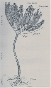 7-13 – Typical crinoid, courtesy NY State Museum
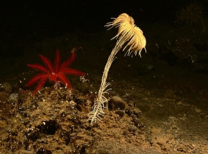 Living crinoid.
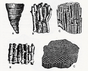
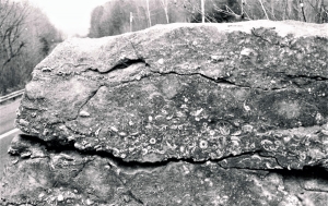 7-14 – Limestone ledge, rich in crinoids