"I will never kick a rock"

Author

Robert Titus - page 37

Robert Titus has 440 articles published.

Boom Town – The asteroid strikes 12/20/17

in Uncategorized by

Boom Town

On the Rocks

Woodstock Times

Jan. 16, 1997

Updated by Robert and Johanna Titus


Woodstock, Aug. 15, 382,439,953 BC, the predawn hours–There is, of course, no Woodstock at this time, but the land is here. It is a morass of bayous and swamps, populated by the primitive trees of the fossil Gilboa forest. It’s the end of a moonless night and it’s still dark out, but there is a growing light and it’s not the approaching sun. Over the past several weeks there has been a slow moving pinpoint of light in the nighttime sky. It is an asteroid, about a half mile across. It’s moving in from the south and, as it enters the thin upper atmosphere, it is starting to glow quite brightly. Its speed is about 20 miles per second, but it is still so far away that it seems to hang in the sky. As it comes closer, however, its apparent motion speeds up. Now as it enters the denser parts of the Earth’s atmosphere, friction heats it into a great flare. The whole western sky lights up, silhouetting the black horizon below.

This is the critical moment; if the asteroid is small enough and its angle of approach low enough, then it will bounce off the atmosphere and skip harmlessly back into space. If not…. The flare’s flight path doesn’t skip, it plummets silently and disappears behind the western horizon.

Moments pass in what seems to be an endless pause, and then comes a great and instantaneous shock of light. It flickers for a few seconds and then the whole northwest horizon glows red. The color brightens to an orange, then a yellow and finally a brilliant radiance of white. An enormous gassy fireball rises rapidly above the horizon to the west, followed by a rising mass of black smoke. This dark cloud rises quickly and it gradually assumes a funnel shape.

Incredibly, this entire scene has been played out during nine seconds of complete silence, but that ends abruptly. The nearby ground begins to hiss and then roar. Great waves of earth radiate across the landscape. They are powerful surface earthquake waves which move very much like the waves of an ocean. As they pass by, geysers of watery sand erupt from the ground. All of the Gilboa trees fall down; their primitive roots are unable to support them on the shaking, soft, wet ground.

In another six seconds the great shock wave of the impact blast itself hits Woodstock. For several minutes the landscape rocks with the combined effect of the earthquake and the atmospheric shock waves. Then, at two minutes after the impact, the actual sound of the asteroid’s impact catches up with the chaos. Only the word “unimaginable” does some justice to the power that this sound signals.

Meanwhile, the great rising fireball has blown a hole in the stratosphere and it continues to rise. It’s a hundred miles high now and the trailing plume of dust below is catching the high sunlight of the still approaching dawn. The whole thing has become an awe-inspiring pillar of white, starkly outlined by the surrounding dark. The pillar is a chimney with walls of dust; its flue is a vacuum which is drawing a vast draft of air upward. Back at Woodstock things had quieted momentarily, but now a new breeze has started and it’s being sucked toward the chimney. It quickly speeds up to gale force and then to hurricane speeds. All this air is drawn up the chimney and vented out into space.

Next comes a hailstorm of dust and rocks. This is the debris that the impact blasted out of the earth and threw tens of thousands of feet up. Now it’s all falling back again. The first rocks plop loudly into the still churning muds. Then the higher-flying rocks start returning as an incredibly dense shower of meteors. Hundreds of them cascade out of the sky and they light up the entire sky.

In the east the sun is about to rise, but it’s a futile effort; sunlight won’t fall again upon Woodstock for months. A great stratospheric shroud of black has been expanding ominously from the west. Along its front an enormous and continuous rage of dry lightning forms an expanding plexus of sparkles that illuminate the wrecked landscape below. Gradually, a moonless, starless black engulfs the area.

But if there is nothing to see, there is still plenty to hear and feel. The winds still howl and more rocks continue to fall out of the sky. And the temperature has been rising alarmingly over the past hour; it is already more than 100 degrees and getting hotter. Once again light penetrates the dusty gloom, but only in the form of burning plant debris falling slowly out of the sooty black sky. To the west, closer to the impact, forests have been ignited and their burning embers have been lofted into the sky. It is a hellish sight.

Contact the authors at randjtitus@prodigy.net. Join their facebook page “The Catskill Geologist.”

The Panther Mt. Asteroid 12-14-17

in Uncategorized by

The Panther Mountain Asteroid

On the Rocks

The Woodstock Times

Dec. 1996

Updated by Robert and Johanna Titus


Like most geologists we spend a lot of time looking at U.S. Geological Survey topographic maps. The whole country has been mapped and most any camping goods store will stock the maps for its own area. They are a wealth of geography; blue lines define streams, black lines are roads, green is for forests and the little black squares are homes. We find ourselves happily poring over all of these symbols, but most of all we like the sinuous brown contour lines which define our regional landscapes. Closely spaced contours define steep slopes and cliffs, while widely spaced lines indicate flat areas, so we can literally “read” the hills and valleys. We geologists consider this sort of thing to be fun, but there is a serious side to our interest. Topographic maps often tell us where to go look for interesting geological mysteries.

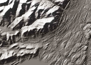
And so it was, about 35 years ago, that the late Dr. Yngvar Isachsen, of the New York State Museum, found his attention drawn to Panther Mountain. The mountain has a distinctly circular shape. Those are Esopus and Woodland Valley Creeks. That’s best displayed by the two streams that nearly encircle the peak. It’s an eye-catching pattern which shows up even better on satellite photos of the Catskills. It’s a big, beautiful, nearly perfect circle about six miles in diameter, and there’s nothing quite like it anywhere else around here.

Such observations are commonplace in science; Nature presents us with strange patterns that cry out for explanation. The scientist picks up the scent and goes on the chase. But from the beginning there was nothing commonplace about the Panther Mountain circle. What could have produced it? Probably one of the first ideas which would cross a person’s mind is an asteroid impact, but such things are too good to be true. Discoveries that exciting come rarely in a career, and a good scientist controls his emotions and looks for other, more mundane explanations. It never hurts to be careful about things like this.

And, for Isachsen, there were some very unexciting alternative explanations. There might have been a large mass of salt beneath Panther Mountain. Salt is buoyant and might have lifted the mountain enough to cause the circle. We find such domes of salt in western New York, but there are no salt-bearing deposits this far east. Then maybe there was a great mass of granite beneath the Panther Mountain. This too might have buoyed the mountain up a bit, but gravity studies ruled that out.

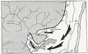
Sometimes the wildest ideas that you can think of gradually start to look better and better. As Sherlock Holmes said, “If you eliminate the impossible, all that remains must be true.” Thus the asteroid hypothesis kept looking better, and there were ways to test the outlandish hypothesis. If Panther Mountain did indeed have an asteroid crater beneath it there must be a horizon of shattered rock down there. That loose rock would cause something called a gravity anomaly, things would actually weigh just a little bit less at Panther Mountain than they should. And in fact there was a gravity anomaly, especially on the north side of the Mountain. That suggested that an asteroid had approached from the south and plummeted into the future Catskills vicinity. After the impact the sediments that now make up the bedrock of the Catskills slowly buried the crater. But as those sediments draped across the rigid rim of the old crater, fractures formed and that softened the rock enough so that Esopus and Woodland Valley creeks could selectively carve their valleys into the ring shape we now see. So Panther Mountain is not a crater, it’s just shaped like the crater buried beneath it.

There are a number of obvious questions. First, just how big was this asteroid? That’s hard to say and nobody knows for sure, but a half a mile across seems reasonable. When did the impact occur? That’s an easy one. The impact lies within the Catskill sedimentary sequence which means the asteroid plummeted into the Catskill Delta a little less than 400 million years ago.

The biggest question is has all this been proved? Well, not exactly. A nice circumstantial case has been made that is very consistent with the asteroid hypothesis. But we scientists are cautious folk, and more work needs be done. Nevertheless it is a marvelous example of the kinds of truly exciting discoveries scientists make, and make routinely. What could be more drab, at first glance, than bedrock, those dull, inert, brown and gray masses of mineral material? And yet what could be more exciting than to find that an asteroid once landed in your very own backyard, a discovery only preserved in those “dull” rocks. We live in a culture rich in the pseudo-sciences, but the real science of rocks can be far more fascinating than any of them. It gives you a different perspective on rocks, doesn’t it?

Folds along the Highway 12-7-17

in Uncategorized by

Our reader’s rocks: Folds along the highway.

Windows Through Time

Updated by Robert and Johanna Titus


Dear Professors Titus: While driving along the New York State Thruway, from Kingston to Leeds, I noticed that the strata are aligned roughly north to south; they are seem inclined either to the west or to the east. Does this have anything to do with the region’s plate tectonic history? Alan Thompson

Dear Mr. Thompson: Over and over again, in this column, we ask readers to take notice of the geology that they pass by every day. So, we should be just a little embarrassed that you have brought our attention to rocks that we have not paid much rattention to. We have passed by these many times, but took little note of them. Thanks for your question; you have done us a favor.

The first chance we got, we drove that length of the New York State Thruway and paid a lot of attention to the stratified rocks that we passed by. Johanna drove and Robert took notes. We soon had to agree that the rocks were oriented north to south along the road and they dipped mostly either to the west or the east. We resolved to be real scientists and collect “data.” Whenever we passed an outcrop we determined whether or not it was dipping west or east.  The highway is posted with milestones so we were able to record which way the rocks were dipping and at which mile. That sounds like real scientific data collection, doesn’t it?

Well, we were able to pick up on patterns. That’s an important step in science. You want to give Nature a chance to show you patterns and then you want to figure out what they represent. Nature frequently “wants” you to notice things and decipher them. We were eager to try. Our focus was between miles 70 and 114. We found about two dozen outcroppings. Twelve of them dipped to the west while another 14 dipped to the east.  So, there was something close to an even split between the east and west dipping strata. We did find several other outcrops where the rocks were flat or where we could not decide which way they dipped; it’s hard to do fieldwork at 65 miles per hour!

Well, we had, indeed, found a pattern and the next step was to come up with a good hypothesis to explain it. What could have folded the rocks equally to the east and west? Explaining that might seem hard to do, but sometimes you can draw upon what you know and come up with a good idea quickly. To us there was a very plausible explanation. All of the strata we had been looking at were early and middle Devonian in age; that is they dated back from 415 to about 380 million years in age. Geologists have determined that these rocks were caught up in a very large mountain building event, called the Acadian Orogeny. That, back during the Devonian, lifted most all of New England into a great mountain range. It’s certainly the event that created all the folding that we had seen.

What happened, in short, is that something most people would call Europe had drifted westward and collided with our North America. Try to imagine what all that involves. Two continents, enduring a collision, would experience a lot of compression. Stratified rocks, caught in between, would be squeezed. The result is something that we sometimes call “accordioning” of the rocks. The once flat lying strata were folded into up and downs that might remind you of the folds of an accordion. Those “ups” are called anticlines while the “downs” are called synclines.

All those early and middle Devonian strata are the ones caught up in all of this. They were folded. You can simulate this by taking a stiff magazine and compressing it. The magazine will crumple up into exactly these sorts of folds.

Your folded magazine quite exactly simulates what happened in the Hudson Valley along the thruway. When they constructed the highway they didn’t know it, but they were cutting through an extensive fold belt. The continental collision had produced any number of westward dipping rocks and an equal number of eastward dipping strata. That’s what you see as you drive from Kingston to Leeds.

You have to keep this in mind the next time you are doing this drive. Take notice of the folded rocks and appreciate what all this represents. The highway is cutting through the bowels of an ancient mountain range. All these rocks were once buried under thousands of feet of mountain range. This certainly gives you a different image of what you see along the highway, doesn’t it? Contact the authors at randjtitus@prodigy.net

Vanderbilt mansion slides 11-30-17

in Uncategorized by

Slides at the Vanderbilt Mansion?

Windows Through Time

Columbia-Greene Media

Robert and Johanna Titus


We have been writing about the landslide threats that face the Hudson Valley, however our focus has been on the Albany area where so many of our readers reside. But landslides can occur up and down the entire Hudson Valley. They are common wherever we find the sediments of Glacial Lake Albany, an ice age lake that filled the whole Valley from the New York City vicinity to well north of Saratoga Springs. Today, let’s travel down the valley to the town of Hyde Park where there is more to be learned about our valley’s landslide dangers.

You have likely been to Hyde Park. We have written about this location several times; it’s a town built upon an ice age delta. There is a stream there, Crum Elbow Creek, which once flowed into Lake Albany. It carried sand and silt into the lake and deposited it as the Hyde Park Delta. Hyde Park is renowned as the birthplace and home of Franklin Delano Roosevelt. His family home, Springwood, shows features of past landslides, but today let’s focus on another national landmark and its glacial features.

That would be the Vanderbilt mansion “Hyde Park.” It is an enormous, even massive, mansion lying above the Hudson. If you visit the site, you should first tour the mansion; it is well worth the effort. Then you will want to do some hiking. This was a huge estate and there is much to see. Head south from the mansion and you will find the formal gardens. They are still well cared for and likely look much as they did when the Vanderbilt’s last saw them. Then turn around and hike north of the mansion. Soon you will find one of the finest views of the Hudson Valley that you can see anywhere.

South or north, it doesn’t matter; you will see the same things. To your east you will observe a broad flat land surface, that’s the one that the Vanderbilt’s built their home on. Most of the rest of the estate was spread out across this surface; it’s dotted with a fine arboretum of ornamental trees. But, what we saw was the top of the Hyde Park Delta. The flat top of a delta is called the delta topset. Now, after taking in the beauty of this topset, turn around and see the sudden drop-off, just to the west. It’s a steep slope which forms the edge or border of the delta. This steep slope is typical of a delta and the feature is called a delta foreset.

We have mentioned the term delta foreset several times in this series of columns. Foreset slopes are very prone to rotational landslides, just the sort that have been so common in the Hudson Valley. At the Vanderbilt Mansion we think the evidence allows us to see the results of such landslides. Let’s do those hikes all over again and see what we can see.

Let’s head south again from the Mansion. You will be following a nice dirt path. We see the same things again; to our left is the delta topset; to our right is the foreset. But, this time, the foreset is forested. Now we have to use our newly trained eyes. These past two weeks we have learned about how rotational landslides leave hemispherical scoops in the tops of steep slopes. Take a look at our photo. You will see one of these “scoops.” See the broad curve to the top of the slope. We think that what we are looking at is the scar left by and ancient rotational slide. See the abrupt drop-off? We think that this is what we have called the “headwall” of a rotational slide. Do you remember the photo of the slide at the Sons and Daughters of Italy from a week ago? Compare the two; a week ago the image was of a recent slide; the one you see today is from the ancient past.

How ancient? We don’t know and wish that we did. Did rotational slides occur only in the distant past, perhaps just after Glacial Lake Albany drained? Or are they events that have been happening throughout the 15,000 years that have passed since the lake disappeared? Again, we don’t know; there seems to be no way to tell.

If these are ongoing events, then that is troubling; it means that they continue to be a threat and that someday, the Vanderbilt Mansion may be caught up in a rotational slide. That is indeed troubling, but perhaps it is something we should be aware of.


Contact the authors at randjtitus@prodigy.net. Join their facebook page “The Catskill Geologist” Watch for their new article in the winter online issue of Kaatskill Life magazine.

The threat of landslides 11-23-17

in Uncategorized by

Did you hear the news about the recent landslide on Bridge Street in Greenport at the Young Italian Men and Women’s Club? It’s something that happened once before, right there in 2006. I had suspected that something like this was going to happen when I published the following column six months earlier in the Columbia County Independent. Johanna and I have been following the landslide issue ever since.

————————————————————————————————————

Yellow Alert?

Stories in Stone

The Columbia County Independent

July 8, 2005


I have, recently, had a growing sense that something has been going on geologically, here in our upper Hudson Valley. I think a pattern has been developing. Scientists notice patterns and we seek to understand them. I had better explain.

I commonly drive past the Gilboa Reservoir. Lately, the water has been pouring over the top of the dam. That’s unusual; most of the time the reservoir is well below the dam’s top, sometimes the reservoir is nearly empty. It’s easy to say that it has just rained a lot recently, but I wonder.

Over the last few years there have been a number of damaging slumps in the upper Hudson Valley. First came the Delmar slump, south of Albany, which put a major road out of commission for quite some time. It had been built on the muddy sediments of an old ice age lake, Glacial Lake Albany. The sediments simply gave way and slid into Normans Kill. Well, these things happen, or so I thought at the time.

But then, last year there was another slump, this one in Schenectady. The edge of an old Lake Albany delta slid downhill and that doomed six homes. Soon we had a small slide just a mile from the Titus family home in Freehold. Again, this spring, we have seen still another nearby bank give way and now it seems to be oozing water. That’s too close for comfort.

Slumps are an ongoing problem in the Hudson Valley and I have written about them before, but there seem to be a lot of them lately. Two weeks ago there was a new slump in Amsterdam. This one also seems to have involved the sediments of another ice age lake delta. That’s alarming; why are these events coming at such a rapid rate?

But then it got even worse. I began receiving E-mails from people in Valatie, complaining about flooding basements. Three houses on New Street have been experiencing serious problems for weeks. Basements flood; that’s their job, but some of these folks claim that they have never seen the likes of this even after decades of residence and they are worried.

All this may just be coincidence and might mean next to nothing. Or, all this may just indicate that we have had a lot of rain lately. That would explain this year’s problems, but it would not tie in the events of recent years.

In the end, it seemed to me that there was enough to warrant a little investigation. It looks to me, on the face of it, that the region’s water tables have been rising and that the recent heavy rains have triggered a series of problems. This trend may be something that has been developing over the last several decades. Can I document this the way a scientist should, and can that lead to an explanation? Well, I can try.

I checked with the National Oceanic and Atmospheric Administration website and found some interesting things. New Yorkers have seen some climate change over the past century. Our average temperature has climbed only about one degree Fahrenheit. More interestingly, however, our rainfall has climbed about six inches, from 36 to 42 inches/year, that’s 16 percent.

If we have seen a lot more rainfall, then it follows that there should be more groundwater and higher water tables. Add a few heavy rains and it seems logical that basements would start to flood and slumps might be triggered. People might well remember that these things didn’t happen in the distant past because they really couldn’t have.

What I am suggesting is that if we have a wet summer or, worse, a snowy winter and rainy spring next year then we may see serious problems. Is all this good science? Certainly not; it is the result of just a little work over a short period of time in response to some rapidly occurring events. It’s not theory, just hypothesis.

Struggles of a Devonian clam 11-16-17

in Uncategorized by

The struggles of a Devonian clam

The Catskill Geologist

Spring 1994

Updated by Robert and Johanna Titus


We miss Walter Meade’s articles in Kaatskill Life. Walt was with our magazine from its inception until his death. He enjoyed a lifetime of close observation of Catskills natural history and he shared his experiences with us in his writing. Our favorite article was from the Winter 91‑92 issue. Walter had been walking through a light winter snow when he found fresh turkey tracks. He followed them and found the evidence of the unseen animal’s activities. It fed upon a wild rose bush, it drank water from an old tub and then the hungry bird fed yet again, this time upon some ferns. Walt never did catch up with the turkey but he did find evidence from the tracks that the animal had become aware of its stalker. The wary turkey had watched Walt’s approach and then had taken flight. Wing tip marks in the snow were the last traces that Walt found of that bird.

What a wonder it is to observe nature as it is in today’s living outdoors, to see the plants and animals in the fullness of their lives. What a privilege it is to see the effects that seasonal changes have on plants and animals. In our time nobody did it better than Walter Meade.


Though one of us is a biologist and one a paleontologist, most of the time the plants and animals that we study have been dead for about 400 million years. Unlike Walt, we almost always catch up with the creatures we stalk. They are frozen in rock; in the eternal winter of death, they cannot take flight. But, even though we can catch up with them, we are almost always deprived of the pleasures of observing them as they were in life. As we study fossils, we are acutely aware that what we see are just the cold, dead, mineral remains of creatures which were once really alive.

Occasionally, however, the fossil hunter does have the opportunity to make truly vivid observations of moments in the lives of very long ago. Here in the Catskills, you can sometimes come across some of the most remarkable records of ancient life, moments of danger and desperation endured by some of the most humble creatures of the very ancient Catskills, the clams.

These clams are of a species which has no common name. It is described in Latin as Archanodon catskillensis. The species lived in the rivers and lakes of the Devonian age Catskill Delta (Kaatskill Life, Summer 1992). Lardner Vanuxem, a New York State Museum geologist, discovered them during the 1830’s. Figure one shows his illustration of one of them. Figure two shows how we interpret them to have reposed on the stream be3ds during life.  They each had a strong, muscular “foot” to dig a shallow

   < Fig. 1                                                                           Fig. 2 >


on the stream beds during life. They each had a strong, muscular “foot” to dig a shallow

resting place on the stream bed. Then they laid in the sands with their shells open and inclined toward the currents. Stream flow brought nutrient‑bearing waters to the clam and delicate membranes filtered food from those waters. This species of clam was gregarious and lived in colonies. See figure three which shows a slab covered with the impressions from one of these colonies. Each imprint is the resting mark of an

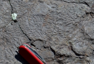
individual clam. The slab is upside down and the marks are of the sediment which filled in the original impressions. Figure four is a close-up of such a burrowed surface.

Archanodon must have had a simple and easy life, although not one without its hazards. These dangers of the Catskill Delta were described earlier (Kaatskill Life, Summer 1991). Frequently there were great floods and huge quantities of brown water swelled the streams, overflowing their banks. As a flood swept across the clam colonies, they were generally able to hang on and survive. Soon thereafter the real perils began. The subsiding flood waters deposited large amounts of sediment. In the Catskill Delta it was not unusual for several feet of sediment to be deposited in a few hours by a single flood. If you are a three‑inch clam buried by three feet of mud, you are in trouble. Our clams faced an unenviable moment of terror: they must dig or die . . . they dug.

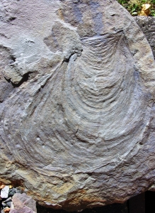
With its large foot, Archanodon was an active clam and it was able to work its way upward through the sediment and escape its premature grave. Look at figure five.

These are the burrows left by the panicky clams. Notice the horizontal structures within the vertical burrows; we call these meniscus structures. Each meniscus records a single

upward motion of the clam as, inch by inch, it worked its way to freedom. Often, in bluestone quarries, we find slabs of sandstone with round traces where the clams burrowed right through the, then still soft, strata (figure six, burrow is above and right of hat). Apparently the clams were

nearly always successful. I have never found a fossil clam only halfway back to the surface nor have I found one still at the bottom. Evidently, whole colonies were able to scramble back to the surface and reestablish themselves, no doubt waiting to face the next flood.


Life is a struggle, today or 400 million years ago, and these fossils demonstrate that so clearly. We paleontologists don’t often get to see history as vividly as do the naturalists of today’s world, but we do have those rare opportunities. The Archanodon burrows are good examples; there are others. These are called trace fossils. They are not traces of the ancient bodies, but traces of life itself. They remind us how brief a single lifetime is in the long history of life itself. These creatures of the distant past were, in their time, just as real and lived just as fully as do the plants and animals of today and those of the distant future. There is philosophy in rocks.

Prehistoric Catskill Monsters 11-9-17

in Uncategorized by

CATSKILL PREHISTORIC MONSTERS:

APPARITIONS OF THE ANCIENT SEA SCORPIONS 

The Catskill Geologist

 Winter l993

Updated by Robert and Johanna Titus


One of our favorite authors is H. P. Lovecraft. He was a horror and fantasy writer, featured mostly in long-ago pulpy magazines such as Weird Tales. Lovecraft’s work, while well thought of, is hardly great literature; it does, however, make very fine reading. His stories were usually set in isolated, backwater New England villages of the l920’s. Villainous creatures and people possessed by evil spirits were commonplace in his plots, as were monsters, aliens, ghosts and other terrible apparitions. Very often you never really did figure out exactly what kind of entity haunted these Lovecraft stories. Typically, his tales had a “lost in time” feeling to them; hence their appeal to a geologist. Often these awful Lovecraft characters were from very ancient epochs in Earth history. Much of the intrigue was in the fact that these dark entities had long ago possessed great mystical powers. Later they lost control of these powers and then they, themselves, fell into the possession of those very same evils. Their defeat banished them to a kind of timelessness. They were only able to take out their terrible rage on those weak mortals who fell within their grasp.  Fantastic as Lovecraft’s stories were, there was a kind of eerie plausibility to them. The stories worked because communications were so much poorer back then and so much of our nation’s rural landscape was isolated and mysterious. After all, back then who knew exactly what all lay out there lurking in the woods? Similarly, do we really know all that is hidden out there in the woods of today’s Catskills?

Lovecraft rarely featured the Catskills in his stories, and we wonder how often he visited our mountains. It’s too bad, as our dark cloves and isolated valleys would have made perfect settings for his stories – malignant versions of “Rip Van Winkle!”  But science often provides us with real-life stories, nearly as good as anything Lovecraft could have written.  And, here in the Catskills, some of these stories abound with monsters – great, creepy, crawling ones at that. The season is cold, dark and gloomy right now, so set a fire in the fireplace and turn down the lights. We would like to tell you about a real-life, monster-ridden town, right here in the Catskills. This is a town where Lovecraftesque monsters really are lurking in the dark; they’re hiding in the fetid, moldy, and darkened foliage of the Catskills. Our rock-Gothic tale even involves the long-ago discovery of the dead and dismembered head and limbs of an ancient monster. And this necromantic tale reminds us that we share this landscape with a heritage of antediluvian beasts that went before us. And maybe, just maybe, you can come face to face with one of these creatures.  We’re not kidding! They’re out there, if you’re “lucky” enough to encounter one.

First you’re probably wondering what peaceful Catskill village harbors the ghostly apparitions of those monsters of the past. Let’s end the suspense: the answer is Andes.  If you haven’t visited Andes before, it’s a pretty little hamlet on Rte. 28 in the western Catskills. Small and isolated, with plenty of l9th Century buildings and homes, it would have been a perfect setting for a Lovecraft story in the 1920’s. Today it remains a remarkably well-preserved old town and is very much worth a visit. Look especially for some nicely kept old homes and the old bank building which is now a real estate office.

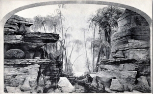
Our story is not about sightseeing, however; it’s about monsters. In recent articles we have described the early history of our Catskill rocks, the Devonian Period, about 380 million years ago, when this area was a great delta complex. One group of organisms, which inhabited the area at that time, was the sea scorpions known also by their scientific name, the eurypterids. We have several pictures to show you. Take a look at the first (fig. l).  It is a painting by the famous paleontological artist, Charles Knight. Knight made his


reputation as an artist primarily by painting dinosaurs, but he also did a number of ancient sea

scapes to illustrate invertebrate fossil species. This Knight painting shows several eurypterids inhabiting a very hypothetical Devonian seafloor. The two largest forms in the scene are of the types that have been found in the Catskills. The one on the left is known as Pterygotus; the one on the right was called Stylonurus until its name was changed to Hallipterus. Pterygotus has been found in the upper reaches of Schoharie Creek near Gilboa.  We will write about that one some other time. Hallipteus, found in Andes, is the one that we want to talk about today.

Eurypterids, now entirely extinct, were still fairly common in the Devonian Period. They crawled and swam in the nearshore marine waters, the brackish coastal estuaries, and even in the nearshore freshwater rivers. If you have read our earlier articles, you will already know that these environments are commonly represented in Catskill rocks.  You will be reminded of scorpions when you examine these pictures, and there is a good reason for that. The scorpions and eurypterids are closely related. In fact, today’s living scorpions probably list the eurypterids in their family tree. Hence the common name, sea scorpion.

Eurypterids were probably quite common in the Devonian Catskill area, but they are rare as fossils. Their skeletons were sturdy in life, but were composed of materials which usually decayed after death. We simply do not see many of them as fossils. Take a look at our second picture (fig. 2). This specimen is the carapace (head) of Hallipterus


excelsior, one of the largest eurypterids ever found. This head, alone, is ten inches long. It was found during the very early l880’s by an Andes farmer in a little quarry. The quarry was close to the town library and the World War I monument, but it seems to be overgrown and buried now; we looked for it recently but could not find it. The specimen was found on a loose boulder, not part of any bedrock. It probably came down the Tremperskill valley from the hills above. The rest of the body, if it still exists, has never been located. The fossil was acquired by M. Linn Bruce, who was then a student at Rutgers College. Bruce, who would later become lieutenant-governor of New York, donated the specimen to Rutgers.  One of us (Robert) was an undergraduate at Rutgers and can very well remember that specimen upstairs in the Museum of Geology Hall.  Perhaps it’s still there. If so, you can see it if you are ever in New Brunswick, New Jersey.

Only a few other fragmental specimens of this type have ever been found. The next picture (fig. 3) shows one of them; these are appendage fragments of a very closely


related species from Pennsylvania. When these fossils were discovered, nobody knew what the whole animal looked like, or even how big it was. Later a paleontologist named Charles Beecher found related species from England and was able to produce the reconstruction we show you in figure four. If his reconstruction is accurate (and it may not be), then this was quite a monster. At an estimated 54 inches in length, this was a lot bigger than your average land scorpion, not something you would worry about finding in your boots.


If you already are a fossil hunter, you would probably like to add one of these to your collection. But, alas, the chances are slim. In fact we don’t expect any of you are likely to find one, but we would like you to know what they look like, just in case. Eurypterids are really scarce in the Catskills; we know of only the two which were found in Andes and Gilboa. But there may be more, and if you feel like doing a little monster hunting in the Catskills, we would certainly encourage you to try. Pay no attention to the red sandstones of the Catskills; they’re old soils and don’t contain marine fossils. Instead, watch the brown and olive gray strata which are probably river beds. Don’t expect to find a complete eurypterid; fossils that good just do not show up. Instead watch for eurypterid parts.  Study figure four, so you will know what to look for, and … good luck!  (If you do find one, please let us know.)

Contact the authors at randjtitus@prodigy.net.

The View from Sunset Rock 11-2-17

in Uncategorized by

On The Rocks

The view from Sunset Rock

Robert Titus

The Woodstock Times

Oct. 3, 1996


Autumn is a gift, especially in the Catskills. This season of leaves is the time of the year to get out and enjoy a farewell to the warm weather. The heart of this scenic season extends from the middle of September to the middle of October. These are times when the first winter high pressure systems come billowing out of Canada. They bring clear, dry, but still warm air masses to the Catskills. With them comes a clarity of the atmosphere and a scenery unmatched the rest of the year. Within an hour’s drive or so from Woodstock there are a great number of wonderful fall landscapes well worth a visit. It is a terrible shame to let this time pass by without getting out. Take advantage of the autumn; winter is so long!

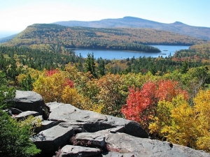
There are some scenic views which stand out, literally above others. Some of the truly great Catskill views can be found at North Lake State Park. From the edge of the escarpment on the Catskill Front there is a 70 mile panorama of the Hudson Valley. Turn around and there is a view of the neighboring Catskill peaks. People have been drawn to North Lake since the early 19th century when the first road was cut up the mountain. During the late 19th and early 20th centuries this was the site of the famed Catskill Mountain House Hotel, once the premier resort hotel of America. Today the location is part of the Catskill Forest Preserve.

After entering the park, drive to North Lake itself and hike north on the Blue Trail. It’s an easy walk for most people, young and old. You are following in the paths of thousands of hikers who have visited here over the past two centuries. Almost all these people have been greatly affected by the scenery here.

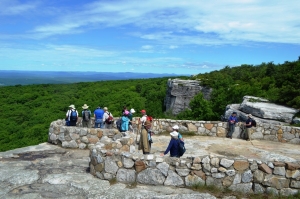
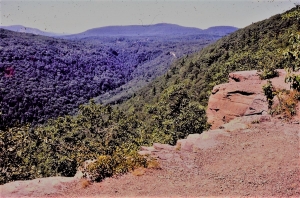
The trail takes you along the very edge of the Catskill Escarpment. At some places it passes within a few feet of a sheer cliff. Along the way you will pass Artist’s Rock and eventually you will reach the Yellow Trail turnoff. Follow this to its end and there you will reach a ledge named “Sunset Rock” after a great boulder there. Before you is one the single grandest views in all of the Catskill Mountains. To the east is that 70 mile view of the Hudson Valley with the Taconic Mountains beyond. To the south is the view of North and South Lakes, and to their east is South Mountain. Beyond them you can just make out the upper reaches of Kaaterskill Clove and still farther away are Roundtop Mountain and High Peak.

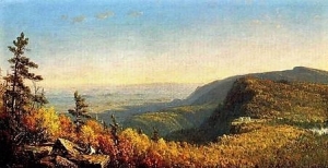
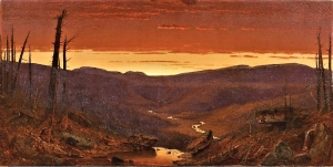
It’s an impressive sight to say the least, and it’s one which has played a role in the development of American art. Virtually all of the great 19th century landscape artists, beginning with Thomas Cole, came here. They set up their easels or sketched here and turned out canvases portraying the site at different times of the year and different times of the day. Watch for work by Cole, Sanford Robinson Gifford, Jasper Cropsey, William Henry Bartlett and others. Most of their many works are easily found online.

But I am a geologist and, while I greatly admire those artists and their work, I see other things from this site. I sit on Sunset Rock and look north, and soon I can see it as it was 23,000 years ago. As I watch, the years and decades pass by rapidly. The climate slowly turns cold and soon it is becoming Arctic. As the decades and centuries elapse the forests turn sickly gray and then die. The skies are usually blue and sunny, but cold dry gale winds blow out of the northeast. They shatter the brittle old tree limbs.

To the north a low whiteness appears in the Hudson Valley. It is dark blue in the morning, radiantly white at noon and aquamarine just before dark. As the years continue this white advances south and its image focuses into that of an advancing glacier. It passes beneath the Sunset Rock ledge and continues down the Hudson. Slowly the swell of ice thickens. Like a stream in flood, the ice slowly rises and fills the valley. It laps up onto the Catskill Front and soon a stream of white overflows the valley and advances southwestward across what someday will be North and South Lakes. The moving ice is very erosive and it’s beginning to scour out these basins.

Now even more ice pours down the Hudson. All along the Catskill Front ice is overflowing the valley and still it continues to thicken. Next comes the great swell of the main glacier, an ice sheet at least 3,000 feet thick. The white soon overwhelms all of this region. It continues to advance southwestward until all of the Catskills are entombed. The whole region becomes a great white, high Arctic plain.

That’s a somber vision to have on a beautiful autumn afternoon, but that is what I see from Sunset Rock.


Contact the author at randjtitus@prodigy.net. Read Robert and Johanna Titus in the Woodstock Times, Kaatskill Life magazine, Upstate Life magazine and the Mountain Eagle.

The Ravine 10-26-17

in Uncategorized by

The Ravine”

Windows Through Time

Columbia/Greene Media

July 29, 2009

Robert and Johanna Titus


When one of us (Robert) was a boy of about ten, one of his absolutely favorite places to go with his friends was a place simply called “the ravine.” It was a pretty decent canyon cutting through a sequence of Triassic age red sandstones. Boys would hike up and down it, scramble beneath overhanging ledges of rock, and just have a good time. As a grownup geologist his life hasn’t changed much. The one exception being that now he now explores ravines with his writing partner and wife.

To the two of us the word ravine still conjures up images of damp recesses and moss covered rocks, with fern forests, whitewater brooks and plenty of rapids. Ravines are still nice places to go, and hike, and explore.

But, as you can probably guess, there is a lot more. We’d like to take you to a ravine in the Hudson Valley and take a look at it and learn something of its marvelous history. That would be the ravine found along something called Doove Kill. We’d like you to visit it with us, take a good look at it, and then, most importantly, think about what a ravine really is.


To get there we would like you to find your way to the village of Blue Store, along Rte. 9 in Columbia County. From there, take County Rte. 8 east and uphill. Travel just about three miles and watch for Black Bridge Road. Turn left there and you will very quickly encounter a bridge. The bridge passes across Doove Kill, and you can park near it, get out and take a look. Here you can get your first glimpse of the ravine and actually think about ravines in general.

The features that most identify a ravine are the walls of rock that make up their steep slopes. You can see them here. Typically, the creek is forced to pass across ledges of bedrock and they break up its flow and produce whitewater which helps the scenery considerably. Turn around and continue east on Rte. 8 for just about a half mile more. You will soon enter the village of Snyderville and there you will find Taghkanic Road. Turn left onto Taghkanic and watch, again to your left, as you continue down that road; you will soon see more of Doove Kill.

For a short distance the road passes parallel and very close to the Kill. Here it is a very real ravine; it meets all of the criteria. It is deep, steep-sloped, and has plenty of exposed bedrock. There are two small waterfalls here, but unfortunately they are on private property, and we would like it if you did not disturb the residents. But there are places where you can pull over, park, and gaze into the gorge, without bothering anybody. It’s a nice place, except for the poison ivy!

But, we have been promising to do some thinking about what exactly a ravine might be, so we had better get going on that. We can learn more by returning to Rte. 8 and driving farther east, and finding our way into Lake Taghkanic State Park. As you can guess the park is named after the lake that is there. If you drive to the northwestern corner of Lake Taghkanic you will find the source of Doove Kill.

We have to go back into time about 14,000 years. Back then the Lake was a great deal larger than it is today; and a lot deeper. The lake was swollen with the water melting off of retreating glaciers.  Flowing out of that ice age version of the lake was an enormous volume of water. In short Doove Kill had a very different personality back then. It was a raging, foaming, pounding, thundering, whitewater and ice age torrent.

Now you must rethink everything that you have just seen along Doove Kill. In your mind’s eye, we would like you take those stretches of ravine that you just saw on Black Bridge and Taghkanic Roads and fill them, almost to the top, with that powerful whitewater flow. That makes Doove Kill something that you might call a Category Six whitewater stream, or at least is was back at the end of the Ice Age.

Changes your impression of Doove Kill, doesn’t it?

You might even say that it rearranges your whole sense of reality. All of a sudden your image of the Kill has been dramatically altered. It has become a far more exciting place, one with a real ice age heritage.

And that is the whole point. We all started out with an appreciation for the scenic beauty of something that we called “the ravine.” Probably all of us have been to our own ravines and enjoyed the experience immensely. But now we have learned something very different. There is the notion that such a landscape feature has a geological heritage. And it can be a very rewarding experience to come to understand that heritage.


The glaciers of Overlook 10-19-17

in Uncategorized by

The Glaciers of Overlook

The Woodstock Times

Aug 22, 1996

Robert Titus


Mountaintops develop over millions of years and they show all the scars of those great lengths of time. If you know what to look for, you can read a lot of the history that those scars record. Such is certainly the case with Overlook Mountain. The mountain is virtually a history book, recording the events of the great glaciations that once buried the Woodstock area in thousands of feet of ice.

Overlook has long been a popular goal for day hikers. The final stretch of trail leads to the old fire tower at the mountain’s summit. As you round the last turn and approach the tower you will find considerable bedrock at your feet and that is where the story begins. Bedrock is common on the mountain but here it is different; it has a polished look. Also there are long straight gouges, called glacial striations, on its surface. These are the unmistakable signs of the great ice sheet that once covered Overlook.


Glaciers move slowly, but they do move. A great thick glacier, as it passes across a knob of rock, will act like a sheet of sandpaper; it will grind the rock down. The bottom of the glacier is dirty with sand, gravel, cobbles and boulders. The sand causes the polishing. The last few cobbles to be dragged across the rock leave the striations. Hence, the features at the top of Overlook.

The fire tower site thus conjures up quite an image. This location is more than 3,100 feet above sea level and more than 2,500 feet above the floor of the Hudson Valley. The glacier must have been a half mile thick  . . . or more. This is known to science as the Woodfordian advance of the Wisconsin glaciation of about 23,000 years ago. With the possible exception of Slide Mountain, it seems likely that all the Catskill Mountains were covered by the Wisconsin ice sheet. The Catskills then resembled Antarctica or Greenland of today.

We can read the nature of the ice’s movement. There is a compass direction to the striations, a little west of south. The ice sheet must have been relatively thin at first. It seems to have been channeled southward down the Hudson Valley. Then, as it thickened, it swelled up out of the valley and flowed southwest across Overlook Mountain.

The fire tower site is only the first stop in an exploration of the Overlook glaciation. From the fire tower, head east to the ledge which looms over the Hudson Valley with Lewis Hollow immediately below. The site was a popular one during the hotel days. The drop-off is an impressive one and this is a fine example of sheer cliff. The cliff faces a little west of south. And so it is oriented with flow of the ice. That betrays its glacial origins.

The cliff is an example of what is called “glacial plucking.” Ice tends to stick to rock, and so as the ice passed across the south end of the Mountain, this adherence caused it to yank or pluck loose large mases of rock. After enough of this plucking a cliff developed.

You will find the occasional boulder on top of Overlook; I found an especially large one right on the brink of the cliff. These are called glacial erratics. They had been plucked off somewhere to the north and dragged south to this site. They were left behind when the ice melted. Once there were probably a lot more erratics near the edge of the cliff. Alf Evers, in his history of the Catskills, records that all the smaller ones were, long ago, pushed over the edge. The sport was called “boulder rolling.”

Still, there are a lot of erratics on Overlook – away from the cliff. Take the trail back down the hill. To the right, just past the ruins of the old Overlook Mountain House Hotel, is another plucked ledge. Below it the woods are littered with an abundance of erratics. There is no cliff here to push them over.

Before leaving Overlook it is worth returning to the ledge. Gaze out into the valley and with your mind’s eye you can visualize the time when it was filled with a stream of ice flowing south. The ice gleamed white with an abundance of dark blue curved crevasses. Its tide slowly rose up the valley walls and eventually overtopped the mountain. All the Catskills were soon a vast Arctic wasteland. It’s quite a scene to imagine, a scene now only recorded in the rooks.

Contact the author at titusr@hartwick.edu.

1 35 36 37 38 39 44
Go to Top