Memories come flooding back – Oct. 1, 2020
Memories Come Flooding Back
On the Rocks/ The Woodstock Times
July 2, 1998
Updated by Robert and Johanna Titus
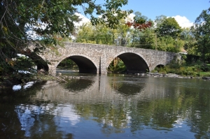
A little east of the town of Delhi we found a ledge of Devonian aged river sandstone which had been a deep channel cut into a now fossil soil horizon. This sort of thing is hardly rare in the Catskills, there are, for example, many such fossil rivers in the hills above Woodstock, but this was a very good one, however, and it made us ponder the history that such ledges represent: There was a story here.
March 14th, the year 387,469,184 BC, late afternoon.– All day long, very moist air has been rising up the slopes of the Acadian Mountains to the east, and now dark banks of storm clouds tower above the tall mountain peaks. Soon three closely spaced lines of thunderstorms unload, in quick succession, upon the mountains. The rain of the first line of storms quickly waterlogged the soils and the subsequent torrents have raced off downhill in deep, fast-flowing, erosive streams. Deep gullies have been rapidly cut into the soft, blue-black earths of the upper mountain slopes. A thick ooze of dirty water (in fact, almost watery dirt) has funneled into gullies too numerous to count. Down slope, those gullies combine into several powerful cascading streams; deep channels are being widened rapidly. More dark earth is engulfed by the expanding flow, and whole slopes slide into the torrent. The rush of the confined water is being pushed and hurried along by the great torrents backed up behind.
From various compass points, similar flows combine to a point well down on the face of the Acadians. Here, today’s cascade, and many earlier ones like it, have combined to carve a great, vee-shaped cleft in the mountain range. This gap dwarfs the canyons above it. Through this cleft, on this day, flow several large Niagaras; this is a catastrophic event, a thousand year flood.
Below the narrows, the Acadian slopes level out. Vast piles of coarse sand and gravel have formed an enormous, rounded apron of sediment, draped against the slopes of the range. As it flows across this slope, the water breaks up into a number of smaller streams, which continue several miles down the gentle slope until the streams enter a broad plain, a flat morass of flooded bayous, marshes and ponds.
The morass we speak of makes up the great Catskill Delta. Now, its various glutted and disorganized channels reflect the brunt of the flood; their powerful flows cut into adjacent flood plains and carve new channels. Their banks give way and, along with whole stands of trees, collapse into the flow. The channels are soon clogged and dammed with mud and broken trees. The dammed, blue-black waters rise up and flood out across the delta plain.
Flash floods like this are violent but they don’t last long. At the bottom of the now-submerged stream channels, the flood currents eventually slow down and the sediments begin to be deposited as dark horizons of muddy sand. Many plants and animals are being buried within these sands.
As the evening advances, the main flow continues down the channels of the delta. Downstream, the flow is still rapid, but it is beginning to ebb. At the mouths of the rivers, the flood waters, dark with sand and silt, are being disgorged into the western Catskill Sea. From above, large plumes of dirty water can be seen slowly expanding out into the sea. Many tree trunks and a flotsam of broken foliage drift seaward, half hidden in the darkening skies.
By midnight the storms have long been over. The sky is clear and the stars shine, competing with a wine-colored moon. The upper slopes of the Acadian Mountains are now dark, silent silhouettes. Downstream, the churning flows of the day are still rapid and gurgling with noise, but the normal languid flow of the delta will soon return. The rivers are still dirty, but they are clearing. Offshore the plumes of sediment are settling into thick strata of sticky sand. A large number of shellfish are dying in that burial. Their shells will lie, buried as fossils, for 400 million years.
It has been a very hard day for the biota of the Catskill Delta. But nobody cares. The world of the Devonian is a soul-less one; there is no mourning, no grief, no pity or even self pity. Indeed, there is no real understanding of exactly what happened today, and by midnight, there are few living creatures who can even remember these terrible events.
Contact the authors at randjtitus@prodigy.net. Join their facebook page “The Catskill Geologist.”