Brachiopods Nov. 23, 2023
Brachiopods
The Catskill Geologists; May 25, 2018
Robert and Johanna Titus
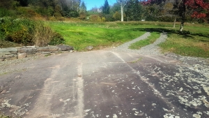
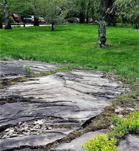
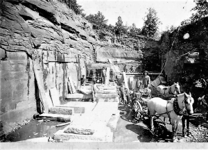
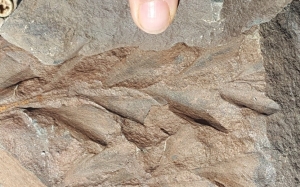
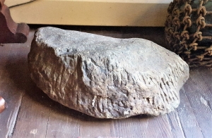
If you do a lot of fossil hunting in the Catskills then you probably already know much about what we will be writing this week. But, even if you do, you may well find our column worth reading. It’s about a group of invertebrate shellfish that lived right here. And we mean right here. Look around you. Where you are now was once the bottom of an ocean called the Catskill Sea. That sea takes us back roughly 400 million years ago to the Devonian time period. Now take a look at our photo; it’s a piece of sandstone. Its flat surface is a petrified bit of that sea floor. And, just as it was hundreds of millions of years ago, it is littered with shellfish, now fossils. They are brachiopods. We see them on this rock – right where they lived and right where they died.
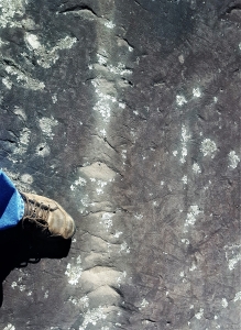
These animals, in life, lived within two shells so you might be tempted to call them clams. The similarity to clams is accidental. Brachiopods are a very different group of animals. Their internal, soft anatomy is entirely different from that of clams. Brachiopods are not even mollusks. We have blown up the image of one of these brachiopods in our second photo. Notice that there is a plane of symmetry running down the center of the shell. With clams there are also planes of symmetry but they are found in between the shells, not down their centers. Using symmetry you can always quickly tell apart clams from brachiopods. All this is important because these two groups are the most common fossils found in the deposits of the Catskill Sea. You need to know the difference. With experience that will soon become second nature.
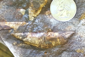
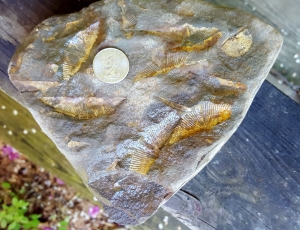
All but one of these fossils belongs to a form of brachiopods called Mucrospirifer. Mucrospirifer shells are categorized by their heavy ridges and those two – tapering left and right – extensions, sometimes informally called “wings.” Mucrospirifer is a very common brachiopod in our region’s marine sedimentary rocks. It enjoyed great success during the Devonian. There is a second species of brachiopod in the upper right corner of our photo. It too has a plane of symmetry running down the center of its shell.
There are more things that need to be explained here. First, notice how many Mucrospirifers are seen on this bit of that ancient sea floor. And also notice that they are all just about the same size. We are guessing that this represents something that is common among marine invertebrate animals. Such creatures commonly begin life as single fertilized cells, zygotes that were cast out by their mothers. Alternatively, they may have been early and primitive larva. But in the end it was all the same; these very young invertebrates drifted with seafloor currents until they detected a suitable ecology and, then and there, they settled to the bottom and began their lives. A group of invertebrates of this sort, all the same size, is called a spatfall.
Another thing about these spatfalls is that they seem to us to be commonly found on very dark shales. Geologists generally assume that dark shales represent a quiet sea floor with a low oxygen content. If so, then much of the success of Mucrospirifer came from its ability to survive in a wide variety of environments, places that other animals found inhospitable.
But, in the end, what is important here is for you to learn about a common form of fossil, typical of our Catskills. Don’t your feel just a little smarter now that you have read our column?
Contact the authors at randjtitus@prodigy.net. Join their facebook page “The Catskill Geologist.”