
Roeliff Jansen Kill, Part 6 –Bottom of a lake
Stories in Stone
Updated by Robert and Johanna Titus
We continue our journey down the Roeliff Jansen Kill. Last time we had reached the village of Elizaville and there we found an ice age delta. Back, about 14,000 years ago, the Roeliff Jansen Kill had reached the shores of an ice age lake. It’s known to geologists as Glacial Lake Albany. For quite some time that lake represented the downstream end of the Roe-Jan and, as the river flowed into the lake, it deposited the sediments of the Elizaville Delta.
But the lake was doomed; all lakes are. Lakes are ephemeral features; time will always bring their destruction. The waters of Glacial Lake Albany eventually drained down the Hudson and into the Atlantic Ocean. That left behind a big empty basin with the Roe-Jan flowing into it.
Now the Roe-Jan tumbled over the edge of its old delta and reached the flats of the old lake bottom. This constitutes a whole new stretch of the river, and we can, of course, explore that stretch. We can see it with or without the lake waters.
From Elizaville, take County Rte. 19 north. You will soon cross a small creek and then see a large apple orchard. Just beyond the orchard, the road will cross another small creek and then start to climb uphill a bit. You have just crossed Doove Kill and are now rising up onto the Manorton Delta. Doove Kill, just like the Roe-Jan, flowed into Lake Albany and created its own delta. On the left (west) side of the road you will see a small pond. That is an old ice age pond. It formed just like Twin Ponds at Elizaville. A large block of ice was buried in the delta and, when it melted, it left behind the hole in the ground that became a pond.
What we are doing now is driving north, parallel to the shores of what had been the old lake. Look to your left and imagine the waters of Lake Albany stretching out before you. The first 50 or 100 feet of lake are covered with a thin sheet of ice. Beyond that are the open waters of the lake. There are a number of small islands out there, but it is, otherwise, a very big lake. The other side of Lake Albany is nine miles away. You can see Mount Marion rising above the western shoreline. When we look north and then south, we see the lake disappearing into the horizon; it is, indeed, a very large lake!
But we have exploring to do. We continue driving north on Rte. 19 until we reach the village of Manorton. There we take a left fork and follow County Rte. 8 off to the northwest. We begin a long steady descent and drop down from and elevation of 260 feet to one of 190 feet. We are dropping off of the Manorton Delta and our descent is a journey into the depths of Lake Albany.
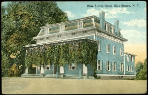
Imagine the waters deepening around you as you drive down the road and imagine it growing darker as well. Our journey takes us about a mile and a half until we get to the village of Blue Store. That’s a historic old town, but out trip is taking us well beyond what most people reckon as history. We arrive at the old hotel and restaurant and look around. The countryside here is flat and expansive; it is the floor of the lake.
It is always somewhat startling to see a flat landscape and recognize it as an old lake bottom. We are now 70 feet beneath the waves of Lake Albany. This is not a nice place to be; the water is murky and it is dark and very cold here. But, like or not, this is Blue Store as it was, about 14,000 years ago. Once again, the Roe-Jan has made us time travelers.
Contact the authors at randjtitus@prodigy.net. Join their facebook page “The Catskill Geologist.”


