"I will never kick a rock"

Monthly archive

March 2019

John Burroughs birthday blog Mar. 29, 2019

in Uncategorized by

Burroughs’ Boyhood Rock
Poughkeepsie Journal
Updated by Robert and Johanna Titus

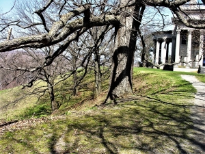
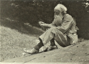
Every rock has a story within it that can be read if you just know how to. As geologists, we know that this is so. Like so many of us we learned, long ago, how to read these tales of the distant past. So, it was no surprise that, upon visiting “Boyhood Rock,” we found a story worth repeating. This is certainly one of the Catskills best known rocks. It’s at Woodchuck Lodge, John Burroughs’ hideaway home in the western Catskills. Burroughs was the beloved turn of the 20th Century nature writer. His boulder is on his old family farm. He spent many an hour sitting upon it, gazing at its magnificent view and pondering the natural history all around him. Best known for his writing about birds, Burroughs, especially late in life, was an avid amateur geologist. He understood at least part of the story of Boyhood rock. He knew that the boulder was a glacial erratic. There is a photo of him, proudly pointing out to Charles Edison the nearby glacial striations.


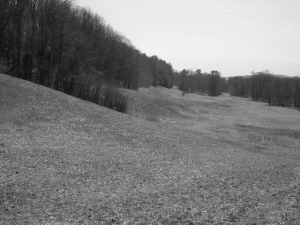
The boulder is from the Oneonta Formation which makes up the local bedrock of the upper Pepacton Valley. The Oneonta sandstones are, for the most part, river deposits of the old Catskill Delta. The fossil delta is very well known within the geological community; it was an enormous complex of streams that originated in the Acadian Mountains in what is western now New England. From there these rivers flowed westward down into the Catskill Sea of today’s New York State.
There was a problem, however, that bothered us for a while. We were puzzled by the many small holes that littered the boulder’s surface. At first. we guessed that these were fossil animal burrows. Could these be the burrows of Burroughs rock? Alas the gods of nature writing would not be that kind to us. No, they just did not look right for burrows. Eventually, we found an especially well-preserved one and quickly recognized it as the cast of a fossil tree root. They were fossils of the Gilboa trees from one of the world’s oldest fossil forests. These were tropical plants, and so Boyhood Rock, a product of the ice age, must have had an older, equatorial ancestry.
Gilboa tree roots are common in the Catskills, but it was the first time we had ever seen them in a river sandstone. How could trees have been growing in the channel of a fossil river? In science, the solution of one problem often leads to another. A possible answer is that this stretch of the old channel had once been a great bend in the river. During an especially bad flood, the river carved a new route and the old bend was abandoned, leaving a large, curved lake called an oxbow. The lake gradually filled with sediment, and then trees began to grow, their roots penetrating the old river sands. That’s what we see today.
But there was another mystery that bothered us a lot. There are three boulders here, all of which match each other in terms of lithology, and all have fossil tree roots. This can’t be a coincidence as the odds are too great; the three rocks must once have been joined. Our guess is that there once was a much larger Boyhood Rock, transported not beneath a glacier but within it. As the ice melted this boulder was lowered toward the ground. Stresses generated at this time caused the original rock to break up into the three pieces, each of which “landed” near each other and remain as we see them today.
And, so it was that Boyhood Rock gave up its geological secrets. There is a great deal of satisfaction that comes from cracking a scientific problem, even if it is a problem of absolutely no practical significance.
___________________________________________________________________
Contact the authors at rndjtitus@prodigy.net. Join their facebook page “The Catskill Geologist.”

Geology at the Vanderbilt mansion Mar. 21, 2019

in Uncategorized by

The Fall of the House of Vanderbilt
Stories in Stone
Oct. 29, 2004
Robert and Johanna Titus

Do you remember the story of that neighborhood in Schenectady that suffered the slump late last winter (2018)? Two houses and the earth beneath them suddenly began a slow collapse. A dozen or so people had to be evacuated. It made quite the splash in local news, for a while, and then faded from our regional consciousness. Well, we have followed the story and the end was sad, but predictable. It was ordered that both houses be razed. The danger was deemed too great to allow people to return to their homes.
We wrote about this back then and warned that this was no isolated event. Slides of this sort are common where there is uniformly fine-grained sediment, and that is throughout much of the Hudson Valley, including many areas in Columbia County. Our valley once lay beneath the waters of Glacial Lake Albany. Thick sequences of soft clayey sediment accumulated and, periodically, masses of this stuff slide downhill. The formal term is earth flow. It has happened in a lot of places. It will happen again.
You can go and see for yourself one other place where this has been going on and get a good look at how it affects the landscape. At the same time, you can see how a fine piece of architecture is threatened by a future earth flow. Head south down Rte. 9 to Hyde Park and visit the grounds of the Vanderbilt mansion there. The place belongs in Newport, Rhode Island, a great edifice of Indiana limestone. Around it, and to the north and south, is a sprawling estate that lies on a great bluff towering above the Hudson River. The Vanderbilts had a fine view of the Hudson and that must be why they chose this location. In the long term it may have been a fatal choice.
If you look around the mansion you will quickly notice that the grounds are smooth and flat. It might seem unnatural and you might suspect that the landscape was bulldozed, but Nature did this herself. There is an ice age heritage here. About 14,000 years ago this was Glacial Lake Albany. And back then the local stream, “Crum Elbow Creek,” flowed into the lake. This little stream carried a lot of sediment and deposited it in the form of a large delta that expanded out into the lake. It is the nature of deltas to have flat tops and very steep fronts. That accounts for the flat landscape here and also the steep slopes that face the Hudson Valley. The Vanderbilt mansion was built on the edge of the ice age delta. While you are walking the grounds, imagine yourself in chest deep icy lake waters.

Walk south from the mansion, towards the formal garden, and notice that the forested slope has a scalloped appearance; it looks as if a large ice cream scoop took out masses of earth. This is typical earth flow landscape. Each “scoop” represents an old slide. These have had the time to “heal” with the return of the forest.

Return to the south end of the mansion and take the dirt path downhill. Beyond is a long grassy meadow. If you look along the edge of this meadow you will, once again, see that scalloped appearance.
Now head north from the visitor’s center on the estate driveway. Soon you will find a very nice vista of the Hudson Valley. It’s worth the trip by itself. But, once again, look over the edge of the steep slope here and see the scalloped appearance. Over the eons many earth flows have occurred all along the edge of the old Crum Elbow Delta.
There is no reason to think that any of this has stopped. We would expect that every century or so, more of these events will occur. Now look and see how close to the edge of the delta the great mansion is. We are predicting that someday, much as was the case in Schenectady, a sizable portion of the Vanderbilt mansion will begin a downhill slide. Earth movements are very egalitarian; they affect the rich as well as the poor.
————————————————————————————————————
Contact the authors at randjtitus@prodigy.net. Join their facebook page “The Catskill Geologist.”

Kaaterskill Clove by air March 14, 2019

in Uncategorized by

Palenville by air
The Catskill Geologists
The Mountain Eagle – June 15, 2017
Robert and Johanna Titus

We would like to welcome what we hope are a large number of new readers from Palenville. The Mountain Eagle has expanded its coverage to your town. Palenville has an extensive historical heritage. It has been a place where visitors have long begun their ascent into scenic Kaaterskill Clove. Originally a tough trek, nowadays there is a modern highway so the journey is easy. In the 19th Century Palenville became an artist’s colony. Landscape painters of the famed Hudson Valley School of Art commonly spent their summers there and devoted themselves to sketching and painting the area’s scenic landscape. A lot of very good work was done in the vicinity of the clove. Palenville has always seen a great number of tourists passing through on their ways to the mountains.
Let’s visit the town of Palenville as geologists; and, let’s ask a deceptively simple question: why does it exist? The answer takes us back to the Ice Age. Geologists have long been drawn to Kaaterskill clove to view its landscape with a more scientific eye. That’s where we fit into the story. We love to hike the clove and the mountains north and south of it. There is an awful lot of very good geology to be seen there. So, when we got the chance to fly over it, we welcomed the opportunity. We had a pretty good idea of what we would see. Kaaterskill Clove is a great gash in the Catskill Front. Most of it was carved during the Ice Age, especially during the closing phases of that time. Melting glaciers provided enormous amounts of water that cascaded down the canyon, eroding it. Think of it as an oversized gulley!


Kaaterskill Clove had been there before our most recent ice age. It probably began eroding at the end of the Ice Age’s previous chapter. But about 13,000 or 14,000 thousand years ago there was another time of melting . . . and another time of erosion. You have to visit the clove and imagine it with deafening masses of raging, foaming, pounding whitewater thundering down its canyon. Erosion would have been going on at an alarming rate. Where there is erosion, the destruction of rock, then there must also be the production of large masses of sediment. Rock is converted into sediment, and it must be deposited somewhere. That is exactly what we were going to see.
Palenville has long been recognized by geologists as something that is called an “alluvial fan.” That is a large, fan-shaped heap of earth. Such fans spread out across a dry valley floor at the bottom of the sediment’s source. In this case, large amounts of sediment traveled down an eroding Kaaterskill Clove, and then spread out into a fan shaped heap at the bottom of that clove
A trained geologist can recognize such a feature on any good topographical map, and we did this a long time ago. But now, we were up in a plane, and there it was. As we flew by, we gazed into the great wide yawning clove. And spread out before it was the alluvial fan. We could recognize three roads that we knew. These were Bogart Road, Rt. 23A, and Rt. 32A. The three of them radiated out from the bottom of the canyon and spread out across the top of the fan. Nobody knew it at the time but, as laid out, those roads all descend the gentle slopes of the alluvial fan. The fan made an ideal location to build homes and, one by one, they appeared. And that is the geological story behind the origins of Palenville.
=================================================================
Reach the authors at randjtitus@prodigy.net and see more at their facebook page “The Catskill Geologist.

The Cohoes Waterfalls March 7, 2019

in Uncategorized by


Family Day Trip: Cohoes Falls
Windows Through Time
The Register Star
Robert and Johanna Titus
Nov. 27, 2015

There’s probably some good weather ahead of us so let’s go for another “family day trip.” That’s when we tell you how to get to some wonderful geological location that just happens to be far enough away so that you have to spend the day getting there, seeing it, and coming back. That’s something that the two of us enjoy doing, especially when the children and grandchildren are visiting. This time let’s go to the town of Cohoes.
You have probably heard of Cohoes, but perhaps you have not visited it. The town is famed for three things: 1) the Cohoes mastodon, whose skeleton is now housed at the New York State Museum; 2) the old Harmony Mills factory, which was one of our state’s premier industrial centers back during the 19th Century; and 3) the Cohoes Falls which the Mohawk River tumbles over. As it happens those all three are very closely associated with each other. An elephant, a factory, and a waterfall? How could they have anything in common, never mind a lot? Obviously, we have a great deal of explaining to do. Today let’s hold off on the mastodon and focus on the other two.
Harmony Mills is typical of New York State industrial might, not so much today, but back in the 19th Century when the “Empire State” was almost truly imperial. You have to go there and see them to believe them. To properly describe Harmony Mills we have to use two words that we usually hate to use: the Mills are an awesome icon of 19th Century industry. Those words have come to be used far too often in modern vernacular. They should only be employed when they are truly needed; here they are. The mills were based on water power and all that water power came from just a little upstream; that’s where the falls are. In the 19th Century waterfalls were an important component of our energy needs. Where there were awesome waterfalls then there would soon be large iconic factories. Harmony Mills was an enormous textile mill complex. It was constructed in 1872; it fell into hard times and closed in 1988. Today, it has been converted into upscale lofts.


The falls were harnessed to provide the awesome amounts of energy needed, so let’s talk about them. You can visit a site that has been developed to provide the most awesome possible view of this natural icon. Find your way to North Mohawk St. and head north through town until you can turn right onto Cataract Road. There you can park, get out and walk to the viewing stand. It provides an iconic vista of the falls, which lie maybe a mile to the northwest. Why are they there?
The falls are mapped as belonging to one of the most important rock units in all of the Hudson Valley – that is the Normanskill Formation. It is a mass of dark gray sandstone and black shale. The sediments that formed these first accumulated in an awesomely deep marine basin. The Normanskill Basin was likely tens of thousands of feet deep. Sediments, mostly awesome amounts of sand, tumbled down its steep slopes as submarine landslides, and piled up at the bottom. Those sediments eventually hardened into dark gray sandstones. During the awesome stretches of time that passed in between the landslides, muds accumulated and those hardened into the black shales.
When, and just after they were deposited, these materials formed flat sheets of sediment. But, if you look at our photo, you will see that the once horizontal strata are now steeply inclined. They were deformed during one of several mountain building events that shaped the Appalachian Mountains as they are today. A geologist looks at such deformation and interprets it as evidence for ancient mountain building. Our guess is that this event was the one called the Taconic Orogeny and that it occurred during a time called the Late Ordovician, about 450 million years ago.
If we could we would climb down to the falls and take a good look at the rock types that make them up, our guess is that a lot of those strata are composed of those dark sandstones. Sandstone is mostly composed of quartz and that’s a very resistant mineral. It makes very good cliffs and even better waterfalls.
We are guessing that, a long time ago, those strata came to be tilted during that mountain building event. Many hundreds of millions of years later, the Mohawk River started cutting across the Normanskill rocks. When the river encountered those tough sandstones, it had a very difficult time cutting through them. The result was the waterfalls.

============================================================================
Contact the authors at randjtitus@prodigy.net. Join their facebook page “The Catskill Geologist”

Go to Top