"I will never kick a rock"

Monthly archive

July 2019

End of a Limestone Sea July Geological Rumblings in Greene County The Devonian, Part Five 7-25-2019

in Uncategorized by

End of a Limestone Sea July Geological Rumblings in Greene County The Devonian, Part Five Updated by Robert and Johanna Titus Greenville Press September 7, 2005

We have, in the first four chapters of this opus, encountered a very different Greene County from the one that we are familiar with. We have been visiting outcrops of the Helderberg Limestone and envisioning the tropical, shallow water sea that once covered all of our county. We have seen a sea that can be likened to the Bahamas of today. That’s a remarkable concept to ponder, but that is what the rocks tell us.

Obviously, such a tropical sea did not last. This ecology would disappear and be replaced by something new. It is in the stratigraphy that we pick up in this chapter. Find your way to Rte. 23A and travel to a site exactly three tenths of a mile east of the New York State Thruway. There you will find a large dark outcropping on the south side of the road and a much smaller gray outcrop on the north. There is a lot of history here.

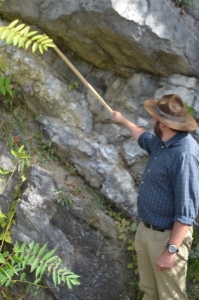
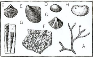
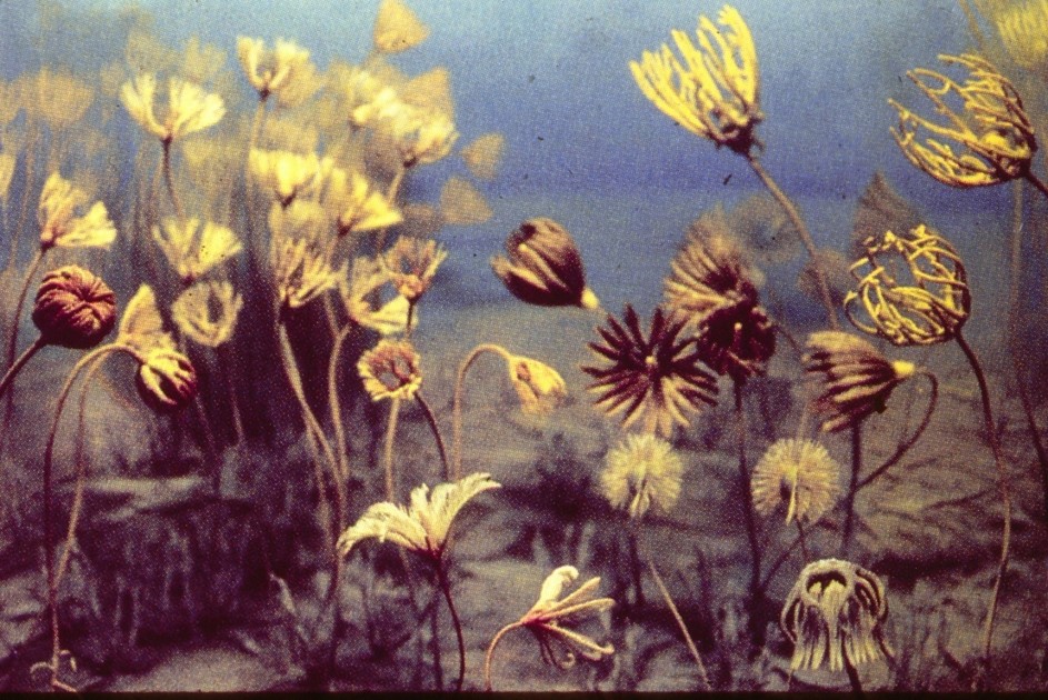
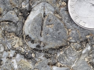
If you look this site over carefully you will realize that, before being largely eroded away, the dark strata passed horizontally over the gray beds; they used to extend across the highway, but they have been eroded away on the north side. That makes them the younger strata. We geologists always start at the bottom so let’s take a look at the older gray rocks. The gray strata represent the top of the Helderberg Limestone. That’s the unit we have been looking at in recent columns. Now, at last, we have reached the end of Helderberg deposition. These limestone strata represent something of an end of an era. If you poke about on this outcrop you will probably be lucky enough to see some fossils here. There aren’t many so please be patient. These creatures were the fortunate inhabitants of a very nice ecology. For millions of years our beautiful shallow tropical seas have been accumulating these limestone sediments and turning them into rock. But now, that time is over. Those overlying dark rocks represent a dramatic, even profound, change for all of Greene County. This was an important moment of history so I hope you can appreciate it.

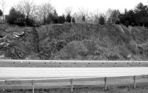
Walk across the street and take a look at the thick sequence of dark beds exposed there. The lower levels are massive ledges of dark strata. The rock type is an unusual one and we were very surprised to find it here. These strata are composed of chert. You likely know chert by one of its other names: flint; it’s a form of silica. Bedded flint is more common east of the Hudson River; it is rare on our western side. The overlying strata, all the way to the top of the outcrop, are black shales. Or at least these beds were black shale originally. These strata have probably been baked a little during Appalachian mountain building events.

These flinty chert and dark shale beds make up a unit of rock called the Esopus Formation. As you can see, it certainly stands out in sharp contrast to the Helderberg Limestone. You can quickly deduce that the environment of deposition must be equally different; this was no tropical shallow sea.

Geologists usually interpret bedded chert as having formed at the bottom of very deep seas. If that is the case here then you are looking at sedimentary rocks which formed at the bottom of an ocean that was, perhaps, thousands of feet deep. We don’t know if this ocean was quite that deep, but this was no puddle. This was a quiet seafloor with very few currents. It was likely that it was very still and that there was very little oxygen in the water. That would have made this a lifeless seafloor.

The overlying black shale accumulated as black mud in waters that were probably a good bit less deep. There may have been some currents, but we suspect that there was very little oxygen. This too is likely to have been a lifeless seafloor.

The Esopus Formation speaks to us of major crustal events. It would seem that the bottom dropped out (literally) of that shallow tropical Helderberg Sea. The crust sagged abruptly, and soon deep, quiet water conditions prevailed. The rich marine sea life and the complex ecologies of the Helderberg Limestone disappeared entirely. A monotonously dark, deep, cold abyss replaced them.

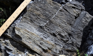
There is more to the story, but you will have to drive a little in order to see it. Find your way to Rte. 23 and then drive a short distance west of the Catskill Creek Bridge. There are outcroppings on the north side of the road. If you look around you will see more of the Esopus Formation here. You will find somewhat baked black shale. The strata here have not only been baked but they have been folded as well. You will see a great round fold in the rock. In the past, this location has been referred to as the “Wheel Cliff”.

On the west (left) side of the outcrop we found some strata that have escaped being baked. Here we could find an original delicate lamination in the strata. These thin beds record long episodes of very slow deposition. A quiet seafloor only slowly accumulates very fined grained, muddy sediment and it does it very slowly. You are looking at a lot of time.

We learned more on the south side of Rte. 23 at the eastern end of the outcrop. There we found another unit of rock. Geologists call this one the Carlisle Center Formation. It is lighter colored, thick-bedded and made up of a little bit courser sediment. The shale has been succeeded by siltstones. This unit completes a sequence which may have a lot to tell us about Devonian history.

Those Esopus chert beds appear to have been deposited in very deep and very still water. They grade upwards into shale strata which seem to represent somewhat more shallow waters. Now there was little in the way of current activity, but conditions were not as stagnant as had been the case. The Carlisle Center siltstones complete the story. These light-colored rocks have much less organic matter in them. Black organics decay in the presence of oxygen which, in turn, is related to currents. The Carlisle seems to have formed in the shallowest waters, in depths which allowed winds to generate currents. This whole sequence of strata can be called a “shallowing upwards cycle”. The great downwarping that initiated this sequence was followed by a prolonged slow shallowing. A lot of that shallowing may have been caused by the sediments that slowly filled in the basin. Pour enough silt and clay into a deep sea and it must become shallow. As it becomes less deep, currents will begin to affect the seafloor. It’s a nice pattern.

But where did the sediment come from? There may be a couple of hundred feet of clay and silt involved. What made it? That, in fact, is the crucial question and answering it tells us the most about what was going on. Geologists look east and back through time to answer that question. Back in the Devonian all of New England was rising in a great, in fact very great, mountain building event called the Acadian Orogeny. What we might call Europe today had collided with old North America just as India has collided with today’s Asia. India’s collision created the enormous Himalayan Mountains, Europe’s collision created the Acadians. Look east from Rte. 23 and imagine the towering mountain range that once was there. It would reach elevations that made it the rival of the Himalayas.

But not during Esopus times. By then the Acadians had just begun their uplift. Small mountains produce small amounts of sediment and most of that is in the form of silt and clay. Our Esopus/Carlisle sequence might look big and thick to us, but it is relatively small by mountain building standards. Still, the infant Acadians had accomplished a lot. They had destroyed that beautiful limestone sea of the Helderberg. They had replaced the limestones with chert and shale, and they had forever left a mark on Greene County. But that was just the beginning. 25, 2019
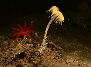
The Kalkberg Limestone July 18, 2019

in Uncategorized by

The Devonian of Greene County, Part 4 – the Open Sea

The Greenville Press

Updated by Robert and Johanna Titus

Both of us have spent time in the Bahamas. One of the most exciting parts of the journey is the first-day plane ride across the Bahamian platform, that great wide shallow tropical sea that makes up most of the Bahamas. From the plane you can look down and see a wonderful, very shallow, tropical ocean. It’s a fabulous sight and the experience has equipped the two of us to see the Catskills in a way that not many can. A plane ride across the Bahamas is also a flight across our land as it was long ago.

Sunrise, October 31, 410,390,139 BC, just before dawn – Weare the mind’s eyes; we can go anywhere and do anything. We can go fast, and we can go slow, we can soar high and we can fly low. Right now, we are a mile above the future site of Stamford, and we are headed east. The sun is, of course, headed west and we watch as the gray eastern horizon brightens into a red and then a yellow. We can see a brightness that betrays exactly where the sun is, even if it still remains hidden below the horizon.

     Below us is the grand expanse of a great broad sea. It is called the Helderberg Sea, but it is still too dark this morning to actually see it. Behind us, the last of the morning stars are still shining but before us the sky continues growing brighter and suddenly a red pinpoint of light expands into the full disk of a rising sun. We, the mind’s eye, pause and hang still in the sky and watch this daily cycle of light. Soon it will be bright enough.

     The rising Sun reveals that, below us and stretching to the east, is a beautiful shallow sea. This ocean can’t be very deep. The water is clean and transparent, but the seafloor is just a little too deep to be clearly visible. Nothing much of it can be seen even this high up, but we are the mind’s eye and we descend down to an altitude of merely 50 feet above the waters. The morning air is still and already warm; the water is undisturbed by any waves. We slowly move across the aqua-colored sea and gaze through the waters of the Helderberg Sea down to its bottom. There are a few fine patches of green. Large seaweeds and sea grasses do not exist yet in this the Devonian time period and it is too deep here for most algae. Nevertheless a few “fronds” of algae rise from the seafloor and make up small green patches.

    We, the minds eye, now are drifting across the sea. It is as if it was given to us to be in a glass bottomed boat, but this boat travels across a 410 million year old ocean. It is fascinating to see the past like this.

     Now, we cross a stretch which appears to be a marine meadow. The seafloor is not covered with our algal greenery but, rising above that, are what appear to be flowers. We drop into the sea and go down to the bottom and look. We are the mind’s eye and we can do this.

     Our “flowers” turn out to be animals; they are called “crinoids” in the Latin terminology, but many people like to just call them “sea lilies” as that is what they look like. They are distant cousins of the starfish. Their brightly colored arms reach up into the waters of the Helderberg Sea as they search for food. There is a lot of food and, not surprisingly there are many crinoids too. They truly make up something that looks like a meadow.

     Our “meadow” is something of a marine jungle and it is not without animals lurking in the “brush.” Shellfish, that paleontologist call brachiopods, are the most common. Then there are the delicate lacy networks of animals called bryozoa, Latin for moss animals. Both of these forms appear sporadically among the green algae. The most interesting of our Devonian animals are the trilobites. They might remind you of a horseshoe crab. One of them is slowly creeping through our meadow. It is clawing at the sediment beneath. This form is a scavenger and it is seeing what sort of food luck has in store for it. We, the mind’s eye, are fortunate enough to see this one alive.

    The brightest of the Devonian animals were the nautiloids. We see them and quickly recognize that they were related to the squids. They had the long tentacles and the fine eyesight that modern squids have and were actually close cousins with the modern forms. The two groups were similar except that, unlike squids, the nautiloids “wore” shells. Some of those were conical, but the ones we are looking at are coiled. Our Helderberg specimens seem to be social. Six of them lull on a patch of sandy sea bottom. Their tentacles paw back and forth through the sand; they too seem to be searching for food.

     We have spent hours drifting lazily across the Helderberg seafloor, but we have covered a lot of ground. Now we have arrived at a spot where someday Rte. 23 will pass the Thruway. Our journey into the Devonian is not over however; our travels will simply take a different route. Now we will travel about 400 million years forward through time, but when we get there, to today’s world, we will still be in the Devonian.

May 16, 2004 – Rte. 23, south side of the road, just east of the Thruway – Traffic speeds by this spot 24 hours a day. Cars rarely stop here; there are few reasons to do so. The only thing of note here are the ledges of gray limestone that line both sides of the road. The rocks have a name: geologists say that they belong to units called the Kalkberg and the overlying New Scotland Limestones. To the discerning eye, these sedimentary rocks are composed of sandy textured materials which were once, indeed, sands. These are not the quartz sands that we know in the northeast; they are soft calcium carbonate sands that harden into limestone.

     The Kalkberg and New Scotland are stratified; the rocks are composed of horizontal layers of limestone. What is remarkable is that each horizon of rock was once, for a short time, the bottom of the Helderberg Sea. Each horizon had its turn as seafloor; its sediments were laid down by passing currents. Then, for a time, warm waters lapped across them. Algae and shellfish took their turns living here. But “turns” are always brief; soon these temporary seafloors were buried by more sediment carried by more currents. When the weight of burial was great enough, they slowly hardened into rock. This describes the almost endless cycle of sedimentation.

   That sea was deepening, and the New Scotland was deposited in deeper waters than the Kalkberg. Geologists call this a “transgressing” sea. We have been seeing this record of transgression in the several articles that we have been writing. The transgression first began with the appearance of the Manlius Limestone. The Helderberg Sea gradually deepened through the sequence of the Coeymans, Kalkberg and New Scotland Limestones. With deposition of the New Scotland the deepening would reach a maximum and the Helderberg Sea would not get any deeper. But it is important to understand that “deep” is relative; this was never anything but a shallow tropical sea, much like the Bahamas of today.

    If you visit a place such as this, you can search out horizontal ledges of limestone. When you look at such surfaces, you are looking into the past. You are literally looking at ancient seafloors. Often these surfaces are littered with the fossils of the very shellfish that once lived here. These creatures have been dead for about 410 million years, but they were the living creatures who actually knew the Helderberg Sea when it covered most of upstate New York

     Those surfaces can still be littered with the fossils of brachiopod, bryozoa, crinoids, trilobites and much more. In a way the Helderberg Sea is still alive, but only to those who know where and how to look.

   Contact the authors at randjtitus@prodigy.net. Join their facebook page at :The Catskill Geologist.

The Coeymans Limestone July 11, 2019

in Uncategorized by

The Devonian of Greene County
Part 3: The Coeymans Limestone
The Greenville Press March 3, 2005
Updated by Robert and Johanna Titus

The two of us once had dinner at the “Seven Seas Restaurant” at Walt Disney World in Florida. It’s quite the experience. If you get a good table, you are right up against the window of one of the world’s largest aquariums. It’s enormous, and they don’t keep just goldfish in there either. There are full size sharks and an abundance of other large, colorful tropical fish. There is even a small living coral reef. Of course, it’s not that the corals actually do anything, but they add a great deal of color to the experience.
You might think that you can’t have dinner at a place like that here in Green County, but you would be wrong – sort of. All you really need is a good imagination and a little bit of knowledge. We can provide the knowledge.
In recent issues of the Press we have been surveying the geology of the Devonian time period, here in Greene County, and so far, the emphasis has been on the Helderberg Sea. That was the shallow tropical sea that once covered our entire county. We have gone and visited outcrops of the Rondout and Manlius Limestones but now it’s time to visit what may be the most interesting of all the local Devonian rock units. It’s called the Coeymans Limestone and it’s named after the town. The Coeymans is composed of thick bedded, very fossiliferous limestone and it is often a good thick unit of rock.
You can go and visit it yourself. Take Rte. 81 east from Greenville until you come to the Quarry Restaurant (yes that’s where you can have dinner next to an imaginary aquarium). Just east of the Quarry, on both sides of the highway, are large outcrops. The upper two-thirds on both sides are exposures of the Coeymans.
If you pull over and take a good look you will see just what we promised. The limestone comes in solid thick layers (strata). From any distance it is pretty dull looking stuff, but if you get really close you will see a lot more. You should be able to pick out the crescent shaped cross sections of fossil shellfish. These are bivalved invertebrates. That means they had two shells, just as a clam does. They just weren’t clams; they belong to a very different group called brachiopods. This one is named “Gypidula coeymanensis.”
With a little patience you should be able to find something a little more recognizable than a cross section. Some of these fossil brachiopods are actually pretty good specimens. Sadly, I don’t think you will have much luck trying to collect any of them; this is very solid rock and it will only give up its fossils grudgingly. Anyway, the outcrop makes a fine outdoor museum just as it is.

You will also likely find a number of what look like fossil Cheerios or fossil Life Savers. These are the circular remains of what are called “sea lilies.” They were distant cousins of the starfish. Imagine a five-armed creature stacked atop a long stem-like structure. In life the small Cheerios were stacked together to make up parts of the stem.

  Living crinoid

All in all, we can conjure up an image of a colorful tropical seafloor here. Imagine pink sands, with some green algae, then add the sea lilies and brachiopods and you have a pretty good marine ecology.
All this gets us back to having dinner with the view of a tropical sea. The Coeymans Limestone once passed right through the site of the Quarry Restaurant. Of course, the limestones long ago eroded away right where the Quarry is, but they were there. And so was that ancient Devonian sea.
What we are saying here is that the very space now occupied by the dining rooms at the Quarry was once shallow tropical sea. Back then this was just as good as, and probably better than, anything you can see at Walt Disney World!
That’s quite a claim, but it all gets even better when you spend a little time looking around. We found a couple of very interesting boulders of the Coeymans nearby at the intersection of County Rtes. 26 and 81. One of those displayed the cross sections of several of those thick limestone layers that typify the Coeymans. But these were special. They each displayed a foot or so of limestone. At the bottom of each horizon was a litter of broken fossil shells. This coarse-grained litter graded upwards into finer-grained limestone. What we were looking at were two storm deposits. Way back in the Devonian, two awful storms, perhaps even hurricanes, swept across Greene County. Each event stirred up the sediment of the seafloor. As the storms passed, the coarse-grained shell fragments settled back onto the seafloor first and then the sand sized particles followed. Geologists call such strata “graded beds.”
So now, when you are sitting and having dinner at the Quarry, you can imagine the raging currents of a passing hurricane swirling all around you. How’s that for an appetizer? But it gets better.
That second boulder really caught our eyes. It displayed several small fossil coral heads. These fossils gave the appearance of honeycombs; they were composed of numerous small hexagonal chambers. That’s what a coral head is supposed to look like. In life, each chamber possessed the soft anatomy of an individual coral animal. This cold gray boulder was, in short, a part of an old coral reef.
This was a pretty good-sized boulder and we have little doubt that it was originally from a site very close by. Once again, you look at the evidence and you begin to realize that things used to be very different around here. Try to imagine a coral reef all around you while dining at the Quarry. These are colorful habitats and rich with living creatures. Few of them would look very familiar. We suspect there were a lot of fish here, but we don’t think you would recognize any of these ancient ancestral fish. We are guessing that these fish would have been a lot slower and clumsier than the ones that typify a reef today.
But they were marine fish, and they did live right here. So too did those corals. Our outcrops on Rte. 81 near the Quarry are a gateway to a distant past. This was Greene County at the time of the Coeymans Limestone. Wave your arms through the space around you and realize that you are sharing space with an ancient marine ecology; you just cannot share its time.
Contact the authors at randjtitus@prodigy.net. Join their facebook page “the Catskill Geologist.

The Manlius Limestone July 4, 2019

in Uncategorized by

The Devonian, Part two
The Greenville Press, Feb. 17, 2005
Updated by Robert and Johanna Titus

The last time we wrote, we traveled down Rte. 23 towards the Rip Van Winkle Bridge and looked at a unit of rock called the Rondout Formation. The strata of that rock unit took us back to a very old fossil mudflat at the edge of the Devonian age Helderberg Sea. This time let’s look at the overlying rocks. Those strata pick up right above the Rondout. The top of the Rondout showed some distorted strata. The next unit, the Manlius Limestone, lies immediately above them.

Geologist points at the Manlius Limestone

These strata are limestones. They are composed of calcium carbonate (CaCO3), and that makes them the same stuff that most of Florida and all of the Bahamas are made of. If you have been to either of those places, then you can begin to imagine what those limestones tell us about what this area was like back in the Devonian. It was tropical and covered by a sparkling, aqua-colored, very shallow sea. Actually, most of the Manlius was deposited within the tidal zone or just above the high tide mark.

In short, most of the Manlius was deposited in a broad tidal flat. It was not exactly a pleasant place to be. It was hot, salty and would have been really uncomfortable for humans. Not many organisms lived in this setting but there were some. There was a form of crustacean living there. This creature, called an ostracod (E in our second illustration), was a small and distant relative of the shrimp. Like brine shrimp these little fellows must have been tolerant of the very salty conditions that prevailed. Alongside the ostracods were some of those mysteries of paleontology, creatures we call tentaculitids (F&G). These were some sort of invertebrate shellfish but, exactly what, we can’t hope to ever know. They possessed handsome little conical shells and those cones were ornately ridged. There is nothing like them alive today and we, thus, have no way of ever figuring out what they might have been.


Ostracods and tentaculitids seem to have been pretty well adapted to life on the hot, mudflats, broiling in the tropical sun. Few other animals could, however, tolerate these conditions. But there was one form of life that did quite well in this setting. These were the blue green algae. They often go by another name, the cyanobacteria, and that name gives you a clue as to just how primitive and old these forms were. These ones are still alive, and we can study them, so we know a lot about them.
Cyanobacteria are, as the name implies, photosynthetic bacteria. That makes them very primitive one-celled organisms which were the earliest to photosynthesize. They first appear in the fossil record about three and one half billion (yes, with a b) years ago and that makes them among the oldest creatures that we know of. Hot, broiling, sunny days were common back then and these creatures, long ago, evolved a tolerance for such conditions. By the Devonian, they were old hands at life in such awful settings.
They formed algal mats that coated the old mudflat surfaces and we can recognize those mats in cross sectional views of the Manlius. We see thinly laminated horizons of the limestone. Each bed is an old algal mat. The algae grew and they were sticky so that grains of silt and clay would stick to them. That made the laminated rock that we see.

Not all of the Manlius was mudflat; the upper part of the unit was deposited in very shallow sea water, just deep enough for another whole ecology. If you look carefully in this outcrop, you can find the faint (very faint) images of reef building organisms. They are called stromatoporoids and these are very mysterious organisms. Just as with the tentaculitids, these forms have long been extinct. We can only guess what they amounted to in life, now they are just poorly preserved fossils. Please see last week’s blog.
The Manlius Limestone most likely records a long period of geological stability, but there are some interesting interruptions. There is at least one level we have evidence of serious erosion. Apparently, the crust buckled upwards (an earthquake?) and this was followed by a period of erosion as Nature sought to reestablish Her pre-uplift level.
Crustal activity such as this must have been very rare in the early Devonian, but as we shall see, this event was the harbinger of much more to come. To look at this erosional surface, and especially to touch it, is to be in direct contact with a moment in the past.

Aug. 23, 406,321,482 BC, high noon – The sky is clear and cloudless, and the Sun is positively baking the landscape below. It is extremely hot, well above 100 degrees, and to make it all the worse, the heat has pooled on the still surface. There is no breeze at all, and the light-colored landscape reflects wavy masses of hot air rising off its surface. This is the stuff mirages are made of, and in the distant east, there appears to be a large pool of water. There isn’t; Nature is trying to fool us.
But to the west there is water; it is the Helderberg Sea. It is active on this day; the large swells of approaching waves roll towards the coast. The waves consist of crests and troughs; it is the troughs that are most interesting. As they pass, they momentarily reveal the top of reef “heads.” These are the brief exposures of stromatoporoids. Too bad they are so far away; we might get a better look at them is maybe learn something about what they really are. But, in a flash, we lose interest in those stromatoporoids.
Suddenly, without any warning, comes a low rumble. It sounds like a very powerful loudspeaker playing a very low frequency sound. Then there is a shaking of the ground beneath us. The earth’s shaking picks up for a few seconds and the mudflat seems to roll and fold up and down just as the advancing waves had been doing, just seconds earlier. The ocean is churned up and wild with action. Now several large waves of displaced water crest and roll over what had been beach.
Almost as quickly as it began, the earthquake has ended. The mudflat is a mess, contorted, distorted and folded by the seismic activity. Strangely, the layers of sediment were cohesive enough to maintain much of their form in the thick of the activity. Now they look like shiny, light-colored carpets that have been folded. The mud flats are a good foot higher than before the quake; the crust has risen that much.
The water that has sloshed across the beach is flowing back into the Helderberg Sea. It is beginning to carve small channels as it finds its way downhill. It’s part of a process; Nature is already trying to lower what the earthquake has lifted.
Hundreds of millions of years from now people will come and look at all this.
Contact the authors at randjtitus@prodigy.net. Join their facebook page “The Catskill Geologist.”

Go to Top