The Glaciers at Fly Creek
The Catskill Geologists; The Mountain Eagle 9-3-19
Robert and Johanna Titus
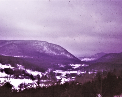
We are scheduled to be at the meeting of the Fly Creek Historical Society at 7:00 on Wednesday night, Sept. 25. (2019) Robert will be giving a PowerPoint presentation. His topic will be the ice age history of the Fly Creek vicinity. If you come from the south on Rte. 28, then the best way to get to there is to turn left, west, onto County Rte. 26. That takes you past some of the most fascinating ice age landscape in the region. And it’s a great way to get ready for the talk.
After making that left you drive a short distance uphill. We would like to take you back through time to the late Ice Age. To your right and left are sweeping mind’s eye vistas of ice age history. Rising above you, on the right, we would like you to envision a towering glacier. It had advanced from the north during a recent episode of especially cold ice age climate. But things have turned and is now warming. The glacier is melting and melting quickly. We look again and see that great volumes of meltwater are pouring out of wide fissures in the ice.
The glacier is actually still advancing. An enormous sheet of ice extends north, all the way to Labrador. The climate up there is still very cold. Heavy Labrador snowfalls are producing new ice which is pushing the ice south all the way to Fly Creek. At Fly Creek the ice is melting just exactly as fast as it is advancing; the front of the ice is at what is called a stillstand. We look again and listen. The advancing ice is making all sorts of cracking, popping and grinding sounds. Then there is the sound of those roaring torrents pouring out of fractures all along the glacier’s front. It is, in short, a loud landscape, the noises of the advance are balanced by the sounds of the melting. This is an audio stillstand!
Next we turn and look to the left, the south. The landscape before us is barren. Wet, bare ground rises and falls in smooth sinuous curves much as you can see today. This is called kame and kettle landscape. Each sinuous hillock is a kame; each smooth downward swale is a kettle. The kettles mark the locations of isolated blocks of ice that had recently been part of the glacier. Now they are melting, and each block of ice will leave behind a kettle. This kame and kettle landscape defines what geologists call a glacial moraine, a heap of earth bulldozed to where we see it by advancing ice and left behind when the ice melted.
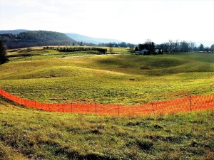
Off in the distance is a wet plain of sediment that has been washed out of the kame and kettle lands by those meltwater flows. It glistens in the sun. A braiding of crisscrossing streams flows across what geologists call an outwash plain.
We continue west on Rte. 26 and soon drop down onto a broad flat farmland. In our mind’s eye we are looking at a landscape from which our glacier has retreated. The moraine is still there, off to our left, but it acts as a dam for meltwater. We are now driving across the floor of and ice age lake. Let’s call it Lake Fly Creek. We continue to drive slowly toward Fly Creek We have seen a lot of ice age landscape in an otherwise modern world
Contact the authors at randjtitus@prodigy.net. Join their facebook page “The Catskill Geologist.”

