THE CATSKILL GEOLOGISTS BY PROFESSORS ROBERT AND JOHANNA TITUS
A Bridge is Washed Out
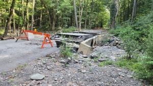
The Mountain Eagle is not a peer-reviewed science journal. And we have to get something out every week, so we don’t always have time to deeply explore the issues we are writing about. That has been the case with our recently published studies at Palenville. We were first attracted there last year by news that had been on local television stations. There had been reports about some flooding that had occurred along that distributary stream we wrote about last week. Take a look at our first photo. That flooding had destroyed a bridge. We talked to Highway Department workmen who were fixing it, and they told us that this had happened at least several times before. There, it seemed, was a persistent flood threat and we wanted to know why. There was a story here, so we had a lot more work to do.
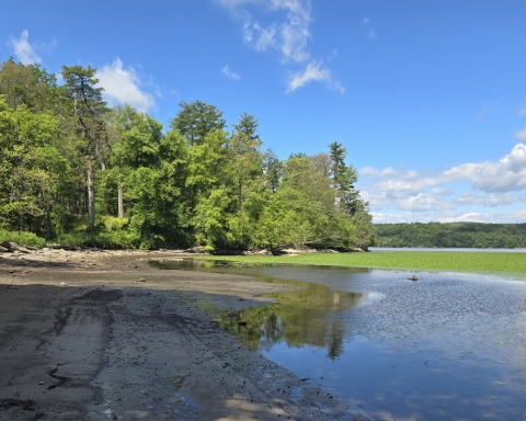
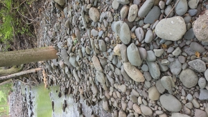
Well, we had some exploring to do so we looked in an upstream direction. This was before last week’s heavy rain, so the channel was nearly dry. But we saw plenty of evidence of seriously powerful stream flows in the past. We observed an abundance of large well-rounded cobbles and even small boulders in the channel See our second photo. Our initial impression was that we were looking at a small stream that was usually dry but from time to time witnessed very strong, even dangerous torrents. What a puzzle this was. Small creek sediments shouldn’t look like this. How could this be?
Looking at a Google Earth image, we continued upstream for quite a distance. We convinced ourselves that this stream reached north far enough to almost come into contact with Kaaterskill Creek. We saw the likelihood that two dynamics were going on here. Our distributary creek seemed to be “trying” to erode and extend itself northwards by a process called headward erosion. At the same time Kaaterskill Creek was piling up materials along its left bank right there. That was blocking the headward erosion. There seemed to be an equibrium between the two processes.
This was pretty strange “field work” but we were learning about the central problem. We could imagine long perods of time when that little distributary was empty. Then we could also imagine times of heavy rainfall when Kaaterskill Creek would become swollen with floodwaters. Masses of that water would jump out of the trunk stream and rush down our distributary. Sometimes that would involve so much water being squeezed into such a small channel that the event could actually destroy that bridge. We had developed a scientific hypotheses that explained what we had been observing.
We stood along that little distributary and looked upstream again. Then we did a little time travel. We drifted just a year or so into the past. We saw that little channel but now it was glutted with a powerful surge of water. It had been raining a lot recently and that distributary was fully engorged with floodwater. Raging, foaming, thundering, whitewater torrents rushed toward us. We were the mind’s eyes so we were safe, but it was a horrifyng sight to see. The roar was earsplitting and we could hear the cracking sounds of rapidly moving boulders colliding with each other. Then, poof, suddenly we returned to the peaceful present; all was green, the sun was shining and birds were singing.
We have identified a persistant flood threat in Palenville – something that is called a geohazard. That little bridge will very likely be wiped out again someday. When that happens we will go there and report on that.
Contact the authors at randjtitus@prodigy.net. Join their facebook page “The Catskill Geologist.” Read their blogs at “thecatskillgeologist.com.”