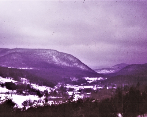
A visit to Glacial Lake Windham
The Catskill Geologists
Robert and Johanna Titus
The Mountain Eagle – Sept. 8, 2017
Last week we visited Windham, actually the Windham Path, just east of town. We wanted to show you something about the ice age origins of the town. Most of the Windham Path lies upon the floor of what’s called a glacial lake. That lake had come into being when a glacier deposited heaps of sediment in something called a moraine. The moraine can be seen just east of the Path. Most of the land from east Windham to here is rolling elevated moraine landscape. That’s the land lying just east of Mitchell Hollow Road.
Let’s learn some more this week. We would like you to drive west from Windham on Rte. 23. You may have done this before, perhaps many times. But, as always, we want you to be paying more attention to the landscape that you are passing. We, especially, want you to take heed of the flat landscapes down at the bottom of the valley. It would be easy to dismiss this as a floodplain, after all valley floors are supposed to display floodplains. But, you would be wrong; this flat landscape is the floor of an ice age lake. Lake deposits are almost always spread out as flat sheets. That’s what we see here.
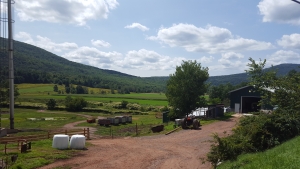
These lake bottom landscapes continue at least as far west as Ashland. They speak to us of a glacial lake. It was a big one, extending at least five miles from the Windham moraine to a bit west of Ashland. Rte. 23 lies on a platform that runs parallel to the old lake. That platform also has an ice age origin. It is composed of sediments that were dropped down the northern valley wall and deposited as a lakeshore deposit called a glacial terrace. That terrace was irresistible to highway engineers when they were making Rte. 23. It lifted the highway up onto a well-drained surface.
The top of the terraces was deposited at just about the old lake level. Our topographic map tells us that that level was at about 1,500 feet in elevation. The map also tells us that the lake bottom lay at about 1,450 feet. We can thus calculate that the lake was about 50 feet deep. It got a good bit deeper toward Ashland. Turn south (left) at Jewett Heights Road and, when you get down to the river, stop and get out. You are now standing on the floor of a deep lake! Have you ever done that before?
You might do a little exploring. Look for a vantage point, somewhere above the 1,500 foot level. Now you can look down and, in your mind’s eye, you can survey Glacial Lake Windham as it once was. We picked a day, very late in the Ice Age. The climate had been warming up considerably and the ice had melted off most of the lake’s surface. There was, however, still a narrow shelf of gray ice all around the lake’s shore.
We were hoping to see some animals. Perhaps a mastodon or two might have been walking the shores of the lake. But, we were disappointed. It was not that late in the Ice Age, it was still too cold in Windham.
Contact the authors at randjtitus@prodigy.net. Join their facebook page “The Catskill Geologist.” Read their blog “thecatskillgeologist.com.”

