A mind’s eye visit to Glacial Lake Grand Gorge
Robert and Johanna Titus
(First presented on WIOX on Sept. 6, 2016)
We are the mind’s eye, the human imagination. We can do anything; we can go anywhere; we can travel as far as we want, we can travel as fast as we want, as high as we want, and as low as we want.
We can even travel through time.
Right now we are several thousand feet above the town of Middleburgh, and climbing higher. It is exactly 14,000 years ago and below us is the whiteness of a glaciated landscape. This is getting toward the end of the Ice Age. We want to see more.
We ascend to an altitude of a 100 miles and then 500 miles. Now we are looking north. Far in the distance, over the curvature of the Earth, lies Labrador. For millennia it has been snowing heavily up there, and the snow has piled up so thick that it has turned into ice and that ice has become a glacier.
Glaciers, of this sort, spread out from their centers and the front of this one is inching its way south. It has spread across parts of Quebec and it is advancing across all of the Adirondacks. Beyond that, some of it is becoming funneled into the Hudson Valley. Glaciations can be complex events and this one gets worse. A lot of the Hudson Valley glacier peels off and heads west up the Mohawk Valley. And then a lessor amount of that ice advances south into the Schoharie Creek Valley. That is a lot of ice, but it is very small compared to the great ice sheet that covers Labrador.
We are the mind’s eye and we have been following all of this from 500 miles up in the sky. Now we drop down to just a thousand feet above Middleburgh. The glacier we have been looking at can be called a valley glacier. It flows, ever so slowly, within the confines of the steep slopes of the Schoharie Creek. Actually, by glacial standards, it is moving along at a pretty good clip. It has been relatively warm these past few decades and the ice has been melting – a little. Great volumes of meltwater have been trickling and then pouring down fractures within the ice. A substantial pool of water lies at the bottom of this valley glacier. It would normally be moving very slowly in a southerly direction, but now it is actually hydroplaning. There are days when it advances a hundred feet or so. That’s fast!
We, the mind’s eye, drift down the valley. We pass Vroman’s Nose. Its giant ledge of sandstone rises above the ice. We keep going south and more cliffs tower above the glacier, left and right of it. We look down and we see many large curved black fractures in the ice. These are crevasses and they result from the stresses that build up within the ice as is moves. We cannot see this movement, but the crevasses betray it.
We continue to drift south. We are following what will be, many millennia from now, Rte. 30. We pass over what will be the locations of Fultonham and Breakabeen. Have you driven this road? When you return, we want you to stop and get out. Look into the sky and see the ice that was once here. It is something that you really need to appreciate.
Now, we approach the site of Mine Kill State Park and there is a surprise ahead. Suddenly, we pass over the downstream end of the ice. We have reached its terminus. Beyond that are the dark waters of a very sizable lake. Schoharie Creek is one of only a limited number of large rivers that flow north. When a glacier is flowing south, it forms a dam and that is what has happened here. This is Glacial Lake Grand Gorge. It is our main destination today

Map of Lake Grand Gorge. Dark blue is Schoharie Reservoir
We drift very slowly to the south. The waters here are very dark; the lake is 600 feet deep. We turn around and look back at the terminus of the ice. It is a cliff of ice, rising a hundred feet above the waters. The recent warmth of the weather, and all the melting that has been going on, produces fountains of water pouring out of fractures in the ice. Lake Grand Gorge should be filling, higher and higher, with meltwater. We will be watching for this.
The lake is already very large. It is about three miles wide and it runs about ten or more miles to the south, down the Schoharie Creek Valley. Here it is deep and it will only shallow very slowly, upstream, which is to the south.
We turn again and continue our southward journey, soaring through the air. Soon we are acutely aware that beneath us is the site of the modern day world’s Gilboa Dam. We can look down into the waters and envision the dam and the Schoharie Reservoir behind it. You have, no doubt, seen the reservoir; you most likely think of it as a very large body of water. But it is small compared to Lake Grand Gorge. The reservoir is only about a half mile wide and a little more than three miles long. It is only about 150 feet deep; it is just a pale imitation of what Lake Grand Gorge was.
Now we turn east. In that direction lies a great embayment of Lake Grand Gorge. That is where the lake’s waters flooded today’s Manorkill Valley. We drift east over what will be Rte. 990V. We pass Conesville and keep going. Ahead of us is the village of Manor Kill. Have you driven this road? If you do, we want you to look at the valley floor. It is mostly a broad flat landscape. You would be forgiven if you called it a floodplain, but it is not. This is a lake bottom; it is the floor of the Manorkill embayment. Long ago, lake waters rose 150 feet above. Back then, Manorkill Creek, like many others, was flowing into the lake. They were all feeding volumes of water to the lake; the lake should have been rising.

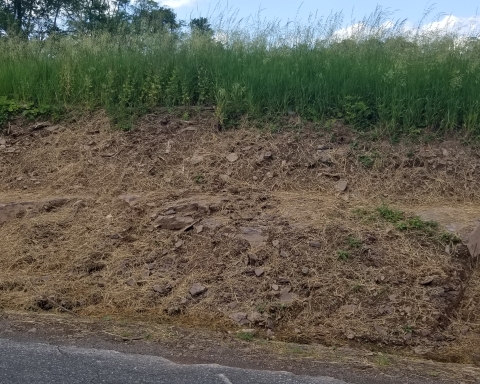
Flat bottom of lake near Manorkill
We turn around and head west, back into the Schoharie Creek Valley. We continue our travel to the south. Soon we pass over what will, in the distant future, be Prattsville. We drift “over the town” and then pass Pratt’s Rock. That ledge of sandstone rises above the lake waters. There were none of Colonel Pratt’s carvings here 14,000 years ago, but the rest of the ledge was much as it is today. Have you climbed to the top of Pratt Rock? If you do, then be sure to look down the valley and see the lake that was once here.
Now we turn to the southeast and follow the lake. In the far distance we spot something white. It is too distant to identify. This is a good time to be the mind’s eye; we rise up a mile into the sky and again look east. In the very far distance we can see the Hudson Valley glacier. Here it is abutting the Wall of Manitou, the Catskill Front. The glacier has filled that valley, right up to its brim and more. Some of its ice has diverted from the mainstream and has been driven up Kaaterskill Clove. A stream of this ice continues into the upper reaches of Schoharie Creek. That is the white we have seen. This is another valley glacier and it is also another dam. The ice has clogged the valley in the vicinity of today’s Hunter. It forms a second, eastern dam, holding back the waters of Lake Grand Gorge. The lake is trapped between two glaciers. We turn around and head back to the west.
We pass Prattsville and see another one of the lake’s embayments. This one extends off to the northwest. Today’s Rte. 23 follows in this path. We drift up this embayment. We can imagine Rte. 23 below us. We reach the site of today’s village of Grand Gorge and see another, lessor, embayment – extending to the west.
This small embayment should be of no particular interest to us, except that we can detect a current of water flowing into it. We look ahead and see that this current is heading toward what is called Grand Gorge – not the village – the gorge itself. Now we are truly drawn – drawn towards this great landscape feature. We appear to be on to something.
We are going in a direction that would take us uphill on Rte. 30 today. But there was no uphill here 14,000 years ago. There was just a flat current of lake water. It was funneling into a narrowing and shallowing canyon. The flow became constricted and it had to speed up. As it speeded up it became increasingly erosive. This is a minor epiphany; we are struck by the fact that we have suddenly stumbled across an explanation for several things that have been bothering us. First of all, this is the current that has eroded Grand Gorge. Have you driven through the gorge? The next time you do we want you to stop and feel the current that was once here. Feel its power. See the canyon it carved.

Grand Gorge – looking north
Then, we have also suddenly learned why the waters of Lake Grand Gorge have not been rising. This is the lake’s “drain.” This is where water escapes from Lake Gorge. We drift to the south and we see the upper reaches of what is today the East Branch of the Delaware River, sometimes called the Pepacton.
Finally, we have learned why the lake is called Lake Grand Gorge.
On this day there is a powerful stream here, a raging, foaming, pounding, thundering torrent of white water. It is eroding a narrow and relatively steep stream valley, just south of Grand Gorge. Have you driven this road? When you do, you will see what the early Pepacton did here.
We continue our journey, heading south to Roxbury. We have left the waters of Lake Grand Gorge and are now following the newborn Pepacton. Roxbury is our final destination; our trek through time is done.