Glacial Lake Albany
Windows Through Time
Robert Titus

Illustration by Jack Cook of the Woods Hole Oceanographic Institute.
IN THE HUDSON VALLEY, all human history begins at the end of the Ice Age. The final melting of the ice and the release of the valley from the frigid icebox conditions that gripped our landscape for millennia, eventually set the stage for the eventual first human populations to enter the region. But even with the ice age over there was one last obstacle to man’s settlement here; that was Glacial Lake Albany.
This is one of the most fascinating chapters in our region’s geological history. A gigantic lake once stretched from Catskill, across the City of Hudson, and on to Kinderhook. That lake also stretched north to the Adirondacks and south to New York City. It was an ice age lake and much of it must have been, most of the time, covered with thick ice. If you could go back in time and imagine a flight from today’s New York City to today’s Glen Falls, you would traverse the length of this enormous lake. You would have been treated to an awesome sight.
Glacial Lake Albany got its start about 18,000 years ago. At that time a great continental ice sheet had swept south across our part of North America. It originated in today’s Labrador and advanced south to approximately the north shore of Long Island. The ice continued west through New Jersey and Pennsylvania. The ice sheet, from there, stretched out across the whole northern half of North America. Similar glaciers covered much of Europe; it was truly the Ice Age.
But the cold climatic conditions, that allowed this ice sheet to form, were coming to an end. The climate would warm up and the ice would begin to melt. Gradually, at first, and then faster, the ice retreated up the Hudson Valley. But the ice had left a great heap of earth behind. It was a mass of coarse sediment which we call a moraine. The moraine makes up the northern half of Long Island and it lies across much of New Jersey as well. It once stretched across the Hudson River from Brooklyn to Staten Island and that is why there was a lake. This moraine, left behind by the retreating ice, formed a dam which blocked the Hudson Valley. As the ice retreated, meltwater accumulated behind this dam and hence the origin of Glacial Lake Albany.
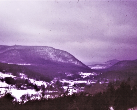
Beneath surficial layers of ice there was deep water and then there was a lake bottom. You can still see the floor of Lake Albany at many locations. Take Route 9 south from the city of Hudson and as you drive along you will encounter many flat landscapes. The flatness is the bottom of the lake. Most all lake bottoms are like that, being blanketed with thick layers of silt and clay. West of the Hudson River, take Route 9W south of Coxsackie and you will commonly pass by and across more flat landscape. This too, is the bottom of the lake.
The ice on the lake eventually thawed out and even then, it must have been a majestic sight. With the final melting of the Ice Age, all the rivers that entered Lake Albany had to have been swollen with raging, foaming, pounding masses of meltwater. Try to imagine Catskill Creek and Kinderhook Creek and Roeliff Jansen Kill thundering with cascades of water, perhaps ten or so times greater than what you see today. Make these flows louder than any torrent you have ever witnessed. It was certainly quite a time.
Those great streams deposited large deltas in the old lake. Virtually all of Schenectady is built upon a huge delta, left by a swollen Mohawk River. Delta tops are flat and please notice, while driving through these cities, how flat the landscape is. There are a lot of other deltas left along what had been the shores of Lake Albany.
This is important stuff. The last vestiges of the Ice Age disappeared about 13,000 years ago. Then there were a few thousand years of reforestation. And that set the stage for the appearance of Native American Indians. We shall visit this landscape, with its thawing ice, many times in future “Windows Through Time” columns. It is quite something to “see.” Contact the author at titusr@hartwick.edu


