"I will never kick a rock"

Author

Robert Titus - page 11

Robert Titus has 406 articles published.

in Uncategorized by

Ecology in the Anthropocene

The Catskill Geologists

Robert and Johanna Titus


The frontiers of science are always exciting places to be. There can be so much creativity going on, sometimes even a frenzy of fast paced deep thinking. Our field, geology, is a very old and a very mature science so you might think that little of this occurs anymore. Maybe – or maybe not. In recent times our science has been debating something called the “Anthropocene.” That’s a, so far, hypothetical unit of time that may have only recently begun. The question is “has mankind altered the world so much that the fossil and stratigraphic record will record and recall the impact of this alteration?” Will geologists of the distant future find stratified rocks that record dramatic and worldwide changes that date back to our times? Late at night in geology bars we, today’s geologists, debate all this.


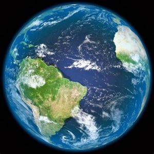
Well, the two of us think that this notion of an Anthropocene just might be legit. We think that there are two trends going on currently that will dramatically alter the future fossil record. First, there seem to be reasons to foresee a general decline in worldwide biodiversity. That’s because of, more than anything else, habitat reduction. Our human species numbers about 7 1/2 billion individuals today and that will quite possibly continue increasing until leveling off at about 11 billion by the end of this century. There were only two billion of us as late as 1930 so you can see that a dramatic population growth has been underway.

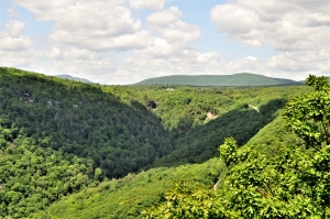
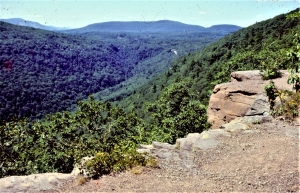
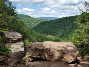
Along the way we have also been expanding into habitats where we had been, not long ago, few in numbers. Currently our accelerating expansion into the Amazon Basin is one of the most striking example of this. All this has led to worldwide habitat reduction which has been literally squeezing out one species after another. We have, for example, real fears for the near future fate of the Amazon Basin. The rapid reduction of elephants is also another cause for concern. We can only guess that the future fossil record will see a depletion of species diversity, recorded in the stratified rocks of our age. That would mark the beginning of the Anthropocene’s new and very different fossil record.

But there is something else. Our expansion throughout the world has facilitated the appearance of abundant invasive species. Where we live, in Greene County, there has been an increasing abundance of Japanese knot weed. Throughout the American South there are massive infestations of kudzu. Both are invasives that were transported from Japan with the help of human intervention. Among other things, invasives have the potential of reducing or eliminating native species. The invasive chestnut blight fungus has, for example, all but eliminated the chestnut. Our images of the Anthropocene ecologies are thus not just depleted in species but far more homogenous as well. Future geologists will likely see depleted and homogenized Anthropocene fossil records. That will help define the new time unit.

We want to make a few more points. First, none of this has anything to do with global climate change. If we could push a button and carbon dioxide emissions would come to a complete halt, that might stabilize the climate, but it would hardly stop or even slow human population growth. So too, it would not end habitat reduction. Nor would it even slow species invasions. Second, we do not recall seeing a lot of discussion of these issues. We suspect they have been overshadowed by talk of climate change. These are altogether different ecological problems. That’s troubling.

Are these changes enough to define a new epoch of geologic time? Others think the appearance of radioactive wastes is important. And how does human driven climate change fit into this scenario? Late at night in geology bars…

Contact the authors at randjtitus@prodigy.net. Join their facebook age “The Catskill Geologist.” Read their blogs at “thecatskillgeologist.com.”
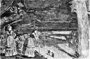
Ghosts at Clermont

in Uncategorized by

Ghosts at Clermont

The Woodstock Times 2009

Updated by Robert and Johanna Titus


A geologist never knows when he is about to take a trip into our distant past. It’s just part of the job. We began one of those time travels recently when we were visiting the Livingston mansion Clermont on the Hudson. Just north of the visitor’s center we saw a fine honey locust tree. The honey locust is certainly not the greatest of trees; there are bigger and prettier ones. Nevertheless, there is something very special about this species. Honey locusts are “armored” with very dangerous looking spikes. These can be three or four inches long, and often they occur in mean-looking clusters. The biggest of those is found on the lower reaches of the tree’s trunk. Up above, there are plenty more strung out on the lower branches.


Brush up against this tree and you will quickly find out what they are for; they are viscous defense mechanisms. The lower branches hang down and seem to reach out with their spikes as if intending to do harm. Browsing mammals will soon find out, and long remember, the dangers of trying to eat the foliage of this tree.

But who are these spikes defending against? Your might guess the white-tailed deer, especially if you are among those who have prized shrubbery in your yard. But white-tailed deer would hardly be bothered by these spikes. They have slender snouts, and they find plenty of space to pick between the spikes. No, locusts have never much worried about deer.

But, if it is not deer, then who? There are no other obvious browsers in today’s woods so why do the trees go to all that trouble of growing those nasty long spikes? Those spikes, also, had to be aimed at something a lot bigger than a deer. And a lot taller too; they reach up to about 15 feet or so above the ground. There is a real problem here; the fact is that there simply are no big creatures in today’s world that threaten our locusts.

But there were some a long ago. Back at the end of the ice age the Hudson Valley did have a great herbivore which might very well have pestered our honey locusts. And it was plenty large enough too. It was the mastodon.

Modern elephants have a bad reputation for tearing up forests. They love to pull down limbs and they are perfectly capable of stripping bark off the lower trunks of trees as well. In fact, elephants can virtually create their own habitat. They destroy so many trees that they break up the forests, creating lots of meadow in between the remaining patches of forest.

That rambunctious behavior creates just exactly the right habitat for honey locusts. Locusts like broken forests, preferring to be right on the border between meadow and trees. So, it would seem that evolution had cleverly adapted the locust for life with the mastodonts. These great elephants created the habitat that was just right for locusts. At the same time the spikes protected the locusts from any potential damage from the mastodons.

And there was more: the honey locust seed pods very likely appealed to the mastodons. Those seed pods hung just above the spikes; the elephants could just reach beyond the spikes, eat the pods and then deposit the seeds elsewhere within their droppings.

All in all, the Mastodons and honey locusts enjoyed a very fine symbiosis. But then, abruptly, it all ended.

The mastodons went extinct about 11,000 years ago. The locusts lost the elephants that had helped them so much in reproduction. They have survived to this day, but surely, they are not as successful as was once the case. Still, in the end, it is quite the concept to contemplate. These trees and their long spikes vigilantly wait for the elephants that will never ever come again. It is only the ghosts of mastodonts that still haunt our forests.

Contact the authors at randjtitusprodigy.net. Join their facebook page “The Catskill Geologist,”

Ghosts at Clermont

in Uncategorized by

Ghosts at Clermont

The Woodstock Times 2009

Updated by Robert and Johanna Titus


A geologist never knows when he is about to take a trip into our distant past. It’s just part of the job. We began one of those time travels recently when we were visiting the Livingston mansion Clermont on the Hudson. Just north of the visitor’s center we saw a fine honey locust tree. The honey locust is certainly not the greatest of trees; there are bigger and prettier ones. Nevertheless, there is something very special about this species. Honey locusts are “armored” with very dangerous looking spikes. These can be three or four inches long, and often they occur in mean-looking clusters. The biggest of those is found on the lower reaches of the tree’s trunk. Up above, there are plenty more strung out on the lower branches.


Brush up against this tree and you will quickly find out what they are for; they are viscous defense mechanisms. The lower branches hang down and seem to reach out with their spikes as if intending to do harm. Browsing mammals will soon find out, and long remember, the dangers of trying to eat the foliage of this tree.

But who are these spikes defending against? Your might guess the white-tailed deer, especially if you are among those who have prized shrubbery in your yard. But white-tailed deer would hardly be bothered by these spikes. They have slender snouts, and they find plenty of space to pick between the spikes. No, locusts have never much worried about deer.

But, if it is not deer, then who? There are no other obvious browsers in today’s woods so why do the trees go to all that trouble of growing those nasty long spikes? Those spikes, also, had to be aimed at something a lot bigger than a deer. And a lot taller too; they reach up to about 15 feet or so above the ground. There is a real problem here; the fact is that there simply are no big creatures in today’s world that threaten our locusts.

But there were some a long ago. Back at the end of the ice age the Hudson Valley did have a great herbivore which might very well have pestered our honey locusts. And it was plenty large enough too. It was the mastodon.

Modern elephants have a bad reputation for tearing up forests. They love to pull down limbs and they are perfectly capable of stripping bark off the lower trunks of trees as well. In fact, elephants can virtually create their own habitat. They destroy so many trees that they break up the forests, creating lots of meadow in between the remaining patches of forest.

That rambunctious behavior creates just exactly the right habitat for honey locusts. Locusts like broken forests, preferring to be right on the border between meadow and trees. So, it would seem that evolution had cleverly adapted the locust for life with the mastodonts. These great elephants created the habitat that was just right for locusts. At the same time the spikes protected the locusts from any potential damage from the mastodons.

And there was more: the honey locust seed pods very likely appealed to the mastodons. Those seed pods hung just above the spikes; the elephants could just reach beyond the spikes, eat the pods and then deposit the seeds elsewhere within their droppings.

All in all, the Mastodons and honey locusts enjoyed a very fine symbiosis. But then, abruptly, it all ended.

The mastodons went extinct about 11,000 years ago. The locusts lost the elephants that had helped them so much in reproduction. They have survived to this day, but surely, they are not as successful as was once the case. Still, in the end, it is quite the concept to contemplate. These trees and their long spikes vigilantly wait for the elephants that will never ever come again. It is only the ghosts of mastodonts that still haunt our forests.

Contact the authors at randjtitusprodigy.net. Join their facebook page “The Catskill Geologist,”

The New Kaaterskill Falls trail, Part 7 – Art at the falls.

in Uncategorized by

Where they sketched: Winslow Homer, “Under the Falls.”

Tri County Historicql Views; Spring 2021

Robert and Johanna Titus


We are endlessly fond of the landscape art done throughout the Catskills by 19th Century painters. Most of them were members of the Hudson River School of Art. Winslow Homer does not belong among those artists. Homer came along just a little too late to be in that School. He started out as a commercial illustrator and, only later, took up oil and watercolor painting. He is best known for his marine subjects, but he did one image in the Catskills that is among our personal favorites. It’s a wood engraving which is kind of an illustrator’s version of a Hudson River School painting. That’s “Under the Falls,” an 1872 picture of Kaaterskill Falls. Take a look at our figure 1. This was originally published in Harper’s Weekly, and copies are commonly found for sale in antique shops and online.


FIG. 1. “Under the falls, 1872.”

FIG, 2 – The same spot today.


The picture shows something that is sometimes called the “amphitheater,” a great cavity lying directly below the top of upper Kaaterskill Falls. Two attractive and well-dressed young women gaze downstream from a perch on the western side of the falls. In the distance are a number of other hikers. It is a typical summer day in the year 1872 and the falls are a busy place.

We just couldn’t keep ourselves from going there. It was years ago when we first climbed up to where Homer sketched. You can follow in our footsteps and see what we saw. Look at our figure 2; we took it from what we think was Homer’s very spot. That was a slope just above the western side of the falls (our figure 3).

FIG. 3- Slope on distant left is where Homer sketched

But we are geologists, not art historians; what is the geological story here? We look into this image and our focus is on the deepest recess of the “amphitheater.” It lies just below an enormous thickness of sandstone and sandstone is rugged material. See our figures 4 and 5. That’s a brown quartz sandstone above and it’s the stuff of an ancient river channel.

Fig . 4 – Fossil red soils below, brown sandstone above.

We have gone back to the Devonian time period, about 385 million years ago, and are standing upon a riverbank deep within the great Catskill Delta. Those thick sandstones are now lying before us as the channel sands of a river. It is an enormous river, deep and wide. It had to be in order to accumulate all that sand. We gaze east and we see, in the distance, the river’s opposite bank. Standing, all around us and on that distant shore, is a forest of primitive trees. That’s the famed Gilboa Forest. Evolution has only recently produced forests, and none of the trees we see here even remotely resemble those of our modern world. Below these trees we spy a brick red soil. Our modern-day selves look at the falls and peer at the brick red sedimentary rocks that make up the lower part of the amphitheater. See our figure 5. Then we look up again at the river sandstones. Our journey into the past has been a fruitful one; now, in a scientific flash, we understand the geology of Kaaterskill Falls, especially its amphitheater.

FIG. 5 – Red petrified soils below river channel sandstones; photo by Don Teator.

It was all those millions of year ago that a great river flowed across a delta that was large enough to rival the Mississippi Delta. Let’s call our stream the Kaaterskill River. It had a powerful flow and that caused it to erode into its banks as it migrated back and forth across the floodplain. Geologists actually prefer to use the verb meander. This meandering stream cut its way through the red soils and muds of its own floodplain. As the Kaaterskill River migrated off to the west, it left a channel filled with brown sands lying upon a sequence of red soils. All this would eventually harden into the rocks of Kaaterskill Falls. Again, see our figures 4 and 5. Those red soil deposits erode easily while the river sandstones resist and for jutting ledges. That is the origin of the amphitheater and Winslow Homer’s art.

We had been privileged to sit where Homer sat and to see what he had seen, But, for us, there was actually so much more.

Contact the authors at randjtitus@prodigy.net. Join their facebook page “The Catskill Geologist.” Read their blogs at “thecatskillgeologist.com.”

The New Kaaterskill Falls Trail, Part Six – Ancient Rivers – Mar. 31, 2022

in Uncategorized by

The New Kaaterskill Falls trail: Part Six: Ancient streams

On The Rocks; The Woodstock Times

Updated by Robert and Johanna Titus


It’s a funny thing about our geological wanderings. Sometimes, when we are on our way back down a trail, we see things that we missed on the way up. That was the case with our adventures at Kaaterskill Falls. We thought we were pretty much done with the day and were hiking back when we just took notice of things that we had not seen earlier.

Take a look at our first photo. It shows a rock type called a conglomerate. That’s a rock composed mostly of pebbles. It is allowed to have at least some cobbles too, especially if they are small ones. That’s what you should be able to recognize in our photo. We found a fair scattering of boulders composed of this rock type in the Kaaterskill Falls canyon. We looked but did not find any bedrock horizons composed of this stuff.

These conglomerates were stream deposits, but not just any streams; these were special ones. It takes a lot of energy for a stream to be able to move a pebble, let alone a cobble. We measure the energy of a stream in terms of current speed. Faster flowing rivers have more energy than the slow ones. These had likely been very fast flowing streams. But that may not make much sense if you have been reading our recent columns. We have been describing ancient streams that were flowing across the broad flat floodplains of a major river delta. There is almost no downhill on a delta so the water should not have picked up much speed. How could such stream deposits have formed?

Modern river deltas almost always display sluggish rivers flowing gently across flat surfaces. Look into any of these types of streams and you find fine grained sand, not pebbles, and certainly not cobbles. So, where did these rocks come from? These were mountain streams; they flowed down the steep slopes of a mountain front. But where were those mountains?

When we got a chance, we looked east and, on that horizon, we envisioned the profile of a tall mountain range. Those were the Acadian Mountains. We have written about them from time to time. Those were lofty mountains that rose up, probably tens of thousands of feet, where the Berkshires are today. We looked east, and into the past; we saw the steep west-facing Acadian slopes. Pounding, raging, foaming, thundering mountains streams cascaded down those hills.

Those were the streams with enough energy (velocity) to sweep up and carry off pebbles and cobbles. You have, no doubt, seen mountain streams. They are sometimes also called whitewater streams and for good reason. We want you, from now on, to be watching for the conglomerates that we are describing. They are in those mountain streams. When you see one, we want you to form an image in your mind’s eye of what they represent.

But we still have a problem here. Whitewater streams are supposed to be on steep mountain slopes so again we ask – what are such rocks doing in the deposits of the Catskill Delta? We pondered that for a while and then hypothesized that these streams must have had so much momentum that, by the time they got to the flat delta surface, they simply continued onward, out across it.

We were happy to have noticed those conglomerates and then we continued on down the trail, almost getting back to the Rte. 23A. But there was still one more stratigraphic feature. Take a look at our second photo. Here we see a cross section from one of those typical Catskill Delta streams, one of those that had slowly meandered across the delta.

Those streams do become far more energetic during flood events, and we saw the evidence. Our photo shows strata dipping to the left and to the right. This is called trough cross bedding. These are flood deposits. During one moment of flooding the currents deposited sediment one way and a little later, sediments were deposited the other way. This is not terribly unusual or uncommon, but this was a very nice example. It was visually striking and made for a good photo, so here it is.

We continued on down to Rte. 23A and made our way back to the car; our day was over. We had explored the new Kaaterskill Falls trail and found it well worth the effort. We are grateful to the Department of Environmental Conservation for what they have done here. They have dramatically improved what had already been a fine scenic trail.

We want you to share this experience and urge you to follow in our footsteps, but we would be remiss if we did not leave out a warning. Soon after our visit a 17-year-old boy fell to his death here. It is a very dangerous place. Go and enjoy it but be very careful.

Contact the authors at randjtitus@prodigy.net. Visit there facebook page “The Catskill Geologist” or their blog site “thecatskillgeologist.com.”

The New Kaaterskill Falls Trail, Part Five – March 24, 2022

in Uncategorized by

The New Kaaterskill Falls trail: Part Five: Beyond the falls

On the Rocks; The Woodstock Times

Updated by Robert and Johanna Titus

We continue our adventures on the newly renovated trail system at Kaaterskill Falls. In our last installment we had climbed up the Canyon below the falls. Then we climbed the new stairs and reached the top of the falls. Now we are ready to continue on toward Kaaterskill Clove itself. It used to be that the trail up the canyon was officially a dead end. It ended at the bottom of the falls, and hikers were discouraged from going any farther. They were the cause of too much erosion, foot erosion. Now, however, as we have seen, you can climb the stairs and hike on to the top of the falls.

From there we can now easily continue on to the rest of the trail system. From the top of the falls we turn around and head back upstream. We walk up the path on the left (west) side of the stream. It does not take long to reach a place where you follow the trail across the stream. When we were there last, we had to make an easy crossing, hopping across large boulders. Since then, a small bridge has been constructed here. Cross it, ascend the trail and head east until you reach a junction with the fabled Blue Trail, otherwise known as the Escarpment Trail.

The Blur Trail may just be one of the most picturesque hiking trails anywhere. It begins just west of Windham High Peak and continues south, many miles to Kaaterskill Falls. The Escarpment Trail then links with parts of the Long Path and then the Overlook Mountain Trail. Altogether, this is a wonderful hiking experience. The recent renovations have, of course, only made it better.

Our goals, when we were there, were less ambitious; we just wanted to reach the north rim of Kaaterskill Clove. We continued south on the Blue Trail, and found our way, skirting the southwest flank of South Mountain. Soon we reached the Layman Monument. It’s a commemoration of the sacrifice made by Frank Layman here in the August of 1900. Layman died fighting a forest fire. His monument commands a view of Haines Falls in the distance (see our first photo).

We continued down the Blue Trail, heading to the east. The trail is blessed with a number of very good views into the clove. People have been coming this way for two centuries. Almost all of them came here for the scenery. You find a good location, pause, and gaze downward. There are massive ledges of sandstone all along the rim, each forming a cliff. The blue trail hugs those cliffs, assuring a picturesque experience. Below, the clove narrows to a knife edge at the bottom, about a thousand feet down.

You look up and gaze across the Clove. On the other side is an equally steep slope. It is cut by several picturesque streams. They include Santa Cruz and Wildcat Ravines. These two streams don’t just flow downstream, they plummet. Each follows an almost perfectly straight line from their tops to their bottoms. They are recognized as belonging to a special category of streams, called parallel streams. After an especially rainy spell they are powerful, raging, foaming, pounding, thundering torrents. They are called “parallel” because they all flow straight downhill, parallel to each other. The steep slopes generate those straight pathways. It’s important to understand what such streams are, and to be able to recognize them; you need to know these things in order to truly comprehend and truly appreciate landscapes such as these.

We continued on until we reached a scenic view which has just the right name. It is “Sunset Rock.” It is a great ledge of sandstone that towers above the Clove. (See our second photo). It’s not just a pretty face; there is a lot of good story telling that can be done right here. Look at our photo and take note of the flat surface. When you are actually there, you will also notice glacial striations that were carved here by a passing glacier. That glacier’s ice once filled all of the valley below and overran the ledge. That’s when this flat surface was carved.

Now, look east from Sunset Rock and envision a great glacier coming out of the Hudson Valley. It advances toward us and, as it does to, we look down and see it rising within the Clove. It swells up and passes over Sunset Rock and scours that flat surface. It will continue westward and enter the canyon below Kaaterskill Falls. Then it will rise up that canyon, cross over the falls, and flow onward as far as South Lake. This is the flow of ice that created the scenery here. Stand atop Sunset Rock and slowly turn a full 360 degrees. Drink in the beauty here. Nothing here is accidental; it is all the product (we think the gift) of the Ice Age.

Contact the authors at randjtitus@prodigy.net. Visit their facebook page “The Catskill Geologist” and their blog site “thecatskillgeologist.com”

The New Kaaterskill Falls Trail – Part Four – The Top of the Falls.

in Uncategorized by

The New Kaaterskill Falls trail:  Part four: The top of the falls

On the Rocks; The Woodstock Times

Updated by Robert and Johanna Titus


Kaaterskill Falls has always been renowned for its scenic beauty. It first became widely known after the nearby Catskill Mountain House Hotel opened in 1824. From the hotel the young landscape artist, Thomas Cole, went exploring and visited the falls. He painted two of his most well-loved views here, one from the top of the falls and another from the bottom. You will have no trouble finding these images online. The falls have, subsequently, been painted by generations of artists who followed in Cole’s footsteps.

Generations of recreational hikers have also visited the falls and now the new staircase makes such visits much easier and far more practical. We have always admired the scenery at Kaaterskill Falls, but we are different from most others; when we visit the falls or look at those paintings, we see glaciers! We stand at the top of the falls and look down to see a glacier filling the valley below us; as we watch, it slowly rises up the canyon and then we have to step out of the way as it swells up over the falls themselves.  We lift ourselves up into the air and turn around to watch as the flow of the ice continues on to South Lake. Geologists can do that sort of thing.

How can we claim such otherworldly visions, especially as scientists? It is an extraordinary claim and Carl Sagan said it best when he said, “Extraordinary claims require extraordinary evidence.” Can we back up our “visions” with evidence? Yes, we can. It all began down at Bastion Falls where we began our trek several columns ago. We had climbed down from Rte. 23A and were about to ascend the canyon. But we looked around and noticed a number of boulders with remarkable features on their surfaces. Take a look at our first photo; see one of these boulders. Notice that the surface of this rock is covered with large deep scratches. These are called glacial striations. This rock had been swept along with the flow of ice and dragged along for who knows how far. Along the way it was dragged up against many other similar rocks, and each impact left a scar in the form of a striation.

????????????????????????????????????

After seeing the first of these down at Bastion Falls, our eyes were trained to notice more – many more. These comprised the “extraordinary” evidence of the glacier that had, long ago, flowed down the Hudson Valley, risen up Kaaterskill Clove and then turned into the falls canyon. We kept finding more of those striated boulders as we climbed up all the way to the bottom of the falls. We realized that we had been following in the path of the glacier that had been here about 14,000 years ago. But, the question remained: had that glacier ascended up and actually crossed over the top of the Kaaterskill Falls themselves. Those falls are 260 feet tall; could a glacier have actually “climbed” over them? We needed more extraordinary evidence. We climbed the new stairs and hiked on to the top of the falls hoping to find that evidence.

At the top of the new staircase a hiker is led to a dirt trail. That trail, in turn, leads to an intersection with the Blue Trail. A right turn there takes you on to the northern rim of Kaaterskill Clove; a left turn takes you to the top of the falls. We went left. Soon we were standing on the great ledge that makes up the top of the falls. We gazed down the canyon below and could not help but envision it filling with the ice of a glacier that slowly rose right up to where we were standing. But had that glacier actually passed this spot; had it risen and continued on to the north? We looked about and there was the evidence, something we had never noticed before at this spot.

It had been very dry in recent weeks and the flow of water was very low. Most of the bedrock at the bottom of the stream was now exposed and on its surface we found the evidence we had been looking for. The sandstone came from a Devonian stream channel and it contained several small quartz cobbles.  These had been carried by that long-ago flow of water. All these cobbles had originally been rounded by the Devonian streamflow. But now, each one had had its upper half planed off. Its flat upper surface had been scraped flat so that it lay at exactly the same level as the surrounding sandstone (see our second photo).

These were ice age features that we have frequently seen elsewhere at North Lake. When a glacier moves across a sandstone landscape it is likely to intersect cobbles within the country rock. It will plane right through them. These are fairly common on the Blue Trail at South Mountain and near Sunset Rock, but this was the first time we had seen them at the top of Kaaterskill Falls. They are features unique to the flow of glacial ice; we had our undisputable (and extraordinary) evidence. Our glacier had risen up over the falls and scoured off the tops of those pebbles as it continued upstream. But there was more.

At the top of Kaaterskill Falls lies a gigantic boulder (our third photo). Curiously, it does not have a name, but we immediately recognized it as being what is called a glacial erratic. Erratics are boulders that were swept up in the flow of ice and transported from where they came from and left where they are found today when the ice melted. This erratic had likely fallen off of South Mountain and onto and into our advancing glacier. It then flowed with the moving ice just to a site which would eventually be the top of the falls. Then the climate warmed, the ice melted and the erratic was lowered down to where it is seen today. It’s additional convincing evidence of the local glacier.

Climbing up to the top of this boulder is not easy but it is worth the effort. We did so and found the name Sanford Robinson Gifford inscribed on its top. Gifford was one of the most esteemed members of the Hudson River School of Art. He had painted here and commemorated his visit with the inscription. We wondered if he knew the ice age origins of this boulder.

One final treat for us was to walk down the dirt path that leads to the lands west of the falls. It only took us three minutes to get to the new deck with its knockout view of all of Kaaterskill Falls. We described that in the next  issue.

Contact the authors at randjtitus@prodigy.net. Visit their facebook page “The Catskill Geologist” and their blog site thecatskillgeologist.com.

The New Kaaterskill Falls Trail, Part Three

in Uncategorized by

The New Kaaterskill Falls trail – Part Three: The Side Trail

On the Rocks; The Woodstock Times

Updated by Robert and Johanna Titus

Perhaps the best thing about the new renovations at Kaaterskill Falls is the new side path. People have always wanted to walk in from the right side of the falls and explore the great ledge that caps the lower falls. To do that in the past, you always had to follow a small natural ledge. It was narrow and, with a dirt path, it could sometimes be slick and dangerous. People had slipped and fallen to their deaths there. That natural ledge had to be widened; it was.

Now there is a broader, flatter and far more stable path (our first photo). You simply make a left turn and walk out onto that part of the new trail. Soon you are atop the ledge of rock that makes up the lower falls. It’s one of the most popular destinations for hikers at Kaaterskill Falls. From the top of that ledge, you get a fine view of the canyon below the lower falls (you should always be very careful not to get too close to the edge – there was a death here this last summer). Alternatively you can turn around and look up into the great amphitheater at the fall’s center (our second photo). That “amphitheater” is a grand rounded cavity, roofed over by a massive ledge of thickly stratified sandstone.


Let’s take in that second view, looking up into the amphitheater; it is so much more revealing, geologically. Our second photo was taken from the top of the ledge. The view looks into that cavity, and the upper half of the photo shows its “roof.” That roof consists of sandstone strata 20 or more feet thick. Those strata dip first right and then left. These are typical stream channel deposits. We are looking at a cross sectional view of an ancient river, and a very large one at that. The strata below the river deposits are finer grained red shales. These were deposited on the floodplain surface that lay adjacent to the old river. These are often called overbank deposits. Take another look; those sandstones are river deposits, the red shales in between are floodplain sediments. Now you know about 90% of what there is to know about the stratigraphy of the Catskill Delta!


The two units of rock are very different in how well they hold up in the face of weathering and erosion. Those sandstones are very sturdy materials. They have resisted the effects of weathering and time has left them as a roof-like ledge, overhanging the softer strata below. Those softer shale strata were far more easily weathered, and nature sculpted them into that amphitheater. All this has always contributed to the scenic beauty of the falls. Thomas Cole painted a view from the inside, looking out. His painting was turned into a print which is commonly available online or in antique shops. Winslow Homer climbed to the back of the amphitheater and did a painting of some “Gibson Girls” climbing its slopes. It too is commonly available as an antique print. Both images are easily found online. Now, with the new trail, it is easier to go see them “in person.”

On our way back down the side trail we found another surprise. As we approached new main staircase we found that the side of the trail exposes one more ledge of rock. This one reveals the presence of a fossil soil. That’s the dark horizon just above the trail on our third photo. That, properly, is called a paleosol. It was not an especially well developed soil but we found some typical soil structures. These were vertical cracks. This sort of thing is called desiccation fracturing. These cracks took us back in time to a Devonian age dry season. Many geologists believe that the Devonian climate here was seasonal. There were dry seasons and wet seasons; the desiccation cracks were formed within the soils during one of those very ancient dry seasons.


Our paleosol was at the very top of the dark part of that side trail ledge. Whenever we see such a thing we can’t help but to reach out and put our fingers on the top of that soil. We understood that we were literally touching the surface of the ground that had existed here 380 million years ago. Once, a person could have walked around on that surface.

We returned to the main staircase and climbed uphill. At the end of the staircase we found a dirt path and there was another curiosity. We looked down and saw that this modern soil was also cracked in a manner to what had happened here during the Devonian (our fourth photo). What a strange thing it should be for the modern-day world to so closely mirror something that is found in ancient rocks!


At the top of the trail, we turned left and headed for the top of Kaaterskill Falls.

Contact the authors at randjtitus@prodigy.net. Visit their facebook page “The Catskill Geologist” or their blog site “thecatskillgeologist.com”


The Kaaterskill Falls Staircase, Part Two March 3, 2022

in Uncategorized by

The New Kaaterskill Falls Trail: Part Two: The Staircase

On the Rocks; The Woodstock Times

Updated by Robert and Johanna Titus


We continue our exploration of the recently renovated trail system at Kaaterskill Falls. The most important of the recent changes here was the installation of a new set of stairs up the right side of the falls (our first photo). You climb up the yellow trail and, just short of the bottom of the falls, you branch off to the right and make your ascent. We are told that there are about 190 of them. They are bluestone steps, cut from modern Catskills quarries. We expect that they will be enormously durable; they should last “forever.” About halfway up there is a side trail which leads to the ledge that makes up the top of the lower falls.

But the new staircase continues up and to the right. After a while it levels off a bit and there you will find that the staircase ends, and a dirt path follows. After some more climbing up that more gentle slope you reach an intersection with the Blue Trail, one of the main trails in all of the Catskill Front. Take a right and you can follow the Blue Trail to North/South Lake Campground and, from there, all the way to Windham High Peak. But we were looking to the left.

In many ways, the staircase is a return to the distant past. During much of the 19th century there was another staircase hereabouts. It was composed of wooden steps and followed much the same path, leading up the right side of the falls. We are very fond of a print done back then, showing a very out-of-shape man climbing down to the bottom of those steps (our second picture). He is sweating profusely, and he is clearly out of breath. We are guessing that this old staircase was built and maintained by the Laurel House Hotel which was perched just above the top of the falls. We do not know when that staircase disappeared.

The new staircase solved an old problem. In the recent past, once you got to the bottom of the falls, it was only natural that you would want to continue on, climbing to its very top. That was never easy. If you look to the left of the falls, then you will find a rocky cliff. There is no way, unless you are a very accomplished mountain climber, you would want to go that way. In the past, if you looked to the right, there was a slope that, although steep, could be climbed by a recreational hiker. At its top you could continue on to the left and reach the top of the falls.

But, of course, there was another problem. After decades of climbing this slope, it had just plain gotten worn out (see our third picture). Human foot traffic is recognized by geologists as a major category of erosion. Tens of thousands of people had made the ascent year after year. The trail on that slope had gotten just plain beaten up and ugly. It just was not what was wanted in a forest preserve. It only got worse when the weather had been rainy. That slope became a quagmire of mud. And the long-term prognosis was very poor. Kaaterskill Falls has always been a draw; it had always been a lure for countless hordes of hikers, and it was only getting worse.

????????????????????????????????????

The irony was that people came to see an especially beautiful natural site and their very presence was destroying it. Our column first took note of all this in 1998. We argued that a staircase was needed to save the falls. There had been that wooden one there during the hotel era of the 19th century, but that was long gone. Sadly, things are never simple. Staircases are expensive but, beyond that, there was the notion that this wilderness site simply should not have a staircase; such things are not “natural.” It involves and age-old debate between the philosophies of conservation and preservation. We always felt that the preservationists had gone too far, but what could we do?

They tried to solve the problem years ago. It was decided that the trail, just right of the falls, should be officially closed. When you got that far, you found a sign that said the trail was closed. A fat lot of good that did; people just kept climbing that slope and its condition continued to worsen. This was a major problem and it had to be addressed. The new staircase solves it. We think they have done a very good job installing it. They tidied up the slope, left and right, removing the scars of recent foot traffic. And, the staircase blends in very nicely with the surroundings. In fact, several of the photos we took were of no value because the stairs were too hard to see!

Contact the authors at randjtitus@prodigy.net. Visit their facebook page “The Catskill Geologist” and their blog site thecatskillgeologist.com. Everybody else has.

A Hike up to Kaaterskill Falls, Pt. 1, Feb. 17, 2022

in Uncategorized by


The New Kaaterskill Falls trail – Part One: Bastion Falls

On The Rocks, The Woodstock Times, 2016

Updated by Robert and Johanna Titus         


We begin today a series of columns about the newly renovated trail leading up to Kaaterskill Falls. We want you to go and see what has been done there; it’s a wonder. We started, of course, at the bottom; geologists always do it that way; that’s where the oldest rocks are. You start at the bottom and work your way upward, traveling through time into younger and younger strata. Hereabouts the bottom is just below the bridge at Bastion Falls.

Bastion Falls tumbles over a thick ledge of rock just right and uphill of the highway, Rte. 23A. It is a massive ledge of tan colored sandstone. Whenever we see a thick sandstone of this sort we envision a river – a big river. These sandstones had, long ago, been sands, and those sands had been deposited in the channel of that river. What a thought this is; we were looking at a modern creek and its waters were tumbling over a ledge of rock created by a much larger river, one that had occupied this very space – about 380 million years ago. The two rivers cross each other in space, but not in time. Roads can intersect each other but rivers cannot – except in time.

But we were only looking at a fragment of something much bigger. Our Bastion Falls River had been only one among many, many others. We turned around and looked up to the top of the clove, rising hundreds of feet above us. Much of what we saw was composed of many other petrified river channels. In between the channel sandstones were the silts and clays of ancient floodplain deposits. Again, we looked up and recalled what we have long known, all this that we call the Catskills is a great petrified delta. It once was a delta that would easily have rivaled the Mississippi River Delta of today’s Louisiana. It has a name: the Catskill Delta. We turned around and continued our climb up a scenic modern canyon but, at the same time, we were acutely aware that we were passing across the top of an ancient delta.

A lot of people confuse Bastion Falls with Kaaterskill Falls, but Bastion is just the warmup for the main act. The falls, here, need more explicit signage. We knew better; we climbed down to the stream bottom below the falls. There we saw a number of very large boulders (the right side of our first photo). These were tan sandstones too; we surmise that they had, perhaps ages ago, weathered free from the main ledge and fell to where we saw them.

It would have been easy to ignore these boulders; they really seemed to be thoroughly routine rocks. But we were curious about them; we scrambled around and looked them over. It was worth the effort. Soon we found something special: several feet of a fossil tree trunk, lying of the surface of one of those boulders. It had been a fairly sizable tree with a four-inch diameter. Unfortunately, its roots and foliage were absent, long lost to the vicissitudes of time.

We had traveled back in time to visit the fabled Gilboa Forest. That was the forest of primitive trees that had, during the Devonian time period, those 380 million years ago, lived upon the floodplains of the Catskill Delta. We did not have a specimen well enough preserved to put a name on it, but we knew with certainty that they had been trees; we could see their bark. You don’t find fossil tree trunks in the Catskills all that commonly, so this was worth our efforts. But it soon got better; we poked around and in just few minutes we found sections of two more fossil tree trunks on two more of those boulders. Finding three trunks in just a few minutes is genuinely unusual. We needed now, as scientists, to conjure up a story to explain this remarkable happenstance.

It wasn’t hard for us to come up with a hypothesis. Our fossil trees had all been buried in the sands of a sizable river channel. Sizable rivers have, from time to time, sizable floods. It was easy for us to look into the past and envision three of those floods, each carrying one of those tree trunks. What a thought! All around us recreational hikers were climbing up the yellow trail. They were admiring the beauty of the canyon. We had been doing the same – until we had taken a detour through time.

Well, you see what we are doing here. Over the course of the upcoming weeks, we intend to continue with a series of articles which will take you up the Kaaterskill Falls canyon. We will see it as it is today, and we will marvel over how recent engineering has improved the experience here. But our main goal is to travel through time and see this vicinity as it was during the Devonian time period, and also about 14,000 years ago during the ending phases of the Ice Age. This canyon has always been a wonderful place for you to visit. We hope to give you the kinds of knowledge that will make it far better.

Contact the authors at randjtitus@prodigy.net. Visit their facebook page “The Catskill Geologist” and their blog site “thecatskillgeologist.com.”


1 9 10 11 12 13 41
Go to Top